Dougherty, Iowa

Last updated

Dougherty, Iowa
Cerro Gordo County Iowa Incorporated and Unincorporated areas Dougherty Highlighted.svg
Location of Dougherty, Iowa
Coordinates: 42°55′21″N93°2′28″W / 42.92250°N 93.04111°W / 42.92250; -93.04111
Country Flag of the United States.svg  United States
State Flag of Iowa.svg  Iowa
County Cerro Gordo
Area
[1]
  Total0.56 sq mi (1.45 km2)
  Land0.56 sq mi (1.45 km2)
  Water0.00 sq mi (0.00 km2)
Elevation
1,102 ft (336 m)
Population
 (2020)
  Total62
  Density110.52/sq mi (42.69/km2)
Time zone UTC-6 (Central (CST))
  Summer (DST) UTC-5 (CDT)
ZIP code
50433
Area code 641
FIPS code 19-22080
GNIS feature ID0455961

Dougherty is a city in Cerro Gordo County, Iowa, United States. The population was 62 at the 2020 census. [2] It is part of the Mason City Micropolitan Statistical Area.

Contents

History

A post office called Dougherty has been in operation since 1900. [3] Dougherty was named for a local farmer. [4]

Geography

Dougherty is located at 42°55′21″N93°2′28″W / 42.92250°N 93.04111°W / 42.92250; -93.04111 (42.922381, -93.041194). [5]

According to the United States Census Bureau, the city has a total area of 0.55 square miles (1.42 km2), all land. [6]

Demographics

Historical populations
YearPop.±%
1910 171    
1920 200+17.0%
1930 215+7.5%
1940 215+0.0%
1950 212−1.4%
1960 177−16.5%
1970 133−24.9%
1980 128−3.8%
1990 107−16.4%
2000 80−25.2%
2010 58−27.5%
2020 62+6.9%
Source: "U.S. Census website". United States Census Bureau . Retrieved March 29, 2020. and Iowa Data Center
Source:
U.S. Decennial Census [7] [2]
The population of Dougherty, Iowa from US census data DoughertyIowaPopPlot.png
The population of Dougherty, Iowa from US census data

2010 census

As of the census [8] of 2010, there were 58 people, 29 households, and 18 families living in the city. The population density was 105.5 inhabitants per square mile (40.7/km2). There were 43 housing units at an average density of 78.2 per square mile (30.2/km2). The racial makeup of the city was 96.6% White and 3.4% Asian.

There were 29 households, of which 10.3% had children under the age of 18 living with them, 55.2% were married couples living together, 3.4% had a female householder with no husband present, 3.4% had a male householder with no wife present, and 37.9% were non-families. 31.0% of all households were made up of individuals, and 13.8% had someone living alone who was 65 years of age or older. The average household size was 1.90 and the average family size was 2.33.

The median age in the city was 51.7 years. 8.6% of residents were under the age of 18; 6.8% were between the ages of 18 and 24; 13.8% were from 25 to 44; 46.5% were from 45 to 64; and 24.1% were 65 years of age or older. The gender makeup of the city was 46.6% male and 53.4% female.

2000 census

As of the census [9] of 2000, there were 80 people, 37 households, and 19 families living in the city. The population density was 144.5 inhabitants per square mile (55.8/km2). There were 52 housing units at an average density of 93.9 per square mile (36.3/km2). The racial makeup of the city was 96.25% White, 2.50% Native American, and 1.25% from two or more races.

There were 37 households, out of which 29.7% had children under the age of 18 living with them, 45.9% were married couples living together, 2.7% had a female householder with no husband present, and 48.6% were non-families. 48.6% of all households were made up of individuals, and 27.0% had someone living alone who was 65 years of age or older. The average household size was 2.11 and the average family size was 3.11.

In the city, the population was spread out, with 22.5% under the age of 18, 5.0% from 18 to 24, 23.8% from 25 to 44, 28.8% from 45 to 64, and 20.0% who were 65 years of age or older. The median age was 44 years. For every 100 females, there were 105.1 males. For every 100 females age 18 and over, there were 113.8 males.

The median income for a household in the city was $36,458, and the median income for a family was $50,417. Males had a median income of $23,750 versus $30,893 for females. The per capita income for the city was $19,569. There were no families and 4.2% of the population living below the poverty line, including no under eighteens and none of those over 64.

Education

Dougherty is part of the West Fork Community School District, [10] formed in 2011 by the merger of SCMT (Sheffield–Chapin–Meservey–Thornton) Community School District and the Rockwell–Swaledale Community School District. [11]

Related Research Articles

<span class="mw-page-title-main">Girard, Georgia</span> Town in Georgia, United States

Girard is a town in Burke County, Georgia, United States. The population was 156 at the 2010 census. It is part of the Augusta, Georgia metropolitan area.

<span class="mw-page-title-main">Maynard, Iowa</span> City in Iowa, United States

Maynard is a city in Fayette County, Iowa, United States. The population was 476 at the time of the 2020 census.

<span class="mw-page-title-main">Popejoy, Iowa</span> City in Iowa, United States

Popejoy is a city in Franklin County, Iowa, United States. The population was 77 at the time of the 2020 census.

<span class="mw-page-title-main">Blairsburg, Iowa</span> City in Iowa, United States

Blairsburg is a city in Hamilton County, Iowa, United States. The population was 176 at the 2020 census.

<span class="mw-page-title-main">Randall, Iowa</span> City in Iowa, United States

Randall is a city in Hamilton County, Iowa, United States. The population was 154 at the time of the 2020 census.

<span class="mw-page-title-main">Clemons, Iowa</span> City in Iowa, United States

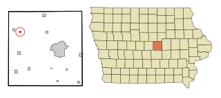
Clemons is a city in Marshall County, Iowa, United States. The population was 140 at the 2020 census.

<span class="mw-page-title-main">Duncombe, Iowa</span> City in Iowa, United States

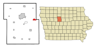
Duncombe is a city in Webster County, Iowa, United States. The population was 381 at the time of the 2020 census.

<span class="mw-page-title-main">McHenry, Kentucky</span> City in Kentucky, United States

McHenry is a home rule-class city in Ohio County, Kentucky, in the United States. The population was 390 at the time of the year 2010 U.S. census.

<span class="mw-page-title-main">Allagash, Maine</span> Town in the state of Maine, United States

Allagash is a town in Aroostook County, Maine, United States. It is on the Allagash River in the North Maine Woods region.

<span class="mw-page-title-main">Westfield, Maine</span> Town in the state of Maine, United States

Westfield is a town in Aroostook County, Maine, United States. The population was 455 at the 2020 census.

<span class="mw-page-title-main">Copemish, Michigan</span> Village in Michigan, United States

Copemish is a village in Manistee County of the U.S. state of Michigan. The population was 195 at the 2020 census. The village is within Cleon Township.

<span class="mw-page-title-main">Lilydale, Minnesota</span> City in Minnesota, United States

Lilydale is a city in Dakota County, Minnesota, United States. The population was 623 at the 2010 census.

<span class="mw-page-title-main">Stephen, Minnesota</span> City in Minnesota, United States

Stephen is a city in Marshall County, Minnesota, United States. The population was 592 at the 2020 census.

<span class="mw-page-title-main">Venango, Nebraska</span> Village in Nebraska, United States

Venango is a village in Perkins County, Nebraska, United States. The population was 157 at the 2020 U.S. census.

<span class="mw-page-title-main">Forsyth, Missouri</span> City in Missouri, United States

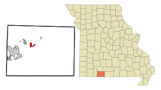
Forsyth is a city in Taney County, Missouri, United States. The population was 2,730 at the 2020 census. It is the county seat of Taney County. The town is part of the Branson, Missouri Micropolitan Statistical Area. Forsyth is located on Lake Taneycomo on U.S. Route 160.

<span class="mw-page-title-main">Oberon, North Dakota</span> City in North Dakota, United States

Oberon is a city in Benson County, North Dakota, United States. The population was 101 at the 2020 census. Oberon was founded in 1886.

<span class="mw-page-title-main">Grandview Heights, Ohio</span> City in Ohio, United States

Grandview Heights, or simply Grandview, is a city in Franklin County, Ohio, United States. The population was 8,085 at the 2020 census.

<span class="mw-page-title-main">Center Township, Butler County, Pennsylvania</span> Township in Pennsylvania, United States

Center Township is a township in Butler County, Pennsylvania, United States. The population was 7,900 at the 2020 census.

<span class="mw-page-title-main">Inman Mills, South Carolina</span> CDP in South Carolina, United States

Inman Mills is a census-designated place (CDP) in Spartanburg County, South Carolina, United States. The population was 1,050 at the 2010 census.

<span class="mw-page-title-main">Encinal, Texas</span> Town in Texas, United States

Encinal is a city in La Salle County, Texas, United States. The population was 540 at the 2020 census. Interstate 35 Business runs through the community. There are few businesses in Encinal; most have closed along the main street.

References

  1. "2020 U.S. Gazetteer Files". United States Census Bureau. Retrieved March 16, 2022.
  2. 1 2 "2020 Census State Redistricting Data". census.gov. United states Census Bureau. Retrieved August 12, 2021.
  3. "Cerro Gordo County". Jim Forte Postal History. Retrieved March 16, 2015.
  4. Chicago and North Western Railway Company (1908). A History of the Origin of the Place Names Connected with the Chicago & North Western and Chicago, St. Paul, Minneapolis & Omaha Railways. p. 65.
  5. "US Gazetteer files: 2010, 2000, and 1990". United States Census Bureau. February 12, 2011. Retrieved April 23, 2011.
  6. "US Gazetteer files 2010". United States Census Bureau. Archived from the original on July 2, 2012. Retrieved May 11, 2012.
  7. "Census of Population and Housing". Census.gov. Retrieved June 4, 2015.
  8. "U.S. Census website". United States Census Bureau . Retrieved May 11, 2012.
  9. "U.S. Census website". United States Census Bureau . Retrieved January 31, 2008.
  10. "West Fork." Iowa Department of Education. Retrieved on January 13, 2019.
  11. "REORGANIZATION & DISSOLUTION ACTIONS SINCE 1965-66 Archived 2019-02-09 at the Wayback Machine ." Iowa Department of Education. Retrieved on January 13, 2019.