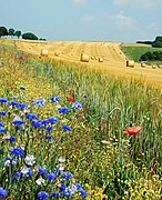
Pasture is land used for grazing.

Rangelands are grasslands, shrublands, woodlands, wetlands, and deserts that are grazed by domestic livestock or wild animals. Types of rangelands include tallgrass and shortgrass prairies, desert grasslands and shrublands, woodlands, savannas, chaparrals, steppes, and tundras. Rangelands do not include forests lacking grazable understory vegetation, barren desert, farmland, or land covered by solid rock, concrete and/or glaciers.

Gerringong is a town located about ten minutes drive south of Kiama, and about twenty minutes north of Nowra in the Illawarra region of New South Wales, Australia in the Municipality of Kiama. At the 2016 census, Gerringong had a population of 3,966. One theory says that the name derives from an Aboriginal word meaning "fearful place".
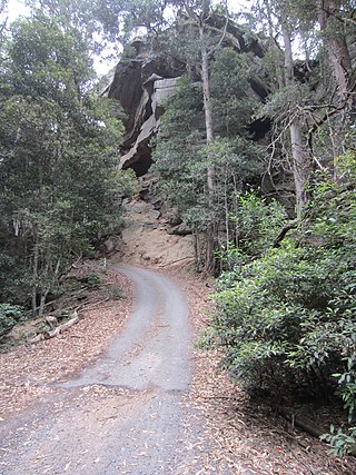
Glenworth Valley is in the Central Coast region to the north of the Hawkesbury River itself 50 km (31 mi) to the north of the city of Sydney, Australia. Popran Creek flows through the valley which includes parts of the suburbs of Glenworth Valley and Mount White. Popran National Park was created in 1994 and is for the most part made up of sandstone cliffs and gullies. The creation of the park is indicative of the value the area has because of its unique indigenous and early European history, fauna, flora and geology. The Park takes its name from Popran Creek which rises in the locality of Central Mangrove and then flows for approximately 24 km (15 mi) in a mostly southern direction till it reaches Mangrove Creek.

The Sydney Gazette and New South Wales Advertiser was the first newspaper printed in Australia, running from 5 March 1803 until 20 October 1842. It was a semi-official publication of the government of New South Wales, authorised by Governor King and printed by George Howe. On 14 October 1824, under the editorship of Robert Howe, it ceased to be censored by the colonial government.

Nerrigundah is a small village on the Eurobodalla Nature Coast in south eastern New South Wales. Situated at the head of the Tuross River Valley, it is nineteen kilometres inland from Bodalla. At the 2016 census, Nerrigundah had a population of 25.
The Australasia County Board of the Gaelic Athletic Association (GAA), or Australasian GAA, or Gaelic Football & Hurling Association of Australasia is one of the county boards of the GAA outside Ireland, and is responsible for Gaelic games all across Australasia. It is also responsible for Australasian inter-state matches, primarily conducted in an annual weeklong tournament. The association is made up of the Australian state associations of New South Wales, Queensland, South Australia, Tasmania, Victoria and Western Australia, and the New Zealand associations of Wellington and Canterbury.
His Majesty's colonial brig Elizabeth Henrietta was completed in 1816 for New South Wales service, but capsized on the Hunter River, Australia later that year with the loss of two lives. The ship was wrecked in 1825.
Charlotte Badger was a former convict who was on board the Venus during a mutiny in Tasmania in 1806. Taken to New Zealand, she was rescued by Captain Turnbull of the Indispensible, and eventually she returned to Sydney. In the intervening centuries, a number of writers have contributed to the fiction that she took an active role in the mutiny and she became known – erroneously – as Australia's first female pirate.
Jembaicumbene is a locality in the Southern Tablelands of New South Wales, Australia, located 8 km (5 miles) out along the Braidwood–Majors Creek Road. Once a thriving goldfield, it is now a peaceful valley on the way to Majors Creek. The mining village of the same name is now virtually a ghost town.

Alexander Cecil Knox Mackenzie was an Australian cricketer. He played 48 first-class matches for New South Wales and Rest of Australia between seasons 1888/89 and 1906/07. In the Sydney grade competition he is most well known for having played for the Paddington and Waverley clubs.

Larbert is a locality in the Queanbeyan-Palerang Region of the Southern Tablelands region of New South Wales. It lies mostly north of the Kings Highway between Bungendore and Braidwood where it crosses the Shoalhaven River. At the 2021 census, it had a population of 34.
The Orielton Homestead is an estate in the Macarthur Region of Sydney, New South Wales, Australia. It is located on the grounds of Harrington Grove, which is part of the Harrington Park estate.
The Wool Road was a historic road in New South Wales, Australia, that ran from Nerriga to what is now called Vincentia on Jervis Bay. It was constructed privately in 1841, using convict labour. Its purpose was to provide a shorter route to a seaport for wool grown at Braidwood and beyond. The historical significance of The Wool Road is that it was the first road, capable of being used by wheeled vehicles, linking the inland area around Braidwood to the South Coast. The road led to the foundation of the privately-owned port town of South Huskisson and the adjacent 'government townshIp' of Huskisson.

James Larmer was a government surveyor in the colony of New South Wales. Between 1830 and 1859, he surveyed land, roads and settlements in New South Wales. He was an Assistant Surveyor to the Surveyor-General, Sir Thomas Mitchell, from 1835 to 1855. In 1835, he was second in command of Mitchell's second expedition. He is also noteworthy for his recording of Aboriginal words from various parts of New South Wales.
Canonba is a locality in the Orana region of New South Wales, Australia. There was also a village of the same name, which is now a ghost town. It lay on Duck Creek, a tributary of the Bogan River, approximately 30 km north-east of Nyngan. Since 1983, the old village site has been known officially as Old Canonba.
Lost River is a locality, in the Upper Lachlan Shire, within the Southern Tablelands of New South Wales, Australia. It lies on either side of the main road between Crookwell and Boorawa, which are the nearest towns to it.
Lieutenant George Meares Countess Bowen (1803–1889) was a military officer and colonial settler of New South Wales, Australia. He was mainly associated with Bowen Mountain, Mount Tomah, Berambing, and the nearby areas of the Blue Mountains.
Captain Duncan Mackellar was a sea captain and, subsequently, a colonial settler of New South Wales, Australia, with his nephew, Duncan Mackellar, Junior (1795—1838). Both are associated with the early days of Braidwood.
Dangelong is a rural locality in the Snowy Monaro Regional Council local government area of New South Wales, Australia. It is located south-east of Cooma. It had no people or a very low population recorded at the 2021 census.