Fifth Street, Texas

Last updated
Fifth Street, Texas
FortBend County FifthStreet.svg
Coordinates: 29°35′53″N95°33′4″W / 29.59806°N 95.55111°W / 29.59806; -95.55111 Coordinates: 29°35′53″N95°33′4″W / 29.59806°N 95.55111°W / 29.59806; -95.55111
Country United States
State Texas
County Fort Bend
Area
  Total0.81 sq mi (2.09 km2)
  Land0.79 sq mi (2.05 km2)
  Water0.02 sq mi (0.04 km2)
Elevation
76 ft (23 m)
Population
 (2010)
  Total2,486
  Density3,147/sq mi (1,215.0/km2)
Time zone UTC-6 (Central (CST))
  Summer (DST) UTC-5 (CDT)
ZIP code
77477 (Stafford)
FIPS code 48-25795
GNIS feature ID1852706

Fifth Street is a census-designated place (CDP) located in the extraterritorial jurisdiction of Stafford within Fort Bend County, Texas, United States. The population was 2,486 at the 2010 census. [1] Fifth Street is within the ZIP code 77477. Therefore, residents of Fifth Street have an address of Stafford, Texas.

Contents

History

By the 1980s the development or at minimum the name "Fifth Street" existed. In 2000 it had 2,059 residents. It is a bedroom community of Houston. [2]

Geography

Map of the Fifth Street CDP FifthStreetTXMap.gif
Map of the Fifth Street CDP

Fifth Street is in northeastern Fort Bend County, near the border with Harris County and between Missouri City and Stafford. [2] Downtown Houston is 20 miles (32 km) to the northeast.

Fifth Street is located at 29°35′56″N95°32′57″W / 29.598888°N 95.549119°W / 29.598888; -95.549119 . [3] According to the United States Census Bureau, the CDP has a total area of 0.81 square miles (2.1 km2), of which 0.02 square miles (0.04 km2), or 1.86%, is water. [1]

Demographics

As of the census [4] of 2000, there were 2,059 people, 503 households, and 422 families residing in the CDP. The population density was 2,536.8 people per square mile (981.5/km2). There were 537 housing units at an average density of 661.6/sq mi (256.0/km2). The racial makeup of the CDP was 50.90% White, 5.15% African American, 0.15% Native American, 0.10% Asian, 0.05% Pacific Islander, 41.23% from other races, and 2.43% from two or more races. Hispanic or Latino of any race were 90.34% of the population.

There were 503 households, out of which 46.3% had children under the age of 18 living with them, 57.3% were married couples living together, 15.7% had a female householder with no husband present, and 16.1% were non-families. 9.3% of all households were made up of individuals, and 2.4% had someone living alone who was 65 years of age or older. The average household size was 4.09 and the average family size was 4.29.

In the CDP, the population was spread out, with 34.0% under the age of 18, 13.1% from 18 to 24, 32.3% from 25 to 44, 15.6% from 45 to 64, and 5.0% who were 65 years of age or older. The median age was 26 years. For every 100 females, there were 129.5 males. For every 100 females age 18 and over, there were 137.4 males.

The median income for a household in the CDP was $29,773, and the median income for a family was $34,740. Males had a median income of $26,310 versus $17,500 for females. The per capita income for the CDP was $9,697. About 20.4% of families and 21.8% of the population were below the poverty line, including 19.6% of those under age 18 and 22.6% of those age 65 or over.

Government and infrastructure

Fort Bend County does not have a hospital district. OakBend Medical Center serves as the county's charity hospital which the county contracts with. [5]

Education

Lynn Armstrong Elementary School in Fifth Street FBISD Armstrong Elementary.jpg
Lynn Armstrong Elementary School in Fifth Street

Fifth Street is within the Fort Bend Independent School District. [6]

Most residents are zoned to Armstrong Elementary School, [7] while some are zoned to Edgar Glover Elementary School. [8] Two secondary schools in Missouri City, Missouri City Middle School and Thurgood Marshall High School, [9] [10] serve Fifth Street.

Before Armstrong opened in August 2008, [11] Fifth Street was divided between Glover Elementary School, E.A. Jones Elementary School, and Quail Valley Elementary School. [12] [13] In 2008 Armstrong took most of Fifth Street. [14]

Prior to April 18, 1959 an elementary school in Missouri City, now E. A. Jones, existed. Quail Valley Elementary School had been occupied by August 1975. Missouri City Junior High School opened in October 1975. Glover opened on August 17, 1994. Marshall High School opened on August 15, 2002. The rebuilt E. A. Jones opened on August 27, 2007. Armstrong opened on August 25, 2008. The rebuilt Missouri City Middle School opened in August 2008. [11]

Parks and recreation

Fort Bend County operates the 5-acre (20,000 m2) Stafford Community Center in Fifth Street. [15]

Related Research Articles

Fort Bend County, Texas U.S. county in Texas

Fort Bend County is a county located in the U.S. state of Texas. According to 2019 census estimates, its population was 811,688 and Texas's 10th-most populous county. In 2015, Fort Bend County became Texas's wealthiest county, with a median household income of $95,389 and a median family income of $105,944, surpassing Collin and Rockwall Counties since the 2000 census. The county seat is Richmond, and the largest city located entirely within the county borders is Sugar Land. The largest city by population in the county is Houston; however, most of Houston's population is located in neighboring Harris County.

Arcola, Texas City in Texas, United States

Arcola is a city in Fort Bend County, Texas, United States, within the Houston–Sugar Land–Baytown metropolitan area. The population was 1,642 at the 2010 census, up from 1,048 at the 2000 census.

Cumings, Texas Census-designated place in Texas, United States

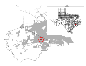
Cumings is an unincorporated community and census-designated place (CDP) in Fort Bend County, Texas, United States. The population was 981 at the 2010 census.

Four Corners, Texas Census-designated place in Texas, United States

Four Corners is a census-designated place (CDP) within the extraterritorial jurisdiction of Houston in Fort Bend County, Texas, United States. The population was 12,382 at the 2010 census, up from 2,954 at the 2000 census.

Fresno, Texas Census-designated place in Texas, United States

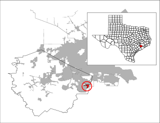
Fresno is an unincorporated community and census-designated place (CDP) in Fort Bend County, Texas, United States. The population was 19,069 at the 2010 census, up from 6,603 at the 2000 census.

Greatwood, Sugar Land, Texas Place in Texas, United States

Greatwood is a city in the state of Texas. It was formerly a census-designated place located in Fort Bend County. The population was 11,538 at the 2010 census, up from 6,640 at the 2000 census. It was annexed into the City of Sugar Land on December 12, 2017.

Meadows Place, Texas City in Texas, United States

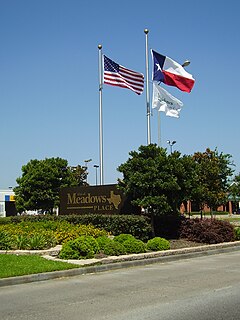
Meadows Place is a city located in Fort Bend County in the U.S. state of Texas within the Houston–Sugar Land–Baytown metropolitan area. As of the 2010 U.S. Census, the city population was 4,660.

New Territory, Sugar Land, Texas Place in Texas, United States

New Territory is a master-planned community within the city of Sugar Land, Texas, United States. It was formerly a census-designated place (CDP) and in the extraterritorial jurisdiction of Sugar Land, in unincorporated Fort Bend County. It was annexed into Sugar Land on December 12, 2017. The population was 15,186 at the 2010 census, up from 13,861 at the 2000 census.

Pecan Grove, Texas Census-designated place in Texas, United States

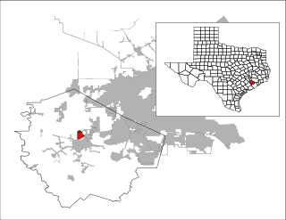
Pecan Grove is a census-designated place and master-planned community within the extraterritorial jurisdiction of Richmond in Fort Bend County, Texas, United States. The population was 15,963 at the 2010 census.

Sienna, Texas Census-designated place in Texas, United States

Sienna, formerly known as Sienna Plantation, is a census-designated place and master-planned community located in Missouri City, mostly in its extraterritorial jurisdiction, within Fort Bend County, Texas, United States. The population was 13,721 at the 2010 census, up from 1,896 at the 2000 census.

Hudson Bend, Texas CDP in Texas, United States

Hudson Bend is a census-designated place (CDP) in Travis County, Texas, United States. The population was 2,981 at the 2010 census.

Cinco Ranch, Texas Census-designated place in Texas, United States

Cinco Ranch is a census-designated place and master-planned community located in the extraterritorial jurisdiction of the city of Houston within Fort Bend and Harris counties in the U.S. state of Texas. The population was 18,274 at the 2010 census. It lies about 25 miles (40 km) west of the Harris County seat of Houston and 10 miles (16 km) north of the Fort Bend County seat of Richmond. Cinco Ranch is considered to be part of the Greater Katy area and is roughly 10 miles southeast of the city of Katy.

Mission Bend, Texas Census-designated place in Texas, United States

Mission Bend is a census-designated place (CDP) around Texas State Highway 6 within the extraterritorial jurisdiction of Houston in Fort Bend and Harris counties in the U.S. state of Texas; Mission Bend is 4 miles (6 km) northwest of the city hall of Sugar Land and 20 miles (32 km) southwest of Downtown Houston. The population was 36,501 at the 2010 census.

Missouri City, Texas City in Texas, United States

Missouri City is a city in the U.S. state of Texas, within the Houston–The Woodlands–Sugar Land metropolitan area. The city is mostly in Fort Bend County, with a small portion in Harris County. As of the 2010 census, the city had a population of 67,358, up from 52,913 in 2000. The population was estimated at 75,457 in 2019.

Stafford, Texas City in Texas, United States

Stafford is a city in the U.S. state of Texas, in the Houston–The Woodlands–Sugar Land metropolitan area. The city is mostly in Fort Bend County, with a small part in Harris County. As of the 2010 census, Stafford's population was 17,693, up from 15,681 at the 2000 census. As of 2019, the population had decreased to an estimated 17,362.

Fort Bend Independent School District

The Fort Bend Independent School District, also known as Fort Bend ISD or FBISD, is a school district system in the U.S. state of Texas based in the city of Sugar Land.

Thurgood Marshall High School (Texas) Public high school in Missouri City, Texas, United States

Thurgood Marshall High School is a public high school located in Missouri City, Texas and is a part of the Fort Bend Independent School District.

First Colony

First Colony is a 9,700-acre (39 km2) master-planned community in Fort Bend County, Texas. The community, with approximately 50,000 residents, encompasses over 9,500 residential houses in 61 neighborhoods located across southern parts of Sugar Land with a few neighborhoods spanning into Missouri City.

Quail Valley (Missouri City, Texas)

Quail Valley is a neighborhood dating from 1969 of Missouri City, in Fort Bend County, Texas, USA.

Ridge Point High School (RPHS) is a public high school located in Sienna, an unincorporated area and planned community in Fort Bend County, Texas.

References

  1. 1 2 "Geographic Identifiers: 2010 Demographic Profile Data (G001): Fifth Street CDP, Texas". U.S. Census Bureau, American Factfinder. Retrieved September 1, 2016.[ dead link ]
  2. 1 2 "Fifth Street, Texas." Handbook of Texas . Retrieved on September 12, 2011.
  3. "US Gazetteer files: 2010, 2000, and 1990". United States Census Bureau. 2011-02-12. Retrieved 2011-04-23.
  4. "U.S. Census website". United States Census Bureau . Retrieved 2008-01-31.
  5. Knipp, Bethany (2016-11-02). "Fort Bend County lacks hospital district". Community Impact Newspaper . Retrieved 2021-10-18.
  6. "2010 CENSUS - CENSUS BLOCK MAP: Fifth Street CDP, TX" (PDF). U.S. Census Bureau . Retrieved 2020-09-28. - Compare this with FBISD school boundary maps.
  7. "Armstrong Elementary Attendance Zone." Fort Bend Independent School District. Retrieved on September 12, 2011.
  8. "Glover Elementary School Attendance Zone." Fort Bend Independent School District. Retrieved on September 12, 2011.
  9. "Missouri City Middle School Attendance Zone." Fort Bend Independent School District. Retrieved on September 12, 2011.
  10. "Marshall High School Attendance Zone." Fort Bend Independent School District. Retrieved on September 12, 2011.
  11. 1 2 "FBISD History Archived September 7, 2008, at the Wayback Machine ." Fort Bend Independent School District. Retrieved on September 12, 2011.
  12. "Elementary School Attendance Zones." Fort Bend Independent School District. October 29, 2005. Retrieved on September 12, 2011.
  13. "2006-2007 Elementary School Attendance Zones." Fort Bend Independent School District. October 6, 2006. Retrieved on September 12, 2011.
  14. "Elementary School Attendance Zones." Fort Bend Independent School District. February 27, 2009. Retrieved on September 12, 2011.
  15. "Community Centers Archived 2011-06-04 at the Wayback Machine ." Fort Bend County. Retrieved on October 11, 2009.