
Osage County is a county in the central part of the U.S. state of Missouri. As of the 2020 census, the population was 13,274. Its county seat is Linn. The county was organized January 29, 1841, and named from the Osage River.

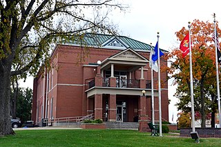
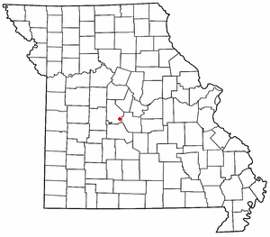
Morgan County is a county located in the central portion of the U.S. state of Missouri. As of the 2020 census, the population was 21,006. Its county seat is Versailles. The county was organized January 5, 1833 and named for General Daniel Morgan of the American Revolutionary War.

Miller County is a county located in the U.S. state of Missouri. As of the 2020 United States census, the population was 24,722. Its county seat is Tuscumbia. The county was organized February 6, 1837 and named for John Miller, former U.S. Representative and Governor of Missouri.

Maries County is a county located in the U.S. state of Missouri. As of the 2020 census, its population was 8,432. Its county seat is Vienna. The county was organized March 2, 1855 and named for the Maries River and Little Maries River. The word "Maries" is derived from the French word marais, which means "marsh, lake, or pond".

Laclede County is a county located in the U.S. state of Missouri. As of the 2020 census, the population was 36,039. Its county seat is Lebanon. The county was organized February 24, 1849, and was named after Pierre Laclède, founder of St. Louis.
Benton County is a county located in the west central part of the U.S. state of Missouri. The population was 19,394 as of the 2020 Census. Its county seat is Warsaw. The county was organized January 3, 1835, and named for U.S. Senator Thomas Hart Benton of Missouri.
Stover is a city in Morgan County, Missouri, United States. The population was 1,094 at the 2010 census.

Portageville is a city in New Madrid and Pemiscot counties in the U.S. state of Missouri. The population was 2,942 according to the 2020 Census.

Morgan is an unincorporated village in southern Laclede County, Missouri, United States. It is located approximately eleven miles south of Lebanon at the intersection of Missouri Supplemental Routes J and PP. Conway is approximately seven miles to the west. The Osage Fork flows past 1.5 miles to the south. There is a combined grocery store and gas station located in Morgan, along with numerous houses.
Rocky Mount is an unincorporated community in eastern Morgan County, Missouri, United States. It is located six miles southwest of Eldon, near the Lake of the Ozarks. The ZIP Code for Rocky Mount is 65072.
Purvis is an unincorporated community in northern Camden County, in the U.S. state of Missouri. The community is located on the north shore of the Lake of the Ozarks. The Purvis cemetery is located to the southwest across the Brush Creek arm of the lake. The community of Laurie is located on Missouri Route 5 and is approximately two miles to the north, in Morgan County.
Rocky Mount is an unincorporated community in western Miller County, Missouri United States. The site is on Missouri Route Y approximately four miles southwest of Eldon. The Rocky Mount church is located at this location, however the post office was moved into neighboring Morgan County about two miles to the southwest in 1919. The Rocky Mount Lookout Tower and Rocky Mount Towersite State Wildlife Area lie approximately two miles to the east.
Aikinsville is an unincorporated community in Morgan County, in the U.S. state of Missouri.
Boylers Mill is an unincorporated community in western Morgan County, in the U.S. state of Missouri. The community is in Pole Hollow just north of the Big Buffalo Creek. The site is on Missouri Route FF.
Buck Creek is an unincorporated community in Morgan County, in the U.S. state of Missouri. The community is on Missouri Route O about four miles northeast of Laurie. The location is just west of the Gravois Creek Arm of the Lake of the Ozarks.
Glensted is an unincorporated community in Morgan County, in the U.S. state of Missouri.
Marvin is an unincorporated community in Morgan County, in the U.S. state of Missouri.
Proctor is an unincorporated community in southwest Morgan County, in the U.S. state of Missouri.
Pyrmont is an unincorporated community in western Morgan County, in the U.S. state of Missouri. The community is located just east of Missouri Route 135 approximately midway between Stover to the south and Florence to the northeast. Gabriel Creek flows past to the east.
Riverview is an unincorporated community in southwestern Morgan County, in the U.S. state of Missouri.
 Hummel Pottery Building 1939

