Laurie, Missouri

Last updated

Laurie, Missouri
Laurie.png
Laurie in May 2024
Morgan County Missouri Incorporated and Unincorporated areas Laurie Highlighted.svg
Location in Morgan County and the state of Missouri
Coordinates: 38°12′29″N92°49′31″W / 38.20806°N 92.82528°W / 38.20806; -92.82528 [1]
Country United States
State Missouri
Counties Morgan, Camden
Area
[2]
  Total5.50 sq mi (14.24 km2)
  Land5.50 sq mi (14.24 km2)
  Water0.00 sq mi (0.00 km2)
Elevation
[1]
883 ft (269 m)
Population
 (2020) [3]
  Total939
  Density170.76/sq mi (65.94/km2)
Time zone UTC-6 (Central (CST))
  Summer (DST) UTC-5 (CDT)
ZIP codes
65037-65038
Area code 573
FIPS code 29-40916 [4]
GNIS feature ID2398400 [1]
Website www.cityoflaurie.com

Laurie is a city in southern Morgan and northern Camden counties, Missouri, United States. The population was 939 at the 2020 census. [3]

Contents

Geography

Laurie is located along the southern border of Morgan County, and a small portion extends south into Camden County. It is about 2 miles (3 km) north of the Lake of the Ozarks. The city is on Missouri Route 5, which leads southeast 3 miles (5 km) to Sunrise Beach and north 8 miles (13 km) to Gravois Mills. [5] Versailles, the Morgan county seat, is 18 miles (29 km) north of Laurie.

According to the U.S. Census Bureau, the city of Laurie has a total area of 5.50 square miles (14.24 km2), all land. [2] The city sits on a ridge which drains in all directions toward the Lake of the Ozarks.

Events

Every year from Mid-November to News Year Day, a drive-through village area of Christmas lights is shown known as "Enchanted Village of Lights." [6]

Demographics

Historical population
CensusPop.Note
1970 106
1980 15445.3%
1990 507229.2%
2000 66330.8%
2010 94542.5%
2020 939−0.6%
U.S. Decennial Census [7]

2010 census

As of the census [8] of 2010, there were 945 people, 457 households, and 241 families living in the city. The population density was 171.8 inhabitants per square mile (66.3/km2). There were 549 housing units at an average density of 99.8 per square mile (38.5/km2). The racial makeup of the city was 97.8% White, 0.2% African American, 0.3% Native American, 0.1% from other races, and 1.6% from two or more races. Hispanic or Latino of any race were 0.6% of the population.

There were 457 households, of which 17.5% had children under the age of 18 living with them, 40.3% were married couples living together, 9.8% had a female householder with no husband present, 2.6% had a male householder with no wife present, and 47.3% were non-families. 40.7% of all households were made up of individuals, and 23.9% had someone living alone who was 65 years of age or older. The average household size was 1.92 and the average family size was 2.52.

The median age in the city was 55.8 years. 14% of residents were under the age of 18; 5.8% were between the ages of 18 and 24; 16.4% were from 25 to 44; 24.6% were from 45 to 64; and 39.2% were 65 years of age or older. The gender makeup of the city was 47.1% male and 52.9% female.

2000 census

As of the census [4] of 2000, there were 663 people, 299 households, and 156 families living in the village. The population density was 126.0 inhabitants per square mile (48.6/km2). There were 329 housing units at an average density of 62.5 per square mile (24.1/km2). The racial makeup of the village was 97.29% White, 0.45% African American, 1.06% Native American, 0.15% from other races, and 1.06% from two or more races. Hispanic or Latino of any race were 0.75% of the population.

There were 299 households, out of which 17.7% had children under the age of 18 living with them, 44.5% were married couples living together, 5.7% had a female householder with no husband present, and 47.8% were non-families. 40.5% of all households were made up of individuals, and 23.1% had someone living alone who was 65 years of age or older. The average household size was 1.92 and the average family size was 2.59.

In the village, the population was spread out, with 14.9% under the age of 18, 4.8% from 18 to 24, 19.5% from 25 to 44, 19.9% from 45 to 64, and 40.9% who were 65 years of age or older. The median age was 55 years. For every 100 females, there were 80.7 males. For every 100 females age 18 and over, there were 76.8 males.

The median income for a household in the village was $24,333, and the median income for a family was $35,357. Males had a median income of $25,833 versus $19,063 for females. The per capita income for the village was $18,023. About 8.6% of families and 12.4% of the population were below the poverty line, including 17.3% of those under age 18 and 7.8% of those age 65 or over.

Climate

The local climate is characterized by relatively high temperatures and evenly distributed precipitation throughout the year. The Köppen Climate Classification subtype for this climate is Cfa" (Humid Subtropical Climate). [9]

Climate data for Laurie, Missouri
MonthJanFebMarAprMayJunJulAugSepOctNovDecYear
Mean daily maximum °C (°F)5
(41)
8
(46)
14
(57)
20
(68)
24
(76)
29
(84)
32
(89)
31
(88)
27
(80)
21
(70)
13
(56)
7
(44)
19
(67)
Mean daily minimum °C (°F)−7
(20)
−4
(24)
1
(33)
6
(43)
12
(53)
17
(62)
19
(67)
18
(65)
14
(57)
7
(45)
1
(34)
−4
(24)
7
(44)
Average precipitation mm (inches)48
(1.9)
51
(2)
76
(3)
100
(4)
130
(5)
110
(4.5)
99
(3.9)
91
(3.6)
110
(4.2)
94
(3.7)
76
(3)
56
(2.2)
1,040
(40.9)
Source: Weatherbase [10]

Related Research Articles

<span class="mw-page-title-main">Merwin, Missouri</span> Village in Missouri, United States

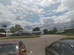
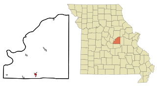
Merwin is a village in Bates County, Missouri, and is part of the Kansas City metropolitan area within the United States. The population was 69 at the 2020 census.

<span class="mw-page-title-main">Smithville, Missouri</span> City in Missouri, United States

Smithville is a city in Clay and Platte counties in the U.S. state of Missouri and is part of the Kansas City metropolitan area, along the Little Platte River. The population was 10,406 at the 2020 United States Census.

<span class="mw-page-title-main">Winston, Missouri</span> Village in Missouri, United States

Winston is a village in southwestern Daviess County, Missouri, United States. The population was 229 at the 2020 census.

<span class="mw-page-title-main">Salem, Missouri</span> City in Missouri, United States

Salem is the county seat of Dent County, Missouri, United States. The population was 4,608 at the 2020 census, which allows Salem to become a Class 3 city in Missouri; however, the city has chosen to remain a Class 4 city under Missouri Revised Statutes. Salem is located a few miles north of the Ozark Scenic Riverways and close to Montauk State Park, which contains the headwaters of the Current River.

<span class="mw-page-title-main">Corning, Missouri</span> Village in Missouri, United States

Corning is a village in Holt County, Missouri, United States. The population was 3 at the 2020 census.

<span class="mw-page-title-main">Mountain View, Missouri</span> City in Missouri, United States

Mountain View is a city in northeastern Howell County, Missouri, United States. The population was 2,533 at the 2020 census.

<span class="mw-page-title-main">Duquesne, Missouri</span> City in Missouri, United States

Duquesne is a Fourth-Class City in Jasper County, Missouri, United States. The population was 2,159 at the 2020 census. It is part of the Joplin, Missouri Metropolitan Statistical Area.

<span class="mw-page-title-main">Festus, Missouri</span> City in Missouri, United States

Festus is a city situated in Jefferson County, Missouri, United States, and is also a suburb of St. Louis. It had a population of 12,706 individuals as of the 2020 census.

<span class="mw-page-title-main">Warrensburg, Missouri</span> City in Missouri

Warrensburg is a city in and the county seat of Johnson County, Missouri, United States. The population was 20,313 at the 2020 census. The Warrensburg Micropolitan Statistical Area consists of Johnson County. The city is a college town as it is home to the University of Central Missouri.

<span class="mw-page-title-main">Freistatt, Missouri</span> Village in Missouri, United States

Freistatt is a village in Lawrence County, Missouri, United States. The population was 163 at the 2010 census.

Stover is a city in Morgan County, Missouri, United States. The population was 1,006 at the 2020 census, down from 1,094 in 2010.

<span class="mw-page-title-main">Versailles, Missouri</span> City in Missouri, United States

Versailles is a city in Morgan County, Missouri, United States. The population was 2,539 at the 2020 census. It is the county seat of Morgan County. Locally, the town's name is pronounced "Ver-sails", rather than the French "Ver-seye".

<span class="mw-page-title-main">Stark City, Missouri</span> Town in Missouri, United States

Stark City is a town in Newton County, Missouri, United States. The population was 139 at the 2010 census, at which time it was a town. It is part of the Joplin, Missouri Metropolitan Statistical Area. It is adjacent to the battlefield of the Second Battle of Newtonia.

<span class="mw-page-title-main">Freeburg, Missouri</span> Village in Missouri, United States

Freeburg is a village in Osage County, Missouri, United States. The population was 409 at the 2020 census. It is part of the Jefferson City, Missouri Metropolitan Statistical Area.

<span class="mw-page-title-main">Park Hills, Missouri</span> City in Missouri, United States

Park Hills is a city in St. Francois County, Missouri, United States. The population was 8,587 at the 2020 census.

<span class="mw-page-title-main">Bel-Ridge, Missouri</span> City in Missouri, United States

Bel-Ridge is a suburban city in northern St. Louis County, Missouri, United States. The population was 2,737 at the 2010 census. Bel-Ridge is part of the Normandy Schools Collaborative. Bel-Ridge became a city in 2015 by a vote of the voters.

<span class="mw-page-title-main">Calverton Park, Missouri</span> City in Missouri, United States

Calverton Park is a city in St. Louis County, Missouri, United States. The population was 1,293 at the 2010 census. The Village of Calverton Park incorporated as the City of Calverton Park in 2014.

<span class="mw-page-title-main">Marlborough, Missouri</span> Village in Missouri, United States

Marlborough is a village in St. Louis County, Missouri, United States. The population was 2,179 at the 2010 census.

<span class="mw-page-title-main">Truesdale, Missouri</span> City in Missouri, United States

Truesdale is a city in Warren County, Missouri, United States. It is directly adjacent to the east of Warrenton and is part of the St. Louis MSA. The population was 732 according to the 2010 Census.

<span class="mw-page-title-main">Clarkson Valley, Missouri</span> City in Missouri, United States

Clarkson Valley is a city in St. Louis County, Missouri, United States. The population was 2,609 at the 2020 census.

References

  1. 1 2 3 U.S. Geological Survey Geographic Names Information System: Laurie, Missouri
  2. 1 2 "2023 U.S. Gazetteer Files: Missouri". United States Census Bureau. Retrieved May 10, 2024.
  3. 1 2 "P1. Race – Laurie city, Missouri: 2020 DEC Redistricting Data (PL 94-171)". U.S. Census Bureau. Retrieved May 10, 2024.
  4. 1 2 "U.S. Census website". United States Census Bureau . Retrieved January 31, 2008.
  5. Missouri Atlas & Gazetteer, DeLorme, 1998, First edition, p. 45, ISBN   0-89933-224-2
  6. Robbins, Kate. "Christmas Lights At The Lake! Here's Where To See Them". LakeExpo.com. Retrieved December 31, 2022.
  7. "Census of Population and Housing". Census.gov. Retrieved June 4, 2015.
  8. "U.S. Census website". United States Census Bureau . Retrieved July 8, 2012.
  9. Climate Summary for Laurie, Missouri
  10. "Weatherbase.com". Weatherbase. 2013. Retrieved on August 3, 2013.