
The Mississippi River is the primary river, and second-longest river, of the largest drainage basin in the United States. From its traditional source of Lake Itasca in northern Minnesota, it flows generally south for 2,340 miles (3,766 km) to the Mississippi River Delta in the Gulf of Mexico. With its many tributaries, the Mississippi's watershed drains all or parts of 32 U.S. states and two Canadian provinces between the Rocky and Appalachian mountains. The main stem is entirely within the United States; the total drainage basin is 1,151,000 sq mi (2,980,000 km2), of which only about one percent is in Canada. The Mississippi ranks as the thirteenth-largest river by discharge in the world. The river either borders or passes through the states of Minnesota, Wisconsin, Iowa, Illinois, Missouri, Kentucky, Tennessee, Arkansas, Mississippi, and Louisiana.

Webster County is a county located in the U.S. state of Missouri. As of the 2020 census, the population was 39,085. Its county seat is Marshfield. The county was organized in 1855 and named for U.S. Senator and U.S. Secretary of State Daniel Webster.
Camdenton is a city in and the county seat of Camden County, Missouri, United States. Its population was 3,718 at the 2010 census. The city is enveloped by the Lower Niangua arm of the Lake of the Ozarks, and serves as a popular trade point for visitors to the area.

The White River is a 722-mile (1,162 km) river that flows through the U.S. states of Arkansas and Missouri. Originating in the Boston Mountains of northwest Arkansas, it arcs northwards through southern Missouri before turning back into Arkansas, flowing southeast to its mouth at the Mississippi River.

The Osage River is a 276-mile-long (444 km) tributary of the Missouri River in central Missouri in the United States. The eighth-largest river in the state, it drains a mostly rural area of 15,300 square miles (40,000 km2). The watershed includes an area of east-central Kansas and a large portion of west-central and central Missouri, where it drains northwest areas of the Ozark Plateau.
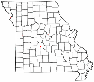
Roach is an unincorporated community in southern Camden County, Missouri, United States. It is located north of U.S. Route 54 on Missouri Route AA, approximately five miles west of Camdenton and 2.5 miles west of the Niangua River arm of the Lake of the Ozarks. The ZIP Code for Roach is 65787.

Lake of the Ozarks is a reservoir created by impounding the Osage River in the northern part of the Ozarks in central Missouri. Parts of three smaller tributaries to the Osage are included in the impoundment: the Niangua River, Grandglaize Creek, and Gravois Creek. The lake has a surface area of 54,000 acres (220 km2) and 1,150 miles (1,850 km) of shoreline. The main channel of the Osage Arm stretches 92 miles (148 km) from one end to the other. The total drainage area is over 14,000 square miles (36,000 km2). The lake's serpentine shape has earned it the nickname "the Missouri Dragon", which has, in turn, inspired the names of local institutions such as the Magic Dragon Street Meet.

A truss arch bridge combines the elements of the truss bridge and the arch bridge. The actual resolution of forces will depend upon the bridge' design. If no horizontal thrusting forces are generated, this becomes an arch-shaped truss which is essentially a bent beam – see moon bridge for an example. If horizontal thrust is generated but the apex of the arch is a pin joint, this is termed as a three-hinged arch. If no hinge exists at the apex, it will normally be a two-hinged arch. In the Iron Bridge shown below, the structure of each frame emulates the kind of structure that previously had been made of wood. Such a wood structure uses closely fitted beams pinned together, so the members within the frames are not free to move relative to one another, as they are in a pin-jointed truss structure that allows rotation at the pin joint. Such rigid structures were further developed in the 20th century as the Vierendeel truss.

The Niangua River is a 125-mile-long (201 km) tributary of the Osage River in the Ozarks region of southern and central Missouri in the United States. Via the Osage and Missouri rivers it is part of the watershed of the Mississippi River.

The Little Niangua River is a 64.4-mile-long (103.6 km) tributary of the Niangua River in the Ozarks region of central Missouri in the United States. Via the Niangua, Osage and Missouri rivers, it is part of the watershed of the Mississippi River. The Little Niangua was so named for its smaller size relative to the Niangua River.
The Washington Bridge was a cantilever truss bridge over the Missouri River at Washington, Missouri over which Route 47 passed between Franklin County, Missouri and Warren County, Missouri. It has also been known as the Route 47 Missouri River Bridge.

The Grand Glaize Bridge is the name of two girder bridges that carry U.S. Route 54 over the Grand Glaize Arm of the Lake of the Ozarks in the city of Osage Beach, Missouri.
Grandglaize Creek is a creek and tributary to the Osage River that forms the Grand Glaize Arm of the Lake of the Ozarks in Missouri. The creek flows for 10 miles (16 km) before reaching the Lake of the Ozarks, and the Grand Glaize Arm extends another 15 miles (24 km) before reaching the Osage River within the lake.
The Little Niangua Suspension Bridge is a Little Niangua River crossing in Camden County, Missouri on Route J. It is a two lane heavy vehicle bridge.

The Hurricane Deck Bridge was a truss arch bridge located on Lake of the Ozarks in the unincorporated community of Hurricane Deck in Camden County, Missouri. It carried Missouri Route 5 across the Osage Arm of the lake. It was perhaps one of the most distinctive features on the lake. It was the only truss-type bridge remaining on the lake. The American Institute of Steel Construction selected the bridge as the most beautiful steel span built in 1936. It was about half a mile long. The bridge was replaced in 2013.

Pawhuska Township is one of eleven townships in Camden County, Missouri, USA. As of the 2000 census, its population was 5,617.

U.S. Route 54 in Missouri is a west-east highway that starts from the Kansas state line in Nevada to the Illinois state line in Louisiana.
Neongwah is an unincorporated community in Camden County, in the U.S. state of Missouri. The community sits above the Niangua River arm of the Lake of the Ozarks. Missouri Route 5 passes just east of the community and Camdenton is three miles to the southeast.
Woolsey Creek is a stream in Camden and Laclede counties the Ozarks of south central Missouri. Woolsey Creek is a tributary to the Niangua River. The stream enters the Niangua just upstream (south) of Lake Niangua.


