Sunrise Beach, Missouri

Last updated

Sunrise Beach, Missouri
Sunrise Beach.png
Sunrise Beach in May 2024
USA Missouri location map.svg
Red pog.svg
Sunrise Beach
Usa edcp location map.svg
Red pog.svg
Sunrise Beach
Coordinates: 38°10′47″N92°46′21″W / 38.17972°N 92.77250°W / 38.17972; -92.77250
Country United States
State Missouri
Counties Camden, Morgan
Incorporated1932
Area
[1]
  Total5.82 sq mi (14.90 km2)
  Land5.81 sq mi (14.88 km2)
  Water0.01 sq mi (0.02 km2)
Elevation
[2]
791 ft (241 m)
Population
 (2020) [3]
  Total431
  Density75.03/sq mi (28.97/km2)
Time zone UTC-6 (Central (CST))
  Summer (DST) UTC-5 (CDT)
ZIP code
65079
Area code 573
FIPS code 29-71728 [4]
GNIS feature ID2399935 [2]
Website sunrisebeachmo.com

Sunrise Beach is a village in Camden and Morgan counties in the U.S. state of Missouri. The population was 431 at the 2020 census, [3] unchanged from 2010.

Contents

History

A post office called Sunrise Beach has been in operation since 1932. [5] The village was named for its location near the Lake of the Ozarks. [6]

Geography

Sunrise Beach is in northern Camden County, with a small portion extending north into the southeast corner of Morgan County. Missouri Route 5 (Sunset Boulevard) runs the length of the village, leading northwest 3 miles (5 km) to Laurie and 21 miles (34 km) to Versailles, and south 15 miles (24 km) to Camdenton.

According to the U.S. Census Bureau, the village has a total area of 5.82 square miles (15.07 km2), of which 0.01 square miles (0.03 km2), or 0.17%, are water. [1] The village sits on the crest of a neck of land bordered by the Lake of the Ozarks. The village limits extend to the lakeshore in several locations to the northeast, southeast, and southwest.

Demographics

Historical population
CensusPop.Note
1960 78
1970 12661.5%
1980 14817.5%
1990 18122.3%
2000 368103.3%
2010 43117.1%
2020 4310.0%
U.S. Decennial Census [7]

2010 census

As of the census [8] of 2010, there were 431 people, 207 households, and 122 families living in the village. The population density was 78.5 inhabitants per square mile (30.3/km2). There were 418 housing units at an average density of 76.1 per square mile (29.4/km2). The racial makeup of the village was 94.7% White, 0.2% African American, 1.6% Native American, 0.5% from other races, and 3.0% from two or more races. Hispanic or Latino of any race were 3.0% of the population.

There were 207 households, of which 21.7% had children under the age of 18 living with them, 43.0% were married couples living together, 10.6% had a female householder with no husband present, 5.3% had a male householder with no wife present, and 41.1% were non-families. 32.4% of all households were made up of individuals, and 18.4% had someone living alone who was 65 years of age or older. The average household size was 2.08 and the average family size was 2.51.

The median age in the village was 48.9 years. 16.7% of residents were under the age of 18; 7.7% were between the ages of 18 and 24; 19.3% were from 25 to 44; 27.9% were from 45 to 64; and 28.5% were 65 years of age or older. The gender makeup of the village was 48.0% male and 52.0% female.

2000 census

As of the census [4] of 2000, there were 368 people, 171 households, and 112 families living in the village. The population density was 83.0 inhabitants per square mile (32.0/km2). There were 350 housing units at an average density of 79.0 per square mile (30.5/km2). The racial makeup of the village was 93.48% White, 2.17% Native American, 0.54% Asian, 1.09% from other races, and 2.72% from two or more races. Hispanic or Latino of any race were 1.90% of the population.

There were 171 households, out of which 15.2% had children under the age of 18 living with them, 59.1% were married couples living together, 4.7% had a female householder with no husband present, and 34.5% were non-families. 28.1% of all households were made up of individuals, and 14.6% had someone living alone who was 65 years of age or older. The average household size was 2.15 and the average family size was 2.52.

In the village, the population was spread out, with 14.9% under the age of 18, 6.3% from 18 to 24, 19.6% from 25 to 44, 29.9% from 45 to 64, and 29.3% who were 65 years of age or older. The median age was 51 years. For every 100 females, there were 96.8 males. For every 100 females age 18 and over, there were 92.0 males.

The median income for a household in the village was $27,679, and the median income for a family was $30,833. Males had a median income of $21,016 versus $15,536 for females. The per capita income for the village was $17,382. About 6.3% of families and 10.7% of the population were below the poverty line, including 43.9% of those under age 18 and 4.3% of those age 65 or over.

Education

Camdenton R-III School District operates Hurricane Deck Elementary School at Sunrise Beach. [9] Lake Christian Academy is a private institution located within the village. [10]

Sunrise Beach has a public library, a branch of the Camden County Library District. [11]

Related Research Articles

<span class="mw-page-title-main">Laclede County, Missouri</span> County in Missouri, United States

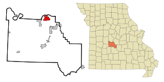
Laclede County is a county located in the U.S. state of Missouri. As of the 2020 census, the population was 36,039. Its county seat is Lebanon. The county was organized February 24, 1849, and was named after Pierre Laclède, founder of St. Louis.

<span class="mw-page-title-main">Camden County, Missouri</span> County in Missouri, United States

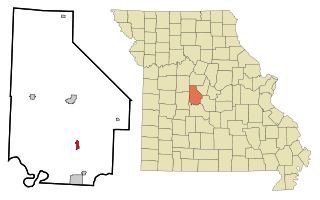
Camden County is a county located in the U.S. state of Missouri. As of the 2020 Census, the population was 42,745. Its county seat is Camdenton. The county was organized on January 29, 1841, as Kinderhook County and renamed Camden County in 1843 after Charles Pratt, 1st Earl Camden, Lord Chancellor of the United Kingdom and leader of the British Whig Party. Camden County is also the primary setting of the Netflix show Ozark.

<span class="mw-page-title-main">Emerald Beach, Missouri</span> Village in Missouri, United States

Emerald Beach is a village in White River Township, Barry County, Missouri, United States. The community is located on a bend in the White River now Table Rock Lake. Cassville is approximately 13 miles to the northwest and Rogers, Arkansas is 32 mile to the southwest.

<span class="mw-page-title-main">Camdenton, Missouri</span> City in Missouri, US

Camdenton is a city in and the county seat of Camden County, Missouri, United States. Its population was 3,718 at the 2010 census. The city is enveloped by the Lower Niangua arm of the Lake of the Ozarks, and serves as a popular trade point for visitors to the area.

<span class="mw-page-title-main">Climax Springs, Missouri</span> Census-designated place in Missouri, United States

Climax Springs is a census-designated place and former village in Camden County, Missouri, United States. The population was 124 at the 2010 census.

<span class="mw-page-title-main">Linn Creek, Missouri</span> City in Missouri, United States

Linn Creek is a city in Camden County, Missouri, United States. The population was 216 at the 2020 census.

<span class="mw-page-title-main">Macks Creek, Missouri</span> Census-designated place in Missouri, United States

Macks Creek is an unincorporated community and census-designated place in southwest Camden County, Missouri, United States. The population was 244 at the 2010 census.

<span class="mw-page-title-main">Village of Four Seasons, Missouri</span> Village in Missouri, United States

Village of Four Seasons is a village in Camden County, Missouri, United States. The population was 2,217 at the 2010 census. The village is situated on the shores of Lake of the Ozarks and is a popular tourist destination along with the other communities in the area.

<span class="mw-page-title-main">Otterville, Missouri</span> City in Missouri, United States

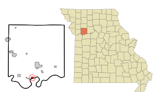
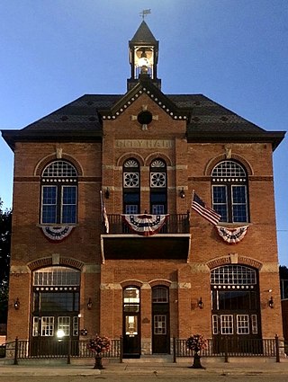
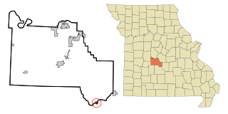
Otterville is a city in southwest Cooper County, Missouri, United States. The population was 454 at the 2010 census.

<span class="mw-page-title-main">Gravois Mills, Missouri</span> Town in Missouri, United States

Gravois Mills is a town in Morgan County, Missouri, United States. The population was 129 at the 2020 census.

<span class="mw-page-title-main">Laurie, Missouri</span> City in Missouri, US

Laurie is a city in southern Morgan and northern Camden counties, Missouri, United States. The population was 939 at the 2020 census.

<span class="mw-page-title-main">Camden, Missouri</span> City in Missouri, United States

Camden is a city in southern Ray County, Missouri, and part of the Kansas City metropolitan area within the United States. The population was 175 at the 2020 census.

<span class="mw-page-title-main">Bull Creek, Missouri</span> Village in Missouri, United States

Bull Creek is a village in northwest Taney County, Missouri, United States. The population was 426 at the 2020 census. It is part of the Branson, Missouri Micropolitan Statistical Area.

<span class="mw-page-title-main">Merriam Woods, Missouri</span> City in Missouri, United States

Merriam Woods is a city in Taney County, Missouri, United States. The population was 2,006 at the 2020 census. It is part of the Branson, Missouri Micropolitan Statistical Area.

<span class="mw-page-title-main">Camden Point, Missouri</span> City in Missouri, United States

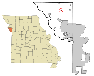
Camden Point is a city in Platte County, Missouri, United States and is part of the Kansas City metropolitan area. The population was 457 at the 2020 census.

<span class="mw-page-title-main">Camden, Ohio</span> Village in Ohio, United States

Camden is a village in Preble County, Ohio, United States. The population was 1,989 at the 2020 census.

<span class="mw-page-title-main">Sunrise Beach Village, Texas</span> City in Texas, United States

Sunrise Beach Village is a city in Llano County, Texas, United States. The village was established in 1973. The population was 713 at the 2010 census.

<span class="mw-page-title-main">Lake Ozark, Missouri</span> City in Missouri, United States

Lake Ozark is a city in Camden and Miller counties in the U.S. state of Missouri, near its namesake, the Lake of the Ozarks. The population was 2,077 at the 2020 census.

<span class="mw-page-title-main">Osage Beach, Missouri</span> City in Missouri, United States

Osage Beach is a city in Camden and Miller counties in the U.S. state of Missouri, near the Lake of the Ozarks. Most of the city is in Camden County, while a small eastern sliver is in Miller County. The population was 4,792 at the 2020 census.

<span class="mw-page-title-main">Stoutland, Missouri</span> City in Missouri, United States

Stoutland is a city in Camden and Laclede counties in the U.S. state of Missouri. The population was 192 at the 2010 census.

References

  1. 1 2 "2023 U.S. Gazetteer Files: Missouri". United States Census Bureau. Retrieved May 13, 2024.
  2. 1 2 U.S. Geological Survey Geographic Names Information System: Sunrise Beach, Missouri
  3. 1 2 "P1. Race – Sunrise Beach village, Missouri: 2020 DEC Redistricting Data (PL 94-171)". U.S. Census Bureau. Retrieved May 13, 2024.
  4. 1 2 "U.S. Census website". United States Census Bureau . Retrieved January 31, 2008.
  5. "Post Offices". Jim Forte Postal History. Retrieved September 8, 2016.
  6. "Camden County Place Names, 1928–1945 (archived)". The State Historical Society of Missouri. Archived from the original on June 24, 2016. Retrieved September 8, 2016.{{cite web}}: CS1 maint: bot: original URL status unknown (link)
  7. "Census of Population and Housing". Census.gov. Retrieved June 4, 2015.
  8. "U.S. Census website". United States Census Bureau . Retrieved July 8, 2012.
  9. "Camdenton R-Iii School District". Greatschools. Retrieved March 18, 2018.
  10. "Homepage". Lake Christian Academy. Retrieved March 18, 2018.
  11. "Hours/Location". Camden County Library District. Archived from the original on March 18, 2018. Retrieved March 18, 2018.