Florida State Road 72

Last updated

Florida 72.svg

State Road 72

Florida State Road 72
SR 72 highlighted in red
Route information
Maintained by FDOT
Length41.582 mi [1]  (66.920 km)
Major junctions
West endUS 41.svg US 41 near Sarasota
I-75.svg I-75 near Sarasota
East endFlorida 70.svg SR 70 near Arcadia
Location
Country United States
State Florida
Counties Sarasota, DeSoto
Highway system
Florida 71.svg SR 71 Florida 73.svg SR 73

State Road 72 (SR 72) is a state highway in DeSoto and Sarasota County, Florida. It is the most direct route to Siesta Key when traveling west on SR 70 from Arcadia and Fort Pierce.

Contents

The western terminus is at an intersection with U.S. Route 41. The road is then 6 lanes wide from US 41 to the Interstate 75 interchange. Immediately east of Interstate 75, the road transforms from 6 lanes wide to 2 lanes wide. It crosses the Myakka River and provides access to Myakka River State Park. A block west of the eastern terminus is CR 661, an alternative of U.S. Route 17 and provides access to State Road 60 (via SR 37). Its eastern terminus is at an intersection of SR 70 near Arcadia.

Route description

SR 72 westbound past I-75 interchange near Bee Ridge FL 72 WB past I-75.jpg
SR 72 westbound past I-75 interchange near Bee Ridge

SR 72 begins at an intersection with US 41/SR 45. SR 72 passes homes and businesses as a seven-lane road with a center left-turn lane, curving east onto Clark Road at the Swift Road intersection. The road continues through developed areas, crossing South Lockwood Ridge Road, CR 773 (Beneva Road), and Sawyer Road. The state road becomes a six-lane divided highway and intersects McIntosh Road as it crosses the Legacy Trail, where the former Seminole Gulf Railway line existed. SR 72 passes more businesses and intersects Sawyer Loop Road, Honore Avenue, and Gantt Road before coming to an interchange with I-75/SR 93 near Bee Ridge. [1] [2]

Past this interchange, the state road narrows to four lanes before becoming a two-lane undivided road as it heads through residential areas, passing to the north of Twin Lakes Park. The road turns to the southeast and heads into a mix of wooded neighborhoods and fields, becoming an unnamed road. SR 72 curves east again and runs through rural areas of woods and swamps. The road enters Myakka River State Park and turns southeast. The state road continues through wooded swamps within the state park, heading east again. SR 72 leaves Myakka River State Park and passes through areas of fields and trees. The road crosses into DeSoto County and continues through rural areas for several more miles, intersecting CR 769. SR 72 turns northeast and passes through farmland and trees with some homes, intersecting CR 661 before ending at an intersection with SR 70 to the west of Arcadia. [1] [2]

In 2018, Sarasota County accepted the state's $40 million offer to swap responsibility for several roads (i.e. road swap) in exchange for the state to perform major improvements on River Road, one of the county's main thoroughfares and vital evacuation routes. [3] One of the roads as part of the swap was SR 72 from Midnight Pass Road to US 41. The state will continue to maintain the Siesta Key bridges. The road transfer was completed in September 2020. [4]

Future

Starting in the summer of 2021, the I-75 interchange will be upgraded to a diverging diamond interchange. The project also includes noise barrier walls, sidewalks, bike lanes added along SR 72, and auxiliary lanes for both directions of Interstate 75 from the interchange to the Proctor Road overpass. The project is expected to cost around $51 million and is anticipated to be completed by summer 2023. [5] [6]

Major intersections

CountyLocationmi [1] [7] kmDestinationsNotes
Sarasota 0.0000.000US 41.svg US 41 (Tamiami Trail South / SR 45) Sarasota, Venice Southern/western terminus
1.8032.902Beneva Road (CR 773)
4.8027.728I-75.svg I-75 (SR 93) Tampa, St. Petersburg, Naples I-75 exit 205
6.51610.486Proctor Road (CR 72A west)
7.96712.822Lorraine Road (formerly Bee Ridge Extension)
DeSoto 36.70159.065South plate county.svg
CR 769 jct.svg
CR 769 south Port Charlotte
40.73165.550South plate county.svg
CR 661 jct.svg
CR 661 south
41.58266.920Florida 70.svg SR 70  Bradenton, Arcadia Eastern terminus
1.000 mi = 1.609 km; 1.000 km = 0.621 mi

County Road 72A

Sarasota County 72A.svg

County Road 72A

Location South Sarasota-Proctor

County Road 72A (CR 72A) is a west-to-east suffixed alternate of SR 72. The road is called Proctor Road and much of it is four lanes wide. It begins as a four-lane undivided highway at US 41 and does not become a divided highway until it reaches the Sarasota County Technical Institute. At McIntosh Road, it narrows to a two-lane undivided highway. At Honore Avenue, it widens to a four-lane divided highway. After the intersection of Cattleman Road and Grove Point Boulevard, the road narrows down to a two-lane undivided highway before crossing over I-75 with no access, then returns to ground level after a power sub-station on the northeast corner of the overpass. After the intersection of a one-lane dead-end street named Falcon Place, it curves to the southeast where it will eventually meet up with its parent route at a signalized intersection with Dove Avenue. A former right of way of the road can be seen on the northeast corner of the terminus.

Related Research Articles

<span class="mw-page-title-main">New Jersey Route 70</span> Highway in New Jersey

Route 70 is a state highway located in the U.S. state of New Jersey. It extends 59.84 mi (96.30 km) from an interchange with Route 38 in Pennsauken Township, Camden County, east to an intersection with Route 34 and Route 35 in Wall Township, Monmouth County. Route 70 cuts across the middle of the state as a two-lane highway through the Pine Barrens in Burlington and Ocean counties. A popular truck route, it provides access between Philadelphia and the surrounding Delaware Valley metropolitan area and the Jersey Shore resorts, particularly Long Beach Island by way of Route 72. It is also a congested commercial route within Philadelphia's New Jersey suburbs. The western section in Cherry Hill and Marlton is a four- to eight-lane divided highway that serves as a major suburban arterial and is locally known as Marlton Pike. The eastern section in Monmouth and Ocean counties is also a multilane divided highway that runs through suburban areas. Route 70 is officially known as the John Davison Rockefeller Memorial Highway its entire length in honor of John Davison Rockefeller.

<span class="mw-page-title-main">New Jersey Route 168</span> State highway in Camden and Gloucester counties in New Jersey, US

Route 168 is a 10.75-mile (17.30 km) state highway in the southern part of New Jersey. The route's southern terminus is an interchange with Route 42 and the Atlantic City Expressway in the Turnersville section of Washington Township, Gloucester County. The northern terminus is an intersection with County Route 603 on the border of Camden and Woodlynne in Camden County. At this point, the route continues toward downtown Camden as CR 605. Route 168 follows the Black Horse Pike for most of its length, running through suburban areas in Gloucester Township, Runnemede, Bellmawr, and Mount Ephraim. It intersects many major roads, including the Route 42 freeway in Gloucester Township, Route 41 in Runnemede, the New Jersey Turnpike and Interstate 295 (I-295) in Bellmawr, Route 76C in Haddon Township, and U.S. Route 130 in Camden.

<span class="mw-page-title-main">U.S. Route 411</span> Numbered U.S. Highway in Alabama, Georgia, and Tennessee in the United States

U.S. Route 411 (US 411) is an alternate parallel-highway associated with US 11. It extends for about 309.7 miles (498.4 km) from US 78 in Leeds, Alabama, to US 25W/US 70 in Newport, Tennessee. US 411 travels through northeastern Alabama, northwestern Georgia, and southeastern Tennessee. It is signed north-south, as with most highways that have odd numbers, but the route runs primarily in a northeast-southwest direction, and covers a more east-west mileage than it does north-south. Notable towns and cities along its route include Gadsden, Alabama; Rome, Georgia; Cartersville, Georgia; Maryville, Tennessee; Sevierville, Tennessee, and Newport, Tennessee.

<span class="mw-page-title-main">Florida State Road 50</span> Highway in Florida

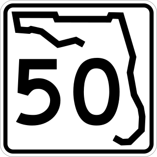
State Road 50 runs across the center of the U.S. state of Florida through Orlando, with its termini at SR 55 at Weeki Wachee and SR 5 in Titusville.

<span class="mw-page-title-main">Florida State Road 777</span> Highway in Florida

State Road 777 is an 5.8-mile-long (9.3 km) state road near North Port, Florida, United States. SR 777 is locally known as River Road from Interstate 75 (I-75) south to its southern terminus at Tamiami Trail where it continues south as a county road.

<span class="mw-page-title-main">Florida State Road 44</span> Highway in Florida

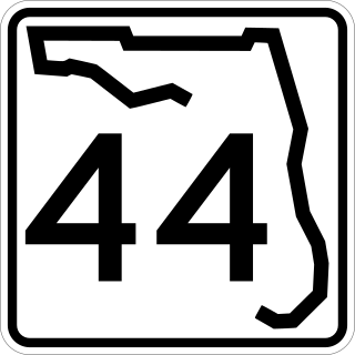
State Road 44 is an east–west state highway in the U.S. state of Florida. It runs from Crystal River on the Gulf of Mexico east to New Smyrna Beach on the Atlantic Ocean, passing through Inverness, Wildwood, Leesburg and DeLand.

<span class="mw-page-title-main">Florida State Road 51</span> Highway in Florida

State Road 51 is a north–south state highway in north Florida. Its northern terminus is along the overlap of US 41 and US 129. It runs southwards as the "secret" designation of US 129 to Live Oak, where it splits off and runs independently south to Steinhatchee. The Hal W. Adams Bridge carries it across the Suwannee River three miles (5 km) north of Mayo.

<span class="mw-page-title-main">Florida State Road 758</span> Highway in Florida

State Road 758 is an 5.4-mile-long (8.7 km) state road in Sarasota, Florida, United States. State Road 758 is locally known as Bee Ridge Road from Tamiami Trail east to its eastern terminus at Interstate 75 where it continues east as a county road.

<span class="mw-page-title-main">Florida State Road 780</span> East–west street in Sarasota, Florida

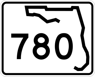
State Road 780, known as Fruitville Road, is a 5-mile-long (8.0 km) east–west street in Sarasota, Florida. The western terminus is an intersection with US 301/SR 683. The eastern terminus is east of an interchange with Interstate 75 in Fruitville, where the road continues east as County Road 780. West of US 301, Fruitville Road extends one mile (1.6 km) to the west of the end of SR 780, ending at an intersection with the Tamiami Trail in downtown Sarasota.

<span class="mw-page-title-main">Florida State Road 24</span> Highway in Florida

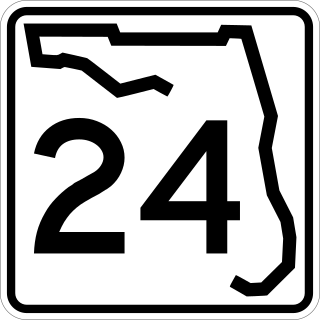
State Road 24 is an east–west state highway that runs between Cedar Key on the Gulf of Mexico and Waldo, Florida, at US 301. State Road 24 runs along a former branch of the Seaboard Air Line Railroad. This branch was originally owned by the Florida Railway and Navigation Company, and used to lead to ferries to both Pensacola, Florida and New Orleans, Louisiana. It also passes through Rosewood, site of the infamous 1923 massacre.

<span class="mw-page-title-main">U.S. Route 17 in Florida</span> Section of U.S. Highway in Florida, United States

U.S. Highway 17 (US 17) in Florida is a north–south United States Numbered Highway that runs 317 miles (510 km) from the Punta Gorda, Florida Metropolitan Statistical Area northeast to the Jacksonville metropolitan area.

<span class="mw-page-title-main">U.S. Route 19 in Florida</span> Highway in Florida

U.S. Highway 19 (US 19) runs about 262 miles (422 km) along Florida's west coast from an interchange with US 41 in Memphis, south of Tampa, and continues to the Georgia border north of Monticello.

<span class="mw-page-title-main">U.S. Route 27 in Florida</span> Section of U.S. Highway in Florida, United States

U.S. Highway 27 (US 27) in Florida is a north–south United States Numbered Highway. It runs 496.352 miles (798.801 km) from the Miami metropolitan area northwest to the Tallahassee metropolitan area. Throughout the state, US 27 has been designated the Claude Pepper Memorial Highway by the Florida Legislature. It was named after long-time Florida statesperson Claude Pepper, who served in both the U.S. Senate and House of Representatives. The stretch running from Miami to South Bay was originally designated the Thomas E. Will Memorial Highway by the Florida Legislature in 1937 when that portion was known as State Road 26 (SR 26). Thomas E. Will, the founder of Okeelanta, had worked for almost 20 years to get the state to build a road from Miami to the area south of Lake Okeechobee. For most of its length in the state, US 27 is a divided highway.

<span class="mw-page-title-main">U.S. Route 41 in Florida</span> Highway in Florida

U.S. Highway 41 (US 41) in the state of Florida is a north–south United States Highway. It runs 479 miles (771 km) from Miami in South Florida northwest to the Georgia state line north of the Lake City area. Within the state, US 41 is paralleled by Interstate 75 (I-75) all the way from Miami to Georgia, and I-75 has largely supplanted US 41 as a major highway.

<span class="mw-page-title-main">U.S. Route 90 in Florida</span> United States historic place

U.S. Route 90 (US 90) in the state of Florida is the northernmost east–west United States Numbered Highway in the state. US 90 passes through the county seats of all 15 counties on its course in Florida, and it is also the road upon which many of the county courthouses are located. It is never more than six miles (9.7 km) from Interstate 10 (I-10) throughout the state. It runs as a two-lane highway through most of the sparsely populated inland areas of the Florida Panhandle, widening to four lanes through and near several towns. The speed limit is 55 mph (89 km/h) for all rural points west of Monticello, and it is 60 mph (97 km/h) on all rural points from where it enters Madison County as far as Glen St. Mary.

<span class="mw-page-title-main">U.S. Route 98 in Florida</span> Highway in Florida

U.S. Route 98 is a major east-west thoroughfare through the U.S. state of Florida. Spanning 670.959 miles (1,079.804 km), it connects Pensacola and the Alabama/Florida state line to the west with Palm Beach and the Atlantic coast in the east. It is the longest US road in Florida, as well as the longest US road in any state east of the Mississippi River.

<span class="mw-page-title-main">U.S. Route 301 in Florida</span> Highway in Florida

U.S. Route 301 in Florida runs from the Sarasota-Bradenton-Venice, Florida Metropolitan Statistical Area northeast to the Greater Jacksonville Metropolitan Area. The road is a spur of U.S. Route 1, which it intersects in Callahan.

<span class="mw-page-title-main">U.S. Route 441 in Florida</span> Highway in Florida

U.S. Route 441 (US 441) in Florida is a north–south United States Highway. It runs 433 miles (697 km) from Miami in South Florida northwest to the Georgia state line, with the overall route continuing to Tennessee in the Rocky Top area.

<span class="mw-page-title-main">Florida State Road 574</span> State highway in Florida, United States

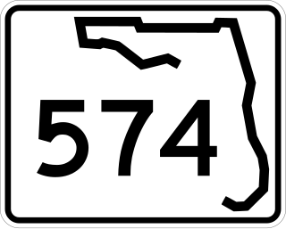
State Road 574 is an east–west state highway in Central Hillsborough County, Florida. It runs from northwestern Tampa to Plant City, and parallels County Road 574 west of Mango.

References

Template:Attached KML/Florida State Road 72
KML is not from Wikidata
  1. 1 2 3 4 "Straight Line Diagram of Road Inventory". Florida Department of Transportation. June 26, 2020. Retrieved August 3, 2021.
  2. 1 2 Google (June 27, 2012). "overview of State Road 72" (Map). Google Maps . Google. Retrieved June 27, 2012.
  3. Rodriguez, Nicole (May 22, 2018). "Sarasota County accepts state deal to widen, improve River Road". Sarasota Herald-Tribune. Retrieved July 30, 2021.
  4. Hackney, Rachel Brown (July 16, 2020). "Final formal step taken by County Commission to effect its assumption of authority over Siesta Key roads, beginning in September". The Sarasota News Leader. Retrieved July 30, 2021.
  5. "I-75 at Clark Road (SR 72) Interchange Improvements in Sarasota County". SWFL Roads. Florida Department of Transportation. Retrieved March 3, 2021.
  6. "FDOT holds public meeting on diverging diamond project at I-75 and Clark Road in Sarasota". WWSB. November 21, 2019. Retrieved November 29, 2019.
  7. "Straight Line Diagram of Road Inventory". Florida Department of Transportation. December 9, 2019. Retrieved August 3, 2021.