Forman, West Virginia

Last updated
Forman, West Virginia
2019-05-14 15 37 00 View east along U.S. Route 48 (Corridor H) at the exit for Grant County Route 5-Patterson Creek Road in Forman, Grant County, West Virginia.jpg
U.S. Route 48 in Forman
USA West Virginia location map.svg
Red pog.svg
Forman
Usa edcp location map.svg
Red pog.svg
Forman
Coordinates: 39°8′24″N79°4′30″W / 39.14000°N 79.07500°W / 39.14000; -79.07500 Coordinates: 39°8′24″N79°4′30″W / 39.14000°N 79.07500°W / 39.14000; -79.07500
Country United States
State West Virginia
County Grant
Time zone UTC-5 (Eastern (EST))
  Summer (DST) UTC-4 (EDT)
GNIS feature ID1549690 [1]

Forman is an unincorporated community on Patterson Creek in Grant County, West Virginia, United States.

Unincorporated area Region of land not governed by own local government

In law, an unincorporated area is a region of land that is not governed by a local municipal corporation; similarly an unincorporated community is a settlement that is not governed by its own local municipal corporation, but rather is administered as part of larger administrative divisions, such as a township, parish, borough, county, city, canton, state, province or country. Occasionally, municipalities dissolve or disincorporate, which may happen if they become fiscally insolvent, and services become the responsibility of a higher administration. Widespread unincorporated communities and areas are a distinguishing feature of the United States and Canada. In most other countries of the world, there are either no unincorporated areas at all, or these are very rare; typically remote, outlying, sparsely populated or uninhabited areas.

Patterson Creek is a 51.2-mile-long (82.4 km) tributary of the North Branch Potomac River in West Virginia's Eastern Panhandle, in the United States. It enters the North Branch east of Cumberland, Maryland, with its headwaters located in Grant County, West Virginia. Patterson Creek is the watershed for two-thirds of Mineral County.

Grant County, West Virginia U.S. county in West Virginia

Grant County is a county in the U.S. state of West Virginia. As of the 2010 census, the population was 11,937. Its county seat is Petersburg. The county was created from Hardy County in 1866 and named for Civil War General Ulysses S. Grant.

The community was named after L. J. Forman, who was instrumental in securing a post office for the town. [2]

Related Research Articles

West Virginia Route 28 state highway in West Virginia, United States

West Virginia Route 28 is a north–south route through the Potomac Highlands of the U.S. state of West Virginia. The southern terminus of the route is at West Virginia Route 39 in Huntersville. The northern terminus is at the Maryland state line in Wiley Ford, where the route continues into Cumberland as Canal Parkway upon crossing the North Branch Potomac River.

Ars-sur-Formans Commune in Auvergne-Rhône-Alpes, France

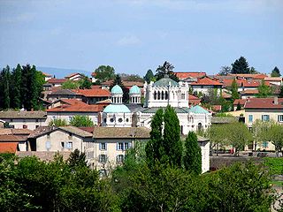
Ars-sur-Formans is a commune in the Ain department in the Auvergne-Rhône-Alpes region of eastern France.

Forman may refer to:

2006 New Orleans mayoral election

The first round of the New Orleans mayoral election of 2006 took place on April 22, 2006; a runoff between incumbent Mayor Ray Nagin and Louisiana Lieutenant Governor Mitch Landrieu took place on May 20, resulting in reelection for Mayor Nagin. The Mayor of New Orleans is the top official in New Orleans' mayor-council system of government.

Tom Forman (actor) American actor

Tom Forman was an American motion picture actor, director, writer, and producer of the early 1920s.

Vance, West Virginia Unincorporated community in West Virginia, United States

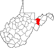
Vance is an unincorporated community in Hampshire County in the U.S. state of West Virginia. Vance lies on the South Branch Potomac River. Most of its residents reside along West Virginia Route 28. Buffalo Creek empties into the South Branch at Vance.

Lewis Johnson Forman was the Republican President of the West Virginia Senate from Grant County and served from 1909 to 1911. He had previously served as the prosecuting attorney of Grant County, a position he held for 16 years. He died in 1933 of heart disease.

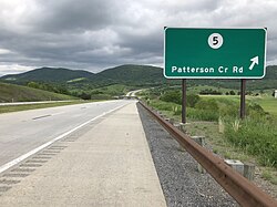
Buffalo Creek is a 4.1-mile-long (6.6 km) free-flowing tributary stream of the South Branch Potomac River, itself a tributary of the Potomac River, making it a part of the Chesapeake Bay watershed. Buffalo Creek is located in west-central Hampshire County in the U.S. state of West Virginia. Because the stream flows through several small farms, Buffalo Creek primarily serves agriculture purposes with segments used for livestock watering.

Belva, West Virginia Census-designated place in West Virginia, United States

Belva is an unincorporated community and census-designated place in west Nicholas County and north Fayette County, West Virginia, United States; while the CDP only includes the Nicholas County portion, the Fayette County portion is considered part of the community. The town is situated at the bottomland surrounding the convergence of Bells Creek with Twentymile Creek and, subsequently, Twenty Mile Creek with the Gauley River. Belva is also the location of the convergence of two state highways: West Virginia Route 16 and West Virginia Route 39.

Amigo, West Virginia Unincorporated community in West Virginia, United States

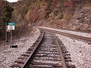
Amigo is an unincorporated community in Raleigh County, West Virginia, United States. The community is located on West Virginia Route 16 at the confluence of the Guyandotte River and Winding Gulf. The Amigo Post Office closed on 10/22/2011, it was established in 1915 The community most likely derives its name from the Amigo Coal Company.

Mahan, West Virginia Unincorporated community in West Virginia, United States

Mahan is an unincorporated community in Fayette County, West Virginia, United States. Mahan is located off exit 66 on the West Virginia Turnpike.

Corton, West Virginia Unincorporated community in West Virginia, United States

Corton is an unincorporated community in Kanawha County, West Virginia, United States. Corton is located on the Elk River and West Virginia Route 4 4 miles (6.4 km) east of Clendenin.

Dimmock, West Virginia Unincorporated community in West Virginia, United States

Dimmock is an unincorporated community and coal town in Fayette County, West Virginia.

MacDonald, West Virginia Unincorporated community in West Virginia, United States

MacDonald is an unincorporated community and coal town in Fayette County, West Virginia, United States.

Olcott, West Virginia Unincorporated community in West Virginia, United States

Olcott is an unincorporated community and coal town in Kanawha County, West Virginia, United States. Its post office is closed.

Lively, West Virginia Unincorporated community in West Virginia, United States

Lively is an unincorporated community in Fayette County, West Virginia.

Weir, West Virginia Unincorporated community in West Virginia, United States

Weir is an unincorporated community in Kanawha County, West Virginia, United States. Its post office is called Falling Rock.

Legg, West Virginia Unincorporated community in West Virginia, United States

Legg is an unincorporated community in Kanawha County, West Virginia, United States. Its post office is closed.

Rensford, West Virginia Unincorporated community in West Virginia, United States

Rensford is an unincorporated community in Kanawha County, West Virginia, United States. Its post office is closed. It was also known as Point Lick.

Jenky, West Virginia Unincorporated community in West Virginia, United States

Jenky is an unincorporated community in Fayette County, West Virginia, United States.

References

  1. U.S. Geological Survey Geographic Names Information System: Forman, West Virginia
  2. Kenny, Hamill (1945). West Virginia Place Names: Their Origin and Meaning, Including the Nomenclature of the Streams and Mountains. Piedmont, WV: The Place Name Press. p. 246.