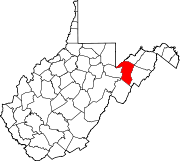
Hampshire County is a county in the U.S. state of West Virginia. As of the 2020 census, the population was 23,093. Its county seat is Romney, West Virginia's oldest town (1762). The county was created by the Virginia General Assembly in 1754, from parts of Frederick and Augusta Counties (Virginia) and is the state's oldest county. The county lies in both West Virginia's Eastern Panhandle and Potomac Highlands regions.

The Great Appalachian Valley, also called The Great Valley or Great Valley Region, is one of the major landform features of eastern North America. It is a gigantic trough—a chain of valley lowlands—and the central feature of the Appalachian Mountains system. The trough stretches about 1,200 miles (1,900 km) from Quebec in the north to Alabama in the south and has been an important north–south route of travel since prehistoric times.

The Cumberland Mountains are a mountain range in the southeastern section of the Appalachian Mountains. They are located in western Virginia, southwestern West Virginia, the eastern edges of Kentucky, and eastern middle Tennessee, including the Crab Orchard Mountains. Their highest peak, with an elevation of 4,223 feet (1,287 m) above mean sea level, is High Knob, which is located near Norton, Virginia.

U.S. Route 58 is an east–west U.S. Highway that runs for 508 miles (818 km) from U.S. Route 25E just northwest of Harrogate, Tennessee, to U.S. Route 60 in Virginia Beach, Virginia. Until 1996, when the Cumberland Gap Tunnel opened, US 58 ran only inside the commonwealth of Virginia. It was then extended southwest along a short piece of former US 25E, which no longer enters Virginia, to end at the new alignment in Tennessee. For most of its alignment, it closely parallels Virginia's southern border with North Carolina.

Blue Ridge Mountain, also known as Blue Mountain, is the colloquial name of the westernmost ridge of the Blue Ridge Mountains in northern Virginia and the Eastern Panhandle of West Virginia. The Appalachian Trail traverses the entire length of the mountain along its western slope and crest.
Kline is an unincorporated community located in Pendleton County, West Virginia, United States. Originally known as Clines Cross Roads, its name was changed to Kline in about 1875. The name comes from Samuel Kline, an early postmaster.

Mill Creek is a 14.0-mile-long (22.5 km) tributary stream of the South Branch Potomac River, belonging to the Potomac River and Chesapeake Bay watersheds. The stream is located in Hampshire County in West Virginia's Eastern Panhandle. Mill Creek flows into the South Branch west of Romney Bridge near Vanderlip along the Northwestern Turnpike.

U.S. Route 50 is a transcontinental highway which stretches from Ocean City, Maryland to West Sacramento, California. In the U.S. state of Virginia, US 50 extends 86 miles (138 km) from the border with Washington, D.C. at a Potomac River crossing at Rosslyn in Arlington County to the West Virginia state line near Gore in Frederick County.
Kline's Mill is a historic grinding mill in Frederick County, Virginia, United States. First built in the 1770s, the rebuilt 1794 mill contains original millwork and is a rare surviving example of a mechanism based on Oliver Evans' continuous milling system.

North Mountain is a mountain ridge within the Ridge-and-valley Appalachians in the U.S. states of Virginia and West Virginia.
The Potomac Water Gap is a double water gap in the Blue Ridge Mountains, located at the intersection of the states of Virginia, West Virginia and Maryland, near Harpers Ferry. At 256 feet (78 m), it is the lowest crossing of the Blue Ridge Mountains.
Keyes Gap or Keyes' Gap is a wind gap in the Blue Ridge Mountain on the border of Loudoun County, Virginia and Jefferson County, West Virginia. The gap is traversed by Virginia State Route 9/West Virginia Route 9. The Appalachian Trail also crosses the gap.

The steamboat Defiance operated in the early 1900s as part of the Puget Sound Mosquito Fleet. In later years this vessel was called Kingston.

The Devonian Foreknobs Formation is a mapped bedrock unit in Pennsylvania, Maryland, Virginia, and West Virginia.
The Lost River is a 31.1-mile-long (50.1 km) river in the Appalachian Mountains of Hardy County in West Virginia's Eastern Panhandle region. The Lost River is geologically the same river as the Cacapon River: It flows into an underground channel northeast of McCauley along West Virginia Route 259 at "the Sinks" and reappears near Wardensville as the Cacapon. The source of the Lost River lies south of Mathias near the West Virginia/Virginia border. Along with the Cacapon and North rivers, the Lost River serves as one of the three main segments of the Cacapon River and its watershed.

Church of the Brethren historian Donald F. Durnbaugh has described John Kline as "arguably the most beloved personality in Brethren History."
Elliott Kline, also known as Eli Mosley, is an American neo-Nazi and military impostor. He is the former leader of Identity Evropa, and was a prominent organizer in the alt-right movement between 2017 and 2018. He was also a key figure behind the August 2017 Unite the Right rally in Charlottesville, Virginia, which was one of several neo-Nazi rallies that Kline helped organize.