Pocahontas County is a county located in the U.S. state of West Virginia. As of the 2020 census, the population was 7,869. Its county seat is Marlinton. The county was established in 1821. It is named after the daughter of the Powhatan chief of the Native Americans in the United States from Jamestown, Virginia. She married an English settler and their children became ancestors of many of the First Families of Virginia.
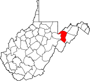
Grant County is a county in the U.S. state of West Virginia. As of the 2020 census, the population was 10,976. Its county seat is Petersburg. The county was created from Hardy County in 1866 and named for Civil War General Ulysses S. Grant.

Mason County is a county located in the U.S. state of Kentucky. Its county seat is Maysville. The county was created from Bourbon County, Virginia in 1788 and named for George Mason, a Virginia delegate to the U.S. Constitutional Convention known as the "Father of the Bill of Rights". Mason County comprises the Maysville, KY Micropolitan Statistical Area, which is included in the Cincinnati-Wilmington-Maysville, OH-KY-IN Combined Statistical Area.

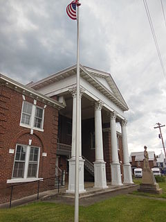
Maysville is a home rule-class city in Mason County, Kentucky, United States and is the seat of Mason County. The population was 8,782 as of 2019, making it the 51st-largest city in Kentucky by population. Maysville is on the Ohio River, 66 miles (106 km) northeast of Lexington. It is the principal city of the Maysville Micropolitan Statistical Area, which includes Mason and Lewis counties. Two bridges cross the Ohio from Maysville to Aberdeen, Ohio: the Simon Kenton Memorial Bridge built in 1931 and the William H. Harsha Bridge built in 2001.
Maysville is the name of several places in the United States of America:

The South Branch Potomac River has its headwaters in northwestern Highland County, Virginia near Hightown along the eastern edge of the Allegheny Front. After a river distance of 139 miles (224 km), the mouth of the South Branch lies east of Green Spring in Hampshire County, West Virginia where it meets the North Branch Potomac River to form the Potomac.
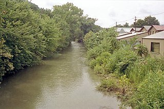
New Creek is an 18.4-mile-long (29.6 km) stream in eastern West Virginia, United States. It is the third major West Virginia tributary to the North Branch Potomac River. Via the Potomac, it is part of the watershed of Chesapeake Bay.
Greenland is an unincorporated community between Walker's Ridge and New Creek Mountain on the North Fork Patterson Creek in Grant County, West Virginia, United States. Greenland lies at the western end of Greenland Gap in New Creek Mountain.
Medley is an unincorporated community on Patterson Creek in Grant County, West Virginia, United States.

Mount Storm is an unincorporated community in Grant County, West Virginia, United States. Mount Storm lies on the Northwestern Turnpike at its junction with West Virginia Route 42. The community is the site of the Union School Complex, which contains Union High School.
Scherr is an unincorporated community in Grant County, West Virginia, United States. The community's name is pronounced like "sheer." Scherr lies to the west of the community of Greenland at the crossroads of West Virginia Route 42, West Virginia Route 93, and U.S. Route 48. Scherr is home to a rock quarry, asphalt plant, and a small country store.

Hartmansville is an unincorporated community in Mineral County, West Virginia, United States. It is part of the Cumberland, MD-WV Metropolitan Statistical Area. Hartmansville lies along the Northwestern Turnpike near the Grant County line.
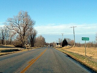
Maysville is an unincorporated community and census-designated place (CDP) in Benton County, Arkansas, United States. It is the westernmost settlement in the state of Arkansas. Per the 2020 census, the population was 117.
Maysville, also known as Mayville, is an unincorporated community in eastern Madison County, Alabama, United States. Maysville borders Ryland.

Maysville is an unincorporated community and a census-designated place (CDP) located in and governed by Chaffee County, Colorado, United States. The population of the Maysville CDP was 135 at the United States Census 2010. The Salida post office serves the area.
Mays Lick(a.k.a.Mayslick, originally known asMay's Lick) is census-designated place and unincorporated community located in Mason County, Kentucky, United States, about nine miles southwest of Maysville.
Pie is an unincorporated community in Mingo County, West Virginia, United States. Pie is located on U.S. Route 52 along Pigeon Creek; the community lies along the road for 3 miles (4.8 km), from Horsepen Mountain to Grants Branch. According to Pie's 1933 postmaster, the community was named for Leander Blankenship, a resident "who really like[d] pie, regardless of kind".
Landes is an unincorporated community in Grant County, West Virginia, United States. Landes is located on U.S. Route 220 7.7 miles (12.4 km) south-southwest of Petersburg.
Pansy is an unincorporated community in Grant County, West Virginia, USA. Located on U.S. Route 220 6.45 miles (10.38 km) south-southwest of Petersburg, the community most likely was named after the garden pansy.
Cirtsville is an unincorporated community located in Raleigh County, West Virginia, United States. The community derives its name from Curt Vass, an early settler.