The South Branch Potomac River has its headwaters in northwestern Highland County, Virginia near Hightown along the eastern edge of the Allegheny Front. After a river distance of 139 miles (224 km), the mouth of the South Branch lies east of Green Spring in Hampshire County, West Virginia where it meets the North Branch Potomac River to form the Potomac.

The Cacapon River, located in the Appalachian Mountains of West Virginia's Eastern Panhandle region, is an 81.0-mile-long (130.4 km) shallow river known for its fishing, boating, wildlife, hunting, and wilderness scenery. As part of the Potomac River watershed, it is an American Heritage River.
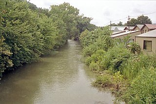
New Creek is an 18.4-mile-long (29.6 km) stream in eastern West Virginia, United States. It is the third major West Virginia tributary to the North Branch Potomac River. Via the Potomac, it is part of the watershed of Chesapeake Bay.
Back Creek is a 59.5-mile-long (95.8 km) tributary of the Potomac River that flows north from Frederick County, Virginia, to Berkeley County in West Virginia's Eastern Panhandle. Back Creek originates along Frederick County's border with Hampshire County, West Virginia, at Farmer's Gap in the Great North Mountain. Its name reflects its location to the west of North Mountain. The perspective of colonists from the east in the 18th century led them to call it "Back Creek", because it lay to the back of North Mountain.
Scherr is an unincorporated community in Grant County, West Virginia, United States. The community's name is pronounced like "sheer." Scherr lies to the west of the community of Greenland at the crossroads of West Virginia Route 42, West Virginia Route 93, and U.S. Route 48. Scherr is home to a rock quarry, asphalt plant, and a small country store.
French Creek is an unincorporated community in Upshur County, West Virginia, United States.
Isaban is an unincorporated community located on Fourpole Creek, in McDowell and Mingo counties in the U.S. state of West Virginia.

Quick is a small unincorporated community in Kanawha County, West Virginia, United States. It is located along Indian Creek Road. The community is where Whitoak Fork and Blue Creek come together and meet. It is also where the abandoned railroad that follows Blue Creek joins the road, and follows it all the way to the community of Hitop, along Pond Fork. Its post office is closed.
Belva is an unincorporated community and census-designated place in west Nicholas County and north Fayette County, West Virginia, United States; while the CDP only includes the Nicholas County portion, the Fayette County portion is considered part of the community. The town is situated at the bottomland surrounding the convergence of Bells Creek with Twentymile Creek and, subsequently, Twenty Mile Creek with the Gauley River. Belva is also the location of the convergence of two state highways: West Virginia Route 16 and West Virginia Route 39.
Soak Creek is an unincorporated community in Raleigh County, West Virginia, United States.

Lick Creek is an unincorporated community in Summers County, West Virginia, United States. Lick Creek is located near the west bank of the New River, 21 miles (34 km) south of Hinton.
Meadow Creek is an unincorporated community in Summers County, West Virginia, United States. Meadow Creek is located on the New River, southwest of Meadow Bridge and north of Hinton.
Sewell is an unincorporated community in Fayette County, West Virginia, United States. Sewell is located on the New River, 6 miles (9.7 km) southeast of Fayetteville. Sewell was the sight of a major coking operation with 193 beehive coke ovens operating in the late nineteenth century and early to mid twentieth century. The operation was serviced by the Mann's Creek Railroad between 1886 and 1955.
Falling Rock is an unincorporated community in Kanawha County, West Virginia, United States. Falling Rock is located at the confluence of Falling Rock Creek with the Elk River 3 miles (4.8 km) southwest of Clendenin along US Route 19. Falling Rock has a post office with ZIP code 25079.
Big Creek is a census-designated place (CDP) in Logan County, West Virginia, United States. Big Creek is located on West Virginia Route 10, 2.5 miles (4.0 km) northwest of Chapmanville. Big Creek has a post office with ZIP code 25505. As of the 2010 census, its population was 237.
Peach Creek is an unincorporated community and census-designated place (CDP) in Logan County, West Virginia, United States. Peach Creek is located on the east bank of the Guyandotte River across from West Logan. Peach Creek has a post office with ZIP code 25639. The community was first listed as a CDP prior to the 2020 census.
Milburn is an unincorporated community and coal town in Fayette County, West Virginia, United States.
Ward is an unincorporated community and coal town in Kanawha County, West Virginia, United States. Its post office is closed. Ward is approximately 3 miles (4.8 km) northeast of Cedar Grove, along Kellys Creek.
New Thacker was an unincorporated community and coal town located in Mingo County, West Virginia, United States. Their Post Office has been closed.
Laurel Creek is an unincorporated community and coal town in Fayette County, West Virginia, United States.