Fort Hull

Last updated
Fort Hull
Near Tuskegee, Alabama in United States
Fort Hull drawing.jpg
1834 survey map showing Fort Hull's location near Persimmon Creek
USA Alabama location map.svg
Red pog.svg
Fort Hull
Usa edcp location map.svg
Red pog.svg
Fort Hull
Coordinates 32°21′14″N85°42′13″W / 32.35389°N 85.70361°W / 32.35389; -85.70361
TypeEarthen fort
Site information
OwnerPrivate
Controlled byPrivate
Open to
the public
No
ConditionSite on private land
Site history
Built1814
Built by Georgia militia
In use1814–1815
Battles/wars Creek War

Fort Hull was an earthen fort built in present-day Macon County, Alabama in 1814 during the Creek War. [1] After the start of hostilities, the United States decided to mount an attack on Creek territory from three directions. The column advancing west from Georgia built Fort Mitchell and then clashed with the Creeks. After a pause in operations, the column from Georgia continued its march and built Fort Hull. The fort was used as a supply point and was soon abandoned after the end of the Creek War.

Contents

History

Background

The Creek War began as a civil war between factions of the Creek tribe. The Red Sticks were angered over the consolidation of tribal government and selling of traditional tribal lands. After the start of the War of 1812, the United States feared that Great Britain might ally with and supply the Red Sticks. In response to attacks on settlers, the United States began a military campaign against the Red Sticks in 1813. [2]

After the Fort Mims massacre, the United States planned a three-pronged attack on the Creek heartland. The initial plan called for troops to march south from Tennessee under the command of Andrew Jackson, east from Georgia under the command of John Floyd, and up from the southwest under Ferdinand Claiborne. Along with allied Creeks under the command of William McIntosh, Floyd set out from Georgia in the latter part of 1813. After crossing the Chattahoochee River, his troops constructed Fort Mitchell. Floyd's forces continued marching westward, culminating in the Battle of Autossee. Floyd was injured in the battle and his forces retreated back to Fort Mitchell. [2]

After recuperating, gathering supplies, and raising new recruits, Floyd left Fort Mitchell on January 17, 1814 with eleven hundred Georgia militia, six hundred allied Creeks, and cannons. [3] Floyd's force marched westward along the Federal Road, planning to construct forts to protect their extended supply lines. [2] Travel was slow due to recent rains, so on January 20 Floyd made the decision to stop near the junction of Persimmon Creek and Calebee Creek and construct a fort to serve as the first supply point. [3] [4]

Construction

Captain Jett Thomas, an engineer officer and artillery commander, led the construction of Fort Hull. [5] The fort was named for Commodore Isaac Hull. [6] No drawing or description of Fort Hull exists, but it is likely it was built in a similar style to other forts built on the Federal Road (such as Fort Bainbridge), with an earth work surrounded by a palisade. [7] The fort likely had at least one blockhouse, officers quarters, and a magazine. [6] A spring that fed into Persimmon Creek was used as the water source for the fort. [8]

Fort Hull was constructed over four days. [9] The four days of construction allowed the roads leading to and from the fort to dry, but construction was also slow due to rationing. In protest over lack of rations and entrenching tools, troops slowed their work. This forced Floyd to reinstate full rations prior to completion of the fort. [4]

While the fort was being constructed Captain John P. Harvey was ordered by Floyd to lead a raid on the plantation of Alexander Cornells, Benjamin Hawkins' former interpreter. Cornells' daughter had led runaway slaves to the plantation with plans to rally other slaves to help the Red Sticks. Harvey's raid captured Cornells' daughter and nine slaves and brought them back to Fort Hull. [10]

Fort Hull in relation to other contemporary forts. Hoitlewaule and Tukabatchee (labeled as Tookaubatchee) are both identified to the upper left of Fort Hull. Fort Hull map.jpg
Fort Hull in relation to other contemporary forts. Hoitlewaule and Tukabatchee (labeled as Tookaubatchee) are both identified to the upper left of Fort Hull.

Military use

On January 25, Floyd felt the Federal Road was passable, so he set out for the Creek town of Tukabatchee and left one hundred men in charge of Fort Hull. [10] Fort Hull was located 15 mi (24 km) to the east of Tukabatchee [11] and 24 mi (39 km) east of the Creek town of Hoitlewaule (also spelled as Othlewallee or Hoithlewalli). [12] American commanders were concerned that Red Stick warriors were concentrating in these two towns and planned to attack the towns as soon as possible. [10] En route to Tukabatchee Floyd's forces were slowed down by obstructions placed in the road by Red Sticks. The delay (in combination with the plan to attack the Red Sticks from an unexpected direction) led Floyd to leave the Federal Road and march northward. The force was slowed down by swampy terrain and quickly erected a temporary camp called Camp Defiance. Floyd ordered the force's tents and cooking utensils sent back to Fort Hull in supply wagons—a decision which upset many of the soldiers. [13]

On January 27, Red Stick warriors made a surprise attack on Camp Defiance in what became known as the Battle of Calebee Creek. [14] After the battle, Floyd remained at Camp Defiance until February 1 treating the wounded and burying the dead. [15] Due to lack of supplies and nearing the end of his soldiers' terms of service Floyd returned to Fort Hull. [16] [17] [18] Spies that were left at Camp Defiance warned Floyd that the Red Sticks who were still in the surrounding area were planning to attack Fort Hull. [19] Floyd's soldiers were relieved to find seven supply wagons awaiting them at Fort Hull. [18] [19] Even with the new supplies, the soldiers grew impatient as their terms of service were ending on February 22. On February 16, Floyd made the decision to march his force back to Fort Mitchell and muster his men out of service. [18]

After Floyd's departure, Colonel Homer V. Milton of the 3rd U.S. Infantry Regiment was placed in command of Fort Hull. [18] [20] Captain John Broadnax from Putnam County, Georgia raised an infantry corps and Lieutenant Fort Adaroin from Franklin County, Georgia raised a rifle corps from the volunteers that remained at the fort. These volunteers were then reinforced by militia from North and South Carolina under the command of Brigadier General Joseph Graham and Thomas Crawford. [8] A US Army company under the command of Captain David E. Twiggs arrived at the fort prior to the North and South Carolina militia. [21] Thomas Simpson Woodward wrote that he was also in command of the fort for a short time. [22] During this time, various raids were conducted on Red Stick camps. [23] While Milton was in command, Fort Hull had a garrison of one hundred to three hundred men, but increased up to six hundred once the fort was better supplied. [24] This force included the Carolina militia, allied Creeks, fifty regular infantry, and four pieces of artillery. [25]

Due to Fort Hull being deep in Creek territory, it was difficult to ensure that supplies would arrive from Fort Mitchell. In March 1814, General Graham constructed Fort Bainbridge on the Federal Road. [26] Fort Bainbridge allowed supply wagons to split the distance between Fort Mitchell and Fort Hull into one-day intervals. [24] After the Battle of Horseshoe Bend, Jackson planned to destroy any remaining Red Stick villages. He planned to gather his forces at Hickory Ground to attack Hoitlewaule with soldiers and supplies from Fort Hull, but this attack was never carried out. [17] Milton then left Fort Hull in March 1814 to construct Fort Decatur further to the west on the Tallapoosa River. [25]

After Milton's departure, only a small number of South Carolina militia remained at Fort Hull. Their terms of service ended in July 1814 after which they returned home. After the militia departed, Fort Hull was under the command of a hospital steward and quartermaster sergeant. Even so, the fort still had a supply of ammunition and rations. [27]

Fort Hull had no military association after 1815 and was soon abandoned. [27] [28]

Postwar

Mail was received at a stop known as "Fort Hull" as early as 1818, but there was never a postmaster at the site. [29]

Nearby the fort site was a church and school that were named Fort Hull Church and Fort Hull School. [9]

As late as 1952 a historical marker for the fort was located south of Tuskegee on U.S. Route 80, but no historical marker exists today. [30]

Present

The original site of Fort Hull is unmarked and on private land. [31] The site has been damaged by relic collecting. [32]

Related Research Articles

<span class="mw-page-title-main">Creek War</span> 1813–14 US Indian War

The Creek War, was a regional conflict between opposing Native American factions, European powers, and the United States during the early 19th century. The Creek War began as a conflict within the tribes of the Muscogee, but the United States quickly became involved. British traders and Spanish colonial officials in Florida supplied the Red Sticks with weapons and equipment due to their shared interest in preventing the expansion of the United States into regions under their control.

Red Sticks —the name deriving from the red-painted war clubs of some Native American Creek—refers to an early 19th century traditionalist faction of Muscogee Creek people in the Southeastern United States. Made up mostly of Creek of the Upper Towns that supported traditional leadership and culture, as well as the preservation of communal land for cultivation and hunting, the Red Sticks arose at a time of increasing pressure on Creek territory by European American settlers. Creek of the Lower Towns were closer to the settlers, had more mixed-race families, and had already been forced to make land cessions to the Americans. In this context, the Red Sticks led a resistance movement against European American encroachment and assimilation, tensions that culminated in the outbreak of the Creek War in 1813. Initially a civil war among the Creek, the conflict drew in United States state forces while the nation was already engaged in the War of 1812 against the British.

<span class="mw-page-title-main">Fort Mims massacre</span> Part of the Creek War (1813)

The Fort Mims massacre took place on August 30, 1813, at a fortified homestead site 35-40 miles north of Mobile, Alabama, during the Creek War. A large force of Creek Indians belonging to the Red Sticks faction, under the command of headmen Peter McQueen and William Weatherford, stormed the fort and defeated the militia garrison.

<span class="mw-page-title-main">Battle of Calebee Creek</span> Battle fought during the Creek War

The Battle of Calebee Creek took place on January 27, 1814, during the Creek War, in Macon County, Alabama, 50 miles (80 km) west of Fort Mitchell. General Floyd, with 1,200 Georgia volunteers, a company of cavalry and 400 friendly Yuchi, repulsed a night attack of the Red Sticks on his camp. Floyd lost so many in this hostile country that he immediately withdrew to the Chattahoochee River. Also referred to as the Battle for Camp Defiance.

Jett Thomas was an American military officer, politician, and builder who served as a member of the Georgia House of Representatives and participated in the early construction of the University of Georgia.

<span class="mw-page-title-main">Fort Williams (Alabama)</span> United States historic site

Fort Williams was a supply depot built in early 1814 in preparation for the Battle of Horseshoe Bend. It was located in Alabama on the southeast shore where Cedar Creek meets the Coosa River, near Talladega Springs.

<span class="mw-page-title-main">Fort Strother</span> United States historic site

Fort Strother was a stockade fort at Ten Islands in the Mississippi Territory, in what is today St. Clair County, Alabama. It was located on a bluff of the Coosa River, near the modern Neely Henry Dam in Ragland, Alabama. The fort was built by General Andrew Jackson and several thousand militiamen in November 1813, during the Creek War and was named for Captain John Strother, Jackson's chief cartographer.

<span class="mw-page-title-main">Canoe Fight (Creek War)</span> Skirmish with Native Indians

The Canoe Fight was a skirmish between Mississippi Territory militiamen led by Captain Samuel Dale and Red Stick warriors that took place on November 12, 1813 as part of the Creek War. The skirmish was fought largely from canoes and was a victory for the militiamen, who only had one member wounded. The victory held little military value in the overall Creek War but its participants gained widespread notoriety for their actions during the fight. The fight has been depicted in multiple illustrations, but only a historical marker currently exists near the site of the fight.

<span class="mw-page-title-main">Fort Claiborne</span> United States historic site in Alabama

Fort Claiborne was a stockade fort built in 1813 in present-day Monroe County, Alabama during the Creek War.

<span class="mw-page-title-main">Battle of Autossee</span> Battle fought during the Creek War

The Battle of Autossee took place on November 29, 1813, during the Creek War, at the Creek towns of Autossee and Tallasee near present-day Shorter, Alabama. General John Floyd, with 900 to 950 militiamen and 450 allied Creek, attacked and burned down both villages, killing 200 Red Sticks in the process.

<span class="mw-page-title-main">Fort Bainbridge</span> United States historic site in Alabama

Fort Bainbridge was an earthen fort located along the Federal Road on what is today the county line between Macon and Russell counties in Alabama. Fort Bainbridge was located twenty-five miles west of Fort Mitchell.

<span class="mw-page-title-main">Fort Decatur (Alabama)</span> United States historic site

Fort Decatur was an earthen fort established in March 1814 on the banks of the Tallapoosa River as part of the Creek War and the larger War of 1812. The fort was located on the east bank of the Tallapoosa River, near the modern community of Milstead. Fort Decatur was also located near the Creek town of Tukabatchee. It was most likely named for Stephen Decatur.

<span class="mw-page-title-main">Fort Armstrong (Alabama)</span> United States historic site

Fort Armstrong was a stockade fort built in present-day Cherokee County, Alabama during the Creek War. The fort was built to protect the surrounding area from attacks by Red Stick warriors but was also used as a staging area and supply depot in preparation for further military action against the Red Sticks.

<span class="mw-page-title-main">Fort Leslie</span> American historical site in Alabama

Fort Leslie was a stockade fort built in present-day Talladega County, Alabama, in 1813 during the Creek War. After the Creek War began, protective stockades were built by settlers and Creeks who were allied with the United States to protect themselves from hostile Creek attacks. Fort Leslie was the focal point of the Battle of Talladega but was soon abandoned after the end of the Creek War.

Sophia Durant was a Koasati Native American plantation owner, who served as the speaker, interpreter, and translator for her brother, Alexander McGillivray, a leader in the Muscogee Confederacy.

Sehoy, or Sehoy I, was an 18th-century matriarch of the Muscogee Confederacy and a member of the Wind clan.

<span class="mw-page-title-main">Fort Madison (Alabama)</span> United States historic site in Alabama

Fort Madison was a stockade fort built in August 1813 in present-day Clarke County, Alabama, during the Creek War, which was part of the larger War of 1812. The fort was built by the United States military in response to attacks by Creek warriors on encroaching American settlers. The fort shared many similarities to surrounding stockade forts in its construction but possessed a number of differences in its defenses. The fort housed members of the United States Army and settlers from the surrounding area, and it was used as a staging area for raids on Creek forces and supply point on further military expeditions. Fort Madison was subsequently abandoned at the conclusion of the Creek War and only a historical marker exists at the site today.

Fort Montgomery was a stockade fort built in August 1814 in present-day Baldwin County, Alabama, during the Creek War, which was part of the larger War of 1812. The fort was built by the United States military in response to attacks by Creek warriors on encroaching American settlers and in preparation for further military action in the War of 1812. Fort Montgomery continued to be used for military purposes but in less than a decade was abandoned. Nothing exists at the site today.

Fort Pierce, was two separate stockade forts built in 1813 in present-day Baldwin County, Alabama, during the Creek War, which was part of the larger War of 1812. The fort was originally built by settlers in the Mississippi Territory to protect themselves from attacks by Creek warriors. A new fort of the same name was then built by the United States military in preparation for further action in the War of 1812, but the fort was essentially abandoned within a few years. Nothing exists at the site today.

<span class="mw-page-title-main">Sandfort, Alabama</span> Unincorporated community in Alabama, United States

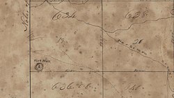
Sandfort, also rendered Sand Fort or Sanfort and also known as Lexington, is an unincorporated community in Russell County, Alabama, United States.

References

  1. Harris 1977, pp. 42.
  2. 1 2 3 Braund, Kathryn. "Creek War of 1813-1814". Encyclopedia of Alabama. Retrieved September 11, 2021.
  3. 1 2 Blackmon 2014, pp. 31.
  4. 1 2 Weir 2016, pp. 319.
  5. O'Brien 2003, pp. 119.
  6. 1 2 Brannon, Peter A. (April 17, 1932). "Fort Bainbridge, In Russell". The Montgomery Advertiser. Montgomery, Alabama. Retrieved September 4, 2021.
  7. Waselkov & Christopher 2012, pp. 206.
  8. 1 2 Brannon 1929, pp. 6.
  9. 1 2 Brannon 1924, pp. 236.
  10. 1 2 3 Weir 2016, pp. 320.
  11. Jackson 1926, pp. 467.
  12. Jackson 1926, pp. 457.
  13. Weir 2016, pp. 321.
  14. Weir 2016, pp. 324.
  15. Weir 2016, pp. 330.
  16. Woodward 1859, pp. 89.
  17. 1 2 Blackmon 2014, pp. 36.
  18. 1 2 3 4 Owsley 2008, pp. 59.
  19. 1 2 Weir 2016, pp. 331.
  20. Blackmon 2014, pp. 32.
  21. Woodward 1859, pp. 90.
  22. Woodward 1859, pp. 147.
  23. Waselkov & Christopher 2012, pp. 189.
  24. 1 2 Owsley 2008, pp. 60.
  25. 1 2 Waselkov & Christopher 2012, pp. 208.
  26. Waselkov & Christopher 2012, pp. 222.
  27. 1 2 Waselkov & Christopher 2012, pp. 209.
  28. Brannon 1929, pp. 10.
  29. Brannon, Peter A. (July 12, 1936). "Old Fort Hull Days". The Montgomery Advertiser. Montgomery, Alabama. Retrieved September 4, 2021.
  30. Owen 1952, pp. 268.
  31. Bunn, Mike; Williams, Clay. "The Canoe Fight". The Creek War and the War of 1812. Retrieved August 22, 2021.
  32. Braund 2012, pp. 250.

Sources