McDonald Chapel is a census-designated place in Jefferson County, Alabama, United States. It is northeast of the Birmingham suburb of Pleasant Grove. At the 2020 census, the population was 739. Large portions of this area were damaged by violent tornadoes in 1956, 1998, and 2011. The 1998 tornado was rated F5 on the Fujita scale.

North Crossett is a census-designated place (CDP) in Ashley County, Arkansas, United States. Per the 2020 census, the population was 2,756.

West Crossett is a census-designated place (CDP) in Ashley County, Arkansas, United States. Per the 2020 census, the population was 1,144.

Charleston Park is an unincorporated community and census-designated place (CDP) in Lee County, Florida, United States. The population was 235 at the 2020 census, up from 218 at the 2010 census. It is part of the Cape Coral-Fort Myers, Florida Metropolitan Statistical Area.
North Fort Myers is an unincorporated area and census-designated place (CDP) in Lee County, Florida, United States. The population was 42,719 at the 2020 census, up from 39,407 at the 2010 census. It is part of the Cape Coral-Fort Myers, Florida Metropolitan Statistical Area.

Homestead Base is a census-designated place (CDP) in Miami-Dade County, Florida, United States. The CDP comprises the extent of Homestead Air Reserve Base plus some surrounding land. It is part of the Miami metropolitan area of South Florida. The population was 999 at the 2020 census.

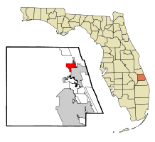
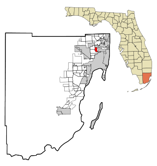
Ives Estates is a census-designated place (CDP) in Miami-Dade County, Florida. It is part of the Miami metropolitan area of South Florida. The population was 25,005 at the 2020 census, up from 19,525 in 2010.

Palmetto Estates is an unincorporated area and census-designated place (CDP) in Miami-Dade County, Florida, United States. It is part of the Miami metropolitan area of South Florida. The population was 13,498 at the 2020 census.
Pinewood is an unincorporated community and census-designated place (CDP) in Miami-Dade County, Florida, United States. It is part of the Miami metropolitan area of South Florida. The population was 17,246 at the 2020 census.

Westview is a census-designated place (CDP) in Miami-Dade County, Florida, United States. It is part of the Miami metropolitan area of South Florida. The population was 9,923 at the 2020 census.

Channel Lake is an unincorporated community and census-designated place (CDP) in Antioch Township, Lake County, Illinois, United States. Per the 2020 census, the population was 1,581.
Forest Lake is an unincorporated community and census-designated place (CDP) in Ela Township of Lake County, Illinois, United States. It is about 35 miles (56 km) northwest of downtown Chicago. Per the 2020 census, the population was 1,784. The community was founded in 1935 as a vacation community for Chicago residents.
Fox Lake Hills is an unincorporated community and census-designated place (CDP) in Lake Villa Township, Lake County, Illinois, United States. Per the 2020 census, the population was 2,684.
Venetian Village is a census-designated place (CDP) in Lake County, Illinois, United States. Per the 2020 census, the population was 2,761.

Frankfort Square is a census-designated place (CDP) in Will County, Illinois, United States. Per the 2020 census, the population was 8,968.

Preston Heights is a census-designated place (CDP) in Will County, Illinois, United States. As of the 2020 census, the CDP population was 2,898.

Friendly is an unincorporated area and census-designated place (CDP) in Prince George's County, Maryland, United States, with an African-American majority population, located a few miles south of Washington, D.C. The population was 9,937 at the 2020 census.

Castle Point is an unincorporated community and census-designated place (CDP) in St. Louis County, Missouri, United States. The population was 3,962 at the 2010 census.
St. Bonaventure is a hamlet and census-designated place (CDP) in the town of Allegany in Cattaraugus County, New York, United States. The population was 1,963 at the 2020 census.
Fort McKinley is an unincorporated community and census designated place in Harrison Township in Montgomery County, Ohio, United States. It was delineated as a census-designated place (CDP) at the 2000 census, when its population was 3,989. It was not delineated as a CDP for the 2010 census.