Franklin Grove, Illinois

Last updated

Franklin Grove, Illinois
Franklin Grove IL Downtown1.jpg
The small commercial district in Franklin Grove
Lee County Illinois Incorporated and Unincorporated areas Franklin Grove Highlighted.svg
Location of Franklin Grove in Lee County, Illinois.
Illinois in United States (US48).svg
Location of Illinois in the United States
Coordinates: 41°50′30″N89°18′1″W / 41.84167°N 89.30028°W / 41.84167; -89.30028
CountryUnited States
StateIllinois
County Lee
Government
  MayorDavid Atkinson
Area
[1]
  Total0.43 sq mi (1.11 km2)
  Land0.43 sq mi (1.11 km2)
  Water0.00 sq mi (0.00 km2)
Population
 (2020)
  Total896
  Density2,088.58/sq mi (806.90/km2)
Time zone UTC-6 (CST)
  Summer (DST) UTC-5 (CDT)
ZIP Code(s)
61031
Area code 815
FIPS code 17-27689
Wikimedia CommonsFranklin Grove, Illinois
Website franklingrove.org

Franklin Grove is a village in Lee County, Illinois, United States. The population was 1,021 at the 2010 census, down from 1,052 in 2000.

Contents

History

Franklin Grove was named for James R. Franklin, a pioneer who settled in a grove near the town site. [2]

The Lincoln Highway Association (LHA) maintains a national tourist center in Franklin Grove, in a historic building built by Harry Isaac Lincoln, a cousin of Abraham Lincoln. The LHA is a national organization dedicated to the preservation and promotion of the Lincoln Highway, the first road across the United States of America, which was routed through Franklin Grove.

Geography

According to the 2010 census, Franklin Grove has a total area of 0.48 square miles (1.24 km2), all land. [3]

Demographics

Historical population
CensusPop.Note
1870 757
1880 730−3.6%
1890 7360.8%
1900 681−7.5%
1910 572−16.0%
1920 5893.0%
1930 6256.1%
1940 6453.2%
1950 74114.9%
1960 7734.3%
1970 96825.2%
1980 965−0.3%
1990 9680.3%
2000 1,0528.7%
2010 1,021−2.9%
2020 896−12.2%
U.S. Decennial Census [4]

As of the census [5] of 2000, there were 1,052 people, 372 households, and 249 families residing in the village. The population density was 2,835.5 inhabitants per square mile (1,094.8/km2). There were 394 housing units at an average density of 1,062.0 per square mile (410.0/km2). The racial makeup of the village was 99.24% White, 0.10% African American, 0.10% Asian, 0.29% from other races, and 0.29% from two or more races. Hispanic or Latino of any race were 0.57% of the population.

There were 372 households, out of which 34.7% had children under the age of 18 living with them, 52.4% were married couples living together, 10.2% had a female householder with no husband present, and 32.8% were non-families. 28.8% of all households were made up of individuals, and 21.0% had someone living alone who was 65 years of age or older. The average household size was 2.51 and the average family size was 3.10.

In the village, the population was spread out, with 24.0% under the age of 18, 8.6% from 18 to 24, 23.3% from 25 to 44, 19.7% from 45 to 64, and 24.4% who were 65 years of age or older. The median age was 41 years. For every 100 females, there were 85.5 males. For every 100 females age 18 and over, there were 76.4 males.

The median income for a household in the village was $41,181, and the median income for a family was $45,875. Males had a median income of $33,654 versus $19,063 for females. The per capita income for the village was $15,427. About 5.9% of families and 7.7% of the population were below the poverty line, including 12.3% of those under age 18 and 6.4% of those age 65 or over.

The Nachusa Grasslands, a prairie restoration operated by the Nature Conservancy, began operating in 1986.

Churches

Franklin Grove has four churches within the city limits: The Franklin Grove United Methodist Church, Church of the Brethren, First Presbyterian and St. Paul's Lutheran Church.

See also

Related Research Articles

<span class="mw-page-title-main">Humboldt, Illinois</span> Village in Illinois, United States

Humboldt is a village in Coles County, Illinois, United States. At the 2020 census, its population was 361. It is part of the Charleston-Mattoon Micropolitan Statistical Area.

<span class="mw-page-title-main">Darien, Illinois</span> City in Illinois, United States

Darien is a city in DuPage County, Illinois, United States. Per the 2020 census, the population was 22,011. A southwestern suburb of Chicago, Darien was named after the town of Darien, Connecticut. Darien is just north of I-55 and Historic U.S. Route 66. The entire south edge of the town borders Waterfall Glen.

<span class="mw-page-title-main">Ridgway, Illinois</span> Village in Illinois, United States

Ridgway is a village in Gallatin County, Illinois, United States. As of the 2020 census, the population was 851. As of 2021, Nancy Kitchens was the town mayor.

<span class="mw-page-title-main">Elkhart, Illinois</span> Village in Illinois, United States

Elkhart is a village in Logan County, Illinois, United States. The population was 405 at the 2010 census.

<span class="mw-page-title-main">Oakwood Hills, Illinois</span> Village in Illinois, United States

Oakwood Hills is a village in McHenry County, Illinois, United States. It was founded in 1959. The population was 2,076 at the 2020 census.

<span class="mw-page-title-main">Prairie Grove, Illinois</span> Village in Illinois, United States

Prairie Grove is a village in McHenry County, Illinois, United States, first incorporated in 1973. Per the 2020 census, the population was 1,963.

<span class="mw-page-title-main">Spring Grove, Illinois</span> Village in Illinois, United States

Spring Grove is a village in McHenry County. Portions of unincorporated Lake County, Illinois also utilize Spring Grove postal addresses. It is a commuter village within the Chicago metropolitan area. Per the 2020 census, the population was 5,487. It is also home to Chain O'Lakes State Park.

<span class="mw-page-title-main">Prairie Village, Kansas</span> City in Kansas, United States

Prairie Village is a city in Johnson County, Kansas, United States, and located within the Kansas City Metropolitan Area. As of the 2020 census, the population of the city was 22,957.

<span class="mw-page-title-main">Newcastle, Maine</span> Town in the state of Maine, United States

Newcastle is a town in Lincoln County, Maine, United States. The population was 1,848 at the 2020 census. The village of Newcastle is located in the eastern part of the town, on the Damariscotta River. Together with the village of Damariscotta linked by the Main Street bridge, they form the Twin Villages.

<span class="mw-page-title-main">Richland, Michigan</span> Village in Michigan, United States

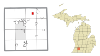
Richland is a village in Kalamazoo County in the U.S. state of Michigan. The population was 751 at the 2010 census, up from 593 at the 2000 census.

<span class="mw-page-title-main">Diamond, Missouri</span> City in Missouri, United States

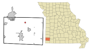
Diamond is a city in north central Newton County, Missouri, United States, located southeast of Joplin. The population was 831 at the 2020 census. It is part of the Joplin, Missouri, Metropolitan Statistical Area. Diamond is primarily renowned as the birthplace of George Washington Carver.

<span class="mw-page-title-main">Cairo, Ohio</span> Village in Ohio, United States

Cairo is a village in Allen County, Ohio, United States. As of the 2020 census it had a population of 517. It is included in the Lima Metropolitan Statistical Area.

<span class="mw-page-title-main">Lincoln Village, Ohio</span> Census-designated place in Ohio, United States

Lincoln Village is a census-designated place (CDP) in Prairie Township, Franklin County, Ohio, United States. It is centered near the intersection of US 40 and I-270 on the west side of Columbus. As of the 2020 census, the population was 9,702.

<span class="mw-page-title-main">Kendrick, Oklahoma</span> Town in Oklahoma, United States

Kendrick is a town in Lincoln County, Oklahoma, United States. The population was 139 at the 2010 census.

<span class="mw-page-title-main">Oak Grove Village, Missouri</span> Village in Missouri, United States

Oak Grove Village is a village in Franklin County, Missouri, United States. The population was 509 at the 2010 census.

<span class="mw-page-title-main">Newman Grove, Nebraska</span> City in Platte County, Nebraska, United States

Newman Grove is a city in Madison and Platte counties in Nebraska, United States. The population was 721 at the 2010 census.

Otego is a village in Otsego County, New York, United States. It is located within the Mohawk Valley Region of the state. The population was 1,010 at the 2010 census.

<span class="mw-page-title-main">Oakfield, Wisconsin</span> Village in Wisconsin, United States

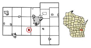
Oakfield is a village in Fond du Lac County, Wisconsin, United States. The population was 1,052 at the 2020 census. The village is located within the Town of Oakfield.

<span class="mw-page-title-main">Hixton, Wisconsin</span> Village in Wisconsin, United States

Hixton is a village in Jackson County, Wisconsin, United States, along the Trempealeau River. The population was 433 at the 2010 census. The village is located within the Town of Hixton.

<span class="mw-page-title-main">Brookfield (town), Wisconsin</span> Town in Wisconsin, United States

The Town of Brookfield is located in Waukesha County, Wisconsin, United States. The population was 6,477 at the 2020 census. The unincorporated community of Goerke's Corners is located in the town.

References

  1. "2020 U.S. Gazetteer Files". United States Census Bureau. Retrieved March 15, 2022.
  2. Chicago and North Western Railway Company (1908). A History of the Origin of the Place Names Connected with the Chicago & North Western and Chicago, St. Paul, Minneapolis & Omaha Railways. p. 74.
  3. "G001 - Geographic Identifiers - 2010 Census Summary File 1". United States Census Bureau. Archived from the original on February 13, 2020. Retrieved August 3, 2015.
  4. "Census of Population and Housing". Census.gov. Retrieved June 4, 2015.
  5. "U.S. Census website". United States Census Bureau . Retrieved January 31, 2008.