Frederickson, Washington

Last updated

Frederickson, Washington
CDP
Pierce County Washington Incorporated and Unincorporated areas Frederickson Highlighted.svg
Location of Frederickson, Washington
Coordinates: 47°4′36″N122°20′47″W / 47.07667°N 122.34639°W / 47.07667; -122.34639
CountryUnited States
State Washington
County Pierce
Area
  Total7.3 sq mi (19.0 km2)
  Land7.3 sq mi (18.9 km2)
  Water0.0 sq mi (0.1 km2)
Elevation
400 ft (122 m)
Population
 (2020) [1]
  Total24,906
  Density2,564.2/sq mi (990.4/km2)
Time zone UTC-8 (Pacific (PST))
  Summer (DST) UTC-7 (PDT)
FIPS code 53-25475 [2]
GNIS feature ID1510979 [3]

Frederickson is a census-designated place (CDP) in Pierce County, Washington, United States. The population was 24,906 at the 2020 census. [1]

Contents

Geography

Frederickson is located at 47°4′36″N122°20′47″W / 47.07667°N 122.34639°W / 47.07667; -122.34639 (47.076729, -122.346339). [4]

According to the United States Census Bureau, the CDP has a total area of 7.3 square miles (19.0 km2), of which, 7.3 square miles (18.9 km2) of it is land and 0.04 square miles (0.1 km2) of it (0.41%) is water.

According to the Frederickson Community Plan published by Pierce County (May 1, 2003) Frederickson's total area is 8,003 acres or 12.5 square miles. [5]

Demographics

Historical population
CensusPop.Note
1990 3,502
2000 5,75864.4%
2010 18,719225.1%
2020 24,90633.1%
U.S. Decennial Census [6]
2020 Census [1]

2000 census

As of the census [2] of 2000, there were 5,758 people, 1,877 households, and 1,542 families residing in the CDP. The population density was 789.6 people per square mile (305.0/km2). There were 1,963 housing units at an average density of 269.2/sq mi (104.0/km2). The racial makeup of the CDP was 84.40% White, 3.18% African American, 1.56% Native American, 3.66% Asian, 0.85% Pacific Islander, 1.60% from other races, and 4.74% from two or more races. Hispanic or Latino of any race were 4.46% of the population.

There were 1,877 households, out of which 46.1% had children under the age of 18 living with them, 69.0% were married couples living together, 8.6% had a female householder with no husband present, and 17.8% were non-families. 12.8% of all households were made up of individuals, and 3.8% had someone living alone who was 65 years of age or older. The average household size was 3.03 and the average family size was 3.28.

In the CDP, the population was spread out, with 31.1% under the age of 18, 7.1% from 18 to 24, 35.2% from 25 to 44, 20.0% from 45 to 64, and 6.7% who were 65 years of age or older. The median age was 32 years. For every 100 females, there were 107.8 males. For every 100 females age 18 and over, there were 107.1 males.

The median income for a household in the CDP was $56,862, and the median income for a family was $57,060. Males had a median income of $41,439 versus $28,690 for females. The per capita income for the CDP was $19,385. About 5.8% of families and 7.4% of the population were below the poverty line, including 9.8% of those under age 18 and 14.3% of those age 65 or over.

Education

Public schools in Frederickson are part of the Bethel School District. Schools in or near Frederickson include:

Surrounding community

Related Research Articles

<span class="mw-page-title-main">Chenega, Alaska</span> CDP in Alaska, United States

Chenega is a census-designated place (CDP) on Evans Island in the Chugach Census Area in the U.S. state of Alaska. Located in Prince William Sound, the CDP consists of the Chugach Alutiiq village of Chenega Bay, which was established only after the Good Friday earthquake destroyed the original community on Chenega Island to the north. As of the 2020 census, the population of the CDP was 59, largely Alaska Natives; as of 2021, the population of Chenega is estimated at 49. Chenega Bay is in the Chugach School District and has one school, Chenega Bay Community School, serving approximately 16 students from preschool through high school.

<span class="mw-page-title-main">Tamalpais-Homestead Valley, California</span> Census-designated place in California, United States

Tamalpais-Homestead Valley is a census-designated place (CDP) in Marin County, California, United States. The population was 11,492 at the 2020 census.

<span class="mw-page-title-main">Stanford, California</span> Census-designated place in Santa Clara County, California, US

Stanford is a census-designated place (CDP) in the northwest corner of Santa Clara County, California, United States. It is the home of Stanford University. The population was 21,150 at the 2020 census.

<span class="mw-page-title-main">Egypt Lake-Leto, Florida</span> Census-designated place in Florida, United States

Egypt Lake-Leto is a census-designated place (CDP) in an unincorporated part of Hillsborough County, Florida, United States. The CDP is located just north of Tampa International Airport. It is part of the Tampa Bay area. As of the 2020 US census, the population had 36,644 residents.

<span class="mw-page-title-main">Luxemburg, Iowa</span> City in Iowa, United States

Luxemburg is a city in Dubuque County, Iowa, United States. It is part of the Dubuque, Iowa Metropolitan Statistical Area. The population was 245 at the time of the 2020 census, down from 246 in 2000. The White Pine Hollow State Forest is located four miles to the northwest of Luxemburg.

<span class="mw-page-title-main">Mehlville, Missouri</span> CDP in Missouri, United States

Mehlville is a census-designated place (CDP) in south St. Louis County, Missouri, United States, an area locally known as "South County". It is an inner-ring suburb of St. Louis, and part of the Greater St. Louis metropolitan area.

<span class="mw-page-title-main">Fort Smith, Montana</span> Census-designated place in Montana, United States

Fort Smith is a census-designated place (CDP) in Big Horn County, Montana, United States. The population was 161 at the 2010 census. The town is named for the former Fort C.F. Smith. The North District of Bighorn Canyon National Recreation Area is accessed at Fort Smith.

<span class="mw-page-title-main">Park Layne, Ohio</span> Census-designated place in Ohio, United States

Park Layne is a census-designated place (CDP) in Bethel Township, Clark County, Ohio, United States. The population of the CDP was 4,248 at the 2020 census. It is part of the Springfield, Ohio Metropolitan Statistical Area. Park Layne became a CDP in the 1980 United States Census.

<span class="mw-page-title-main">Lakeland South, Washington</span> Census-designated place in Washington, United States

Lakeland South is a census-designated place (CDP) in King County, Washington, United States. The population was 13,169 at the 2020 census.

<span class="mw-page-title-main">Mirrormont, Washington</span> Census-designated place in Washington, United States

Mirrormont is a census-designated place (CDP) in King County, Washington, United States, south of Issaquah. The population was 3,858 at the 2020 census. Within the last decade, the area has seen a shift in development as larger homes have been constructed in Cedar Grove, the Highlands at Tiger Mountain and Mirrormont.

<span class="mw-page-title-main">White Center, Washington</span> Census-designated place in Washington, United States

White Center is a census-designated place (CDP) in King County, Washington, United States. It lies between West Seattle and Burien. The population was 16,631 at the 2020 census.

<span class="mw-page-title-main">Elk Plain, Washington</span> CDP in Washington, United States

Elk Plain is a census-designated place (CDP) in Pierce County, Washington, United States. The population was 14,534 at the 2020 census.

<span class="mw-page-title-main">Graham, Washington</span> CDP in Washington, United States

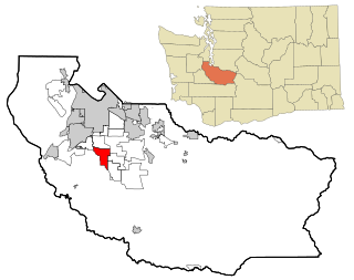
Graham is a census-designated place (CDP) in Pierce County, Washington, United States. It is located 16.2 miles southeast of Tacoma. The population was 23,491 at the 2010 census and grew to 32,658 at the 2020 census.

<span class="mw-page-title-main">Parkland, Washington</span> Census-designated place in Washington, United States

Parkland is a census-designated place (CDP) in Pierce County, Washington. The population was 35,803 at the time of the 2010 census and had grown to 38,623 as of the 2020 census. It is an unincorporated suburb of the city of Tacoma and is home to Pacific Lutheran University.

<span class="mw-page-title-main">South Hill, Washington</span> CDP in Washington, United States

South Hill is a census-designated place (CDP) in Pierce County, Washington, immediately south of Puyallup. The population was 64,708 at time of the 2020 census, up from 52,431 in 2010. The area primarily consists of suburban housing and shopping with several retail shopping centers, residential neighborhoods, and apartment/condo complexes throughout. Because South Hill is unincorporated, its addresses are part of the Puyallup "postal city" or ZCTA.

<span class="mw-page-title-main">Spanaway, Washington</span> CDP in Washington, United States

Spanaway is a census-designated place (CDP) in Pierce County, Washington, United States. The population was 35,476 at the 2020 census, up from 27,227 in 2010. Spanaway is an unincorporated area near Tacoma, and is often identified together with the more urban, less wealthy Parkland.

<span class="mw-page-title-main">Summit, Washington</span> CDP in Washington, United States

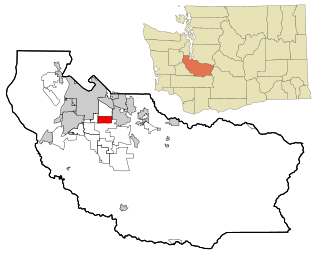
Summit is a census-designated place (CDP) in Pierce County, Washington, United States. The population was 8,270 at the 2020 census.

<span class="mw-page-title-main">Waller, Washington</span> CDP in Washington, United States

Waller is a census-designated place (CDP) in Pierce County, Washington, United States. The population was 8,189 at the 2020 census. The population has seen significant growth in the last decade.

<span class="mw-page-title-main">Edison, Washington</span> CDP in Washington, United States

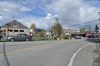
Edison is a census-designated place (CDP) in Skagit County, Washington, United States. The population was 240 at the 2020 census. It is included in the Mount Vernon–Anacortes, Washington Metropolitan Statistical Area.

<span class="mw-page-title-main">Nisqually Reservation</span> CDP in Washington, United States

The Nisqually Reservation, also known as Nisqually Indian Reservation is a federally recognized Indian reservation in Thurston County, Washington, United States. The population was 668 at the 2020 census.

References

  1. 1 2 3 "2020 Census Redistricting Data (Public Law 94-171) Summary File". American FactFinder. United States Census Bureau . Retrieved May 20, 2022.
  2. 1 2 "U.S. Census website". United States Census Bureau . Retrieved January 31, 2008.
  3. "US Board on Geographic Names". United States Geological Survey. October 25, 2007. Retrieved January 31, 2008.
  4. "US Gazetteer files: 2010, 2000, and 1990". United States Census Bureau. February 12, 2011. Retrieved April 23, 2011.
  5. Taylor, Hugh; Pierce County. "Frederickson Community Plan". Pierce County Web Site. Pierce County. p. 19. Archived from the original on February 22, 2014. Retrieved January 26, 2014.
  6. United States Census Bureau. "Census of Population and Housing" . Retrieved July 25, 2013.