Lansing is the capital of the U.S. state of Michigan. It is mostly in Ingham County, although portions of the city extend west into Eaton County and north into Clinton County. The 2020 census placed the city's population at 112,644, making it the sixth largest city in Michigan. The population of its metropolitan statistical area (MSA) was 541,297 at the 2020 census, the third largest in the state after metropolitan Detroit and Grand Rapids. It was named the new state capital of Michigan in 1847, ten years after Michigan became a state.
Lansing Charter Township is a charter township of Ingham County in the U.S. state of Michigan. The population was 8,143 at the 2020 census.
East Lansing is a city in the U.S. state of Michigan. Most of the city lies within Ingham County with a smaller portion extending north into Clinton County. At the 2020 Census the population was 47,741. Located directly east of the state capital of Lansing, East Lansing is well-known as the home of Michigan State University. The city is part of the Lansing–East Lansing metropolitan area.
M-99 is a north–south state trunkline highway in the Lower Peninsula of the US state of Michigan. It runs from the Ohio state border, where it connects to State Route 15 (SR 15), north to Lansing, where it terminates at a junction with Interstate 496 (I-496) and the Capitol Loop. The highway mainly serves local communities along the route as it passes through farm lands in the southern part of the state. One short segment, in Jonesville, is routed concurrently with US Highway 12 (US 12). The segment within Lansing follows Martin Luther King Jr. Boulevard.

Interstate 496 (I-496) is an auxiliary Interstate Highway that passes through downtown Lansing in the US state of Michigan. Also a component of the State Trunkline Highway System, the freeway connects I-96 to the downtown area. It has been named the R.E. Olds Freeway for Ransom E. Olds, the founder of Oldsmobile and the REO Motor Car Company. I-496 runs east–west from I-96/I-69 near the downtown area and north–south along a section that runs concurrently with US Highway 127 (US 127). The trunkline also passes a former assembly plant used by Oldsmobile and runs along or crosses parts of the Grand and Red Cedar rivers.
M-3 is a north–south state trunkline highway in the Detroit metropolitan area of the US state of Michigan. For most of its length, the trunkline is known as Gratiot Avenue. The trunkline starts in Downtown Detroit and runs through the city in a northeasterly direction along one of Detroit's five major avenues. The highway passes several historic landmarks and through a historic district. It also connects residential neighborhoods on the city's east side with suburbs in Macomb County and downtown.
M-50 is a state trunkline highway in the US state of Michigan. Although designated as an east–west highway, it is nearly a diagonal northwest–southeast route. The western terminus is at exit 52 along Interstate 96 (I-96) near Alto a few miles east of the metro Grand Rapids area, and its eastern terminus is in downtown Monroe at US Highway 24. In between the trunkline runs through seven counties of the southern part of the Lower Peninsula mostly through rural farm fields and small communities. The highway also runs through downtown Jackson to connect between two freeway sections of US 127. In the Irish Hills area of the state southeast of Jackson, M-50 runs next to Michigan International Speedway.

M-10 is a state trunkline highway in the Metro Detroit area of Michigan in the United States. Nominally labeled north-south, the route follows a northwest-southeast alignment. The southernmost portion follows Jefferson Avenue in downtown Detroit, and the southern terminus is at the intersection of Jefferson and M-3 next to the entrance to the Detroit–Windsor Tunnel. The northern terminus is in West Bloomfield Township at the intersection with Orchard Lake Road. The highway has several names as it runs through residential and commercial areas of the west side of Detroit and into the suburb of Southfield. It is called the John C. Lodge Freeway, James Couzens Highway, and Northwestern Highway. One segment has also been named the Aretha Franklin Memorial Highway.
M-85, also known as Fort Street or Fort Road for its entire length, is a state trunkline highway in the U.S. state of Michigan. The highway serves several Downriver suburbs of Detroit, as well as neighborhoods in the city itself. From its southern terminus at exit 28 on Interstate 75 (I-75) to its second interchange with exit 43 on I-75 in southwest Detroit, M-85 is part of the Lake Erie Circle Tour. In between, it serves mostly residential areas running parallel to a pair of rail lines; the highway carries between 5,000 and 43,000 vehicles per day on average. Once in the city of Detroit, Fort Street runs parallel to I-75 for several miles before they separate near the Ambassador Bridge. The northern end of M-85 is at the intersection with Griswold Street in downtown Detroit, one block away from Campus Martius Park.
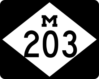
M-203 is a north–south state trunkline highway in the Upper Peninsula of the US state of Michigan. It connects McLain State Park with US 41 on each end in Hancock and Calumet. The trunkline has existed since commissioning in 1933 except a period of time when it was temporarily decommissioned.
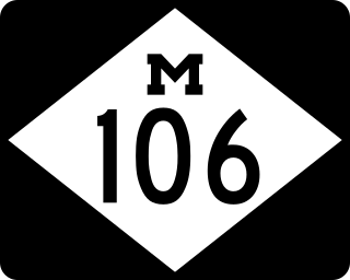
M-106 is a state trunkline highway in the Lower Peninsula of the US state of Michigan in and near the city of Jackson. M-106 travels in a southwest-to-northeast direction from Jackson to Gregory at a junction with M-36 just a few miles northwest of Hell. The highway was first designated in 1928 running north out of downtown Jackson. It connected U.S. Highway 12 (US 12) to the state prison and Bunkerhill Road. A pair of changes in the early 1930s resulted in the extension eastward to Gregory. From the 1960s until the early years of the 21st century, a section of M-106 in downtown Jackson was routed along one-way streets.

There are three business routes of US Highway 10 in the state of Michigan. They serve as connections from the main highway into Reed City, Clare and Midland. Additionally, there were another two business routes that connected US Highway 10 (US 10) to the downtowns of Flint and Pontiac. All of these business routes are, or were, former sections of US 10 that were marked Business US Highway 10 after the main highway was realigned to bypass the downtowns of the cities.

There are currently eight business routes of Interstate 94 (I-94) in the US state of Michigan. These business routes connect I-94 to the downtown business districts of neighboring cities. Seven of the eight routes are business loops which bear the Business Loop I-94 designation while one is a business spur that bears the Business Spur I-94. These loops are former routings of I-94's two predecessors in Michigan: US Highway 12 (US 12) or US 25. The westernmost BL I-94 runs through the twin cities of Benton Harbor and St. Joseph along the former routing of US 12 and US 31/US 33 that now includes a section of the Lake Michigan Circle Tour in the state. The loops in Kalamazoo, Battle Creek, Marshall, Albion, and Jackson were also formerly segments of US 12 which were later designated as separate version of Business US Highway 12 through their respective cities before becoming BL I-94s in 1960. The BL I-94 in Kalamazoo was converted into BS I-94 in 2019. The route of the business loop through Ann Arbor was previously US 12 and then later M-14 before receiving its current moniker. The BL I-94 through Port Huron was previously US 25 and then Business US Highway 25.

There are five business routes of US Highway 131 in the state of Michigan, and previously there was one bypass route and an additional business route. All of the business routes are former sections of US Highway 131 (US 131). These former sections of the mainline highway, along with the necessary connecting roads, allow traffic to access the downtowns business districts of cities bypassed by sections of US 131 built since the 1950s. The extant business loops connect to Constantine, Three Rivers, Kalamazoo, Big Rapids, Cadillac, and Manton. The former bypass route in Grand Rapids allowed traffic to bypass that city's downtown at a time when US 131 still ran through the heart of the city, and the later business route connected through downtown while US 131 ran on a freeway bypassing the central business district.

There are currently four business routes of Interstate 69 (I-69) in the US state of Michigan. Designated Business Loop Interstate 69, they are all former routings of I-69's predecessor highways, US Highway 27 (US 27), M-78 or M-21, in whole or in part. The BL I-69 in Coldwater and the one in Charlotte were both parts of US 27 before the freeway bypassed those two cities in 1967 and the early 1970s, respectively. The BL I-69 through Lansing and East Lansing was previously part of M-78 and Temporary I-69 until it was redesignated in 1987. Before 1984, the loop in Port Huron was originally part of M-21 and was initially a business spur numbered Business Spur Interstate 69. It was later redesignated when it was extended to run concurrently with that city's BL I-94 which was originally part of I-94's predecessor, US 25. Each business loop follows streets through each city's downtown areas and connects to I-69 on both ends, giving traffic a route through the downtown and back to the freeway.
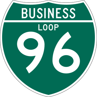
There have been six business routes of Interstate 96 (I-96) in the US state of Michigan. There are two business loops designated Business Loop Interstate 96 : one through Lansing and one through Howell. Both follow the old route of US Highway 16 (US 16), with appropriate connections to I-96. There are three former business spurs that were designated Business Spur Interstate 96. One connected to the carferry docks in Muskegon, running concurrently with part of Business US 31 along former US 16, but it has been eliminated. The second spur ran into downtown Portland until it was decommissioned in 2007. Two routes in the Detroit area—a loop through Farmington and a spur into Detroit—both using Grand River Avenue, and meeting at the temporary end of I-96 near Purdue Avenue, were eliminated when I-96 was moved to the completed Jeffries Freeway in 1977. The Farmington business route is still state-maintained as an unsigned highway, while the Detroit business route remained unsigned until it was decommissioned in 2016 and replaced by an extension of M-5.

REO Town is a district in Lansing, Michigan, United States, located south of downtown. The neighborhood is bordered by West Malcolm X Street to the north; South Cedar Street BL I-96 to the east; West Mount Hope Avenue to the south; and Townsend Street, the Grand River, and South Martin Luther King Jr. Boulevard to the west.

Colonial Village is a neighborhood in Lansing, Michigan. It is located southwest of REO Town in the southside of the city.

There have been 10 business routes of US Highway 127 in the state of Michigan. The business routes are all sections of state trunkline highway that run through the central business districts of their respective towns connecting them to the mainline highway outside of those downtown areas. These various business routes were formerly part of the routing of US Highway 127 (US 127) or its predecessor in Central Michigan, US 27, before the construction of highway bypasses. The southern two, in Jackson and Mason were previously parts of US 127, while seven of the northern eight were originally part of US 27, a highway which was replaced on its northern end by US 127 in 2002. The business loop through Alma was once numbered US 27A.

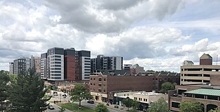
Downtown Lansing is the central business district of Lansing, Michigan, United States. Located in the west-central part of the city along the banks of the Grand River, downtown Lansing is primarily home to Michigan's state government and three colleges, and also contains sports facilities, museums, entertainment and retail, and a growing residential population.