Perry County is a county located in the southwestern part of the U.S. state of Indiana. As of 2020, the population was 19,170. The county seat is Tell City. It is the hilliest county as well as one of the most forested counties in Indiana as it features more than 60,000 acres (240 km2) of Hoosier National Forest. The Ohio River Scenic Byway along Indiana State Road 66 runs along the southern border of the county while Interstate 64 traverses the northern portion of the county. Connecting the two is Indiana State Road 37.

Perry Township is one of the nine townships of Marion County, Indiana, United States, located in the south central part of the county. It was laid out in 1822 by the U.S. Army Corps of Engineers and named after Oliver Hazard Perry – a War of 1812 hero. The township population was 108,972 at the 2010 census. This includes the largest community of Burmese-Americans in the United States, numbering over 24,000. Through the White River, Perry and Decatur townships share the only water boundary among Marion County's townships.

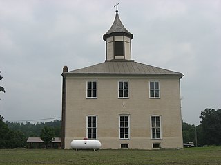
Tobin Township is one of seven townships in Perry County, Indiana, United States. As of the 2010 census, its population was 768 and it contained 418 housing units.

Meadowbrook is an unincorporated community in Perry Township, Tippecanoe County, in the U.S. state of Indiana.

Southwestern Indiana is an 11-county region of southern Indiana, United States located at the southernmost and westernmost part of the state. As of the 2010 census, the region's combined population is 474,251. Evansville, Indiana's third-largest city, is the primary hub for the region, as well as the primary regional hub for a tri-state area that includes Kentucky and Illinois. Other regional hubs include Jasper, Vincennes, and Washington. Although part of a Midwestern state, this region's culture and language is aligned more with that of the Upland South rather than the Midwest.

St. Croix or Saint Croix is an unincorporated community in northern Oil Township, Perry County, in the U.S. state of Indiana.

Rome is an unincorporated community along the Ohio River in southeastern Tobin Township, Perry County, in the U.S. state of Indiana.

Derby is an unincorporated community along the Ohio River in far southern Union Township, Perry County, in the U.S. state of Indiana. It lies at the intersection of State Roads 66 and 70 above the city of Tell City, the county seat of Perry County. Although Derby is unincorporated, it has a post office, with the ZIP code of 47525.
Branchville is an unincorporated community in southern Oil Township, Perry County, in the U.S. state of Indiana. It lies along CR40 northeast of the city of Tell City, the county seat of Perry County. Its elevation is 433 feet (132 m), and it is located at 38°9′49″N86°34′47″W. Although Branchville is unincorporated, it has a post office, with the ZIP code of 47514. The Branchville Correctional Facility is located near the community.
Tobinsport is a small unincorporated community located along the Ohio River in Tobin Township, Perry County, in the U.S. state of Indiana. Directly across the river is Cloverport, Kentucky. It is at the southernmost point of Perry County.
Pettit is a small unincorporated community in Perry Township, Tippecanoe County, Indiana, located east by northeast of Dayton.
Sassafras is an unincorporated community in Clark Township, Perry County, in the U.S. state of Indiana.
Adyeville is an unincorporated community in Clark Township, Perry County, in the U.S. state of Indiana.
Bandon is an unincorporated community in Oil Township, Perry County, in the U.S. state of Indiana.
Bristow is an unincorporated community in Clark Township, Perry County, in the U.S. state of Indiana.
Mount Pleasant is an unincorporated community in Union Township, Perry County, in the U.S. state of Indiana.
Oriole is an unincorporated community in Oil Township, Perry County, in the U.S. state of Indiana.
Uniontown is an unincorporated community in Clark Township, Perry County, in the U.S. state of Indiana.
Niconza was a community, now extinct, in Perry Township, Miami County, in the U.S. state of Indiana.
Hooversburg was a community, now extinct, in Perry Township, Miami County, in the U.S. state of Indiana.


