
Clay County is a county located in the U.S. state of Indiana. As of 2020, the population was 26,466. The county seat is Brazil.

Union County is a county in the U.S. state of Indiana. As of the 2020 United States census, the population was 7,087. The county seat is Liberty.

Ripley County is a county located at the southeastern corner of the U.S. state of Indiana. According to the 2020 Census, the population was 28,995. The county seat is Versailles.
Perry County is a county located in the southwestern part of the U.S. state of Indiana. As of 2020, the population was 19,170. The county seat is Tell City. It is the hilliest county as well as one of the most forested counties in Indiana as it features more than 60,000 acres (240 km2) of Hoosier National Forest. The Ohio River Scenic Byway along Indiana State Road 66 runs along the southern border of the county while Interstate 64 traverses the northern portion of the county. Connecting the two is Indiana State Road 37.

Parke County lies in the western part of the U.S. state of Indiana along the Wabash River. The county was formed in 1821 out of a portion of Vigo County. According to the 2020 census, the population was 16,156. The county seat is Rockville.

Orange County is located in southern Indiana in the United States. As of 2020, its population was 19,867. The county seat is Paoli. The county has four incorporated settlements with a total population of about 8,600, as well as several small unincorporated communities. It is divided into 10 townships which provide local services. One U.S. route and five Indiana state roads pass through or into the county.

Ohio County is a county located in southeastern Indiana. With a 2020 population of 5,940, and an area of just 87 square miles, Ohio County is the smallest county in Indiana by area and the least populous. The county seat and only incorporated municipality is Rising Sun. The county was officially established in 1844 and was one of the last Indiana counties to be created. Ohio County borders the state of Kentucky across the Ohio River for which it was named. It is part of the Cincinnati, OH-KY-IN Metropolitan Statistical Area. The county is divided into four townships which provide local services. Three state roads pass through or into the county.

Madison County is a county in the U.S. state of Indiana. The 2020 census states the population is standing at 130,129. The county seat since 1836 has been Anderson, one of three incorporated cities within the county.

Decatur County is a county in the U.S. state of Indiana. As of the 2020 United States Census, the population was 26,472. The county seat is Greensburg.
Tri-state area is an informal term in the United States which can refer to any of multiple areas that lie across three states. When referring to populated areas, the term implies a shared economy or culture among the area's residents, typically concentrated around a central metropolis.
State Road 145 is a north–south road in the southwest portion of the U.S. State of Indiana.

The geography of Indiana comprises the physical features of the land and relative location of U.S. State of Indiana. Indiana is in the north-central United States and borders on Lake Michigan. Surrounding states are Michigan to the north and northeast, Illinois to the west, Kentucky to the south, and Ohio to the east. The entire southern boundary is the Ohio River.

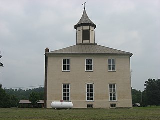
Clark Township is one of seven townships in Perry County, Indiana, United States. As of the 2010 census, its population was 1,180 and it contained 544 housing units.
The Indianapolis Youth Orchestra is an organization in Indianapolis, Indiana that exists "to develop the musical talent and nurture the personal growth of young people in Indianapolis and central Indiana through the rehearsal and performance of orchestral masterworks, both traditional and contemporary." The Indianapolis Youth Orchestra was founded by Susan Kitterman in 1982 and currently consists of three separate orchestras:
On May 22, 2009, James Owen Kitterman, an American citizen, was killed in Iraq's Green Zone.

The 1984 United States presidential election in Indiana took place on November 6, 1984. All 50 states and the District of Columbia, were part of the 1984 United States presidential election. State voters chose 12 electors to the Electoral College, which selected the president and vice president of the United States. President Ronald Reagan of California won the state of Indiana against former Vice President Walter Mondale of Minnesota by a substantial 23.99% margin. Reagan ran for a second time with incumbent Vice President and former C.I.A. Director George H. W. Bush of Texas, and Mondale ran with Representative Geraldine Ferraro of New York, the first major female candidate for the vice presidency.
Scott Corner is an unincorporated community in Union Township, Randolph County, in the U.S. state of Indiana.

The 1972 United States presidential election in Indiana took place on November 7, 1972. All fifty states and the District of Columbia were part of the 1972 United States presidential election. State voters chose 13 electors to the Electoral College, who voted for president and vice president.

Massachusetts House of Representatives' 3rd Berkshire district in the United States is one of 160 legislative districts included in the lower house of the Massachusetts General Court. It covers part of Pittsfield in Berkshire County. Democrat Tricia Farley-Bouvier of Pittsfield has represented the district since 2011.


