Gorham, New York

Last updated

Gorham, New York
USA New York location map.svg
Red pog.svg
Gorham, New York
Location within the state of New York
Coordinates: 42°48′32″N77°13′18″W / 42.80889°N 77.22167°W / 42.80889; -77.22167
Country United States
State New York
County Ontario
Government
  Type Town Council
   Town Supervisor Fred Lightfoote (R)
   Town Council
Members' List
Area
[1]
  Total53.17 sq mi (137.71 km2)
  Land48.85 sq mi (126.53 km2)
  Water4.32 sq mi (11.17 km2)
Elevation
1,076 ft (328 m)
Population
 (2020) [2]
  Total4,130 Decrease2.svg
  Estimate 
(2021) [2]
4,124
  Density87.49/sq mi (33.78/km2)
Time zone UTC-5 (Eastern (EST))
  Summer (DST) UTC-4 (EDT)
ZIP code
14461
Area code 585
FIPS code 36-29531
GNIS feature ID0979007

Gorham is a town in Ontario County, New York, United States. The population was 4,130 at the 2020 census. [2] The town is named after Nathaniel Gorham. [3]

Contents

The Town of Gorham is at the southern border of the county, southeast of Canandaigua.

History

Gorham was created at the same time as the county (1789) as the "Town of Easton." The town changed its name to "Lincoln" in 1806, and adopted the current name, the name of an early proprietor, in 1807. Part of Gorham was taken in 1822 to form the Town of Hopewell. More territory, including the east shore of Canandaigua Lake, was added to Gorham in 1824.

A fire consumed much of Gorham village in 1868.

Geography

According to the United States Census Bureau, the town has a total area of 53.2 square miles (138 km2), of which 48.9 square miles (127 km2) is land and 4.3 square miles (11 km2) (8.10%) is water.

The southern town line is the border of Yates County, and the western town line is marked by Canandaigua Lake, one of the Finger Lakes.

New York State Route 245 intersects New York State Route 247 northeast of Rushville. NY-247 and New York State Route 364 are north–south highways in the town, but NY-364 is farther west, near Canandaigua Lake.

Demographics

Historical population
CensusPop.Note
1820 3,991
1830 2,977−25.4%
1840 2,779−6.7%
1850 2,615−5.9%
1860 2,537−3.0%
1870 2,389−5.8%
1880 2,5215.5%
1890 2,203−12.6%
1900 2,131−3.3%
1910 2,1340.1%
1920 1,936−9.3%
1930 1,843−4.8%
1940 2,02710.0%
1950 2,35416.1%
1960 2,66413.2%
1970 3,03313.9%
1980 3,59818.6%
1990 3,497−2.8%
2000 3,7768.0%
2010 4,24712.5%
2020 4,130−2.8%
2021 (est.)4,124 [2] −0.1%
U.S. Decennial Census [4]

As of the census [5] of 2000, there were 3,776 people, 1,410 households, and 1,036 families residing in the town. The population density was 77.2 inhabitants per square mile (29.8/km2). There were 1,900 housing units at an average density of 38.9 per square mile (15.0/km2). The racial makeup of the town was 98.36% White, 0.37% African American, 0.05% Native American, 0.13% Asian, 0.03% Pacific Islander, 0.21% from other races, and 0.85% from two or more races. Hispanic or Latino of any race were 0.48% of the population.

There were 1,410 households, out of which 32.7% had children under the age of 18 living with them, 60.2% were married couples living together, 8.9% had a female householder with no husband present, and 26.5% were non-families. 19.9% of all households were made up of individuals, and 9.4% had someone living alone who was 65 years of age or older. The average household size was 2.66 and the average family size was 3.05.

In the town, the population was spread out, with 26.3% under the age of 18, 6.8% from 18 to 24, 26.7% from 25 to 44, 26.7% from 45 to 64, and 13.5% who were 65 years of age or older. The median age was 39 years. For every 100 females, there were 97.0 males. For every 100 females age 18 and over, there were 95.0 males.

The median income for a household in the town was $43,138, and the median income for a family was $45,917. Males had a median income of $35,658 versus $23,682 for females. The per capita income for the town was $20,736. About 4.2% of families and 7.0% of the population were below the poverty line, including 9.2% of those under age 18 and 3.2% of those age 65 or over.

Notable people

Communities and locations in the Town of Gorham

Related Research Articles

<span class="mw-page-title-main">Owasco, New York</span> Town in New York, United States

Owasco is a town in Cayuga County, New York, United States. It is part of the traditional territory of the Cayuga nation. The population was 3,793 at the 2010 census. Owasco is in the eastern part of Cayuga County and is at the southeast city line of Auburn. The town borders Owasco Lake, from where it gets its name.

<span class="mw-page-title-main">North Harmony, New York</span> Town in New York, United States

North Harmony is a town in Chautauqua County, New York, United States. The population was 2,182 at the 2020 census. The town is on the west side of Chautauqua Lake. The shore of the lake is the location of many summer resort communities.

Conesus is a town in Livingston County, New York, United States. The population was 2,473 at the 2010 census. The name is derived from a native word meaning "berry place".

<span class="mw-page-title-main">Vienna, New York</span> Town in New York, United States

Vienna is a town in Oneida County, New York, United States. The population was 5,440 at the 2010 census. The town is named after the capital of Austria.

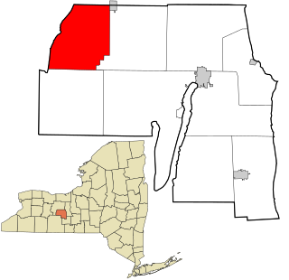
Farmington is a town located in the northern part of Ontario County, New York, United States. The population was 14,275 at the 2020 census.

Hopewell is a town in Ontario County, New York, United States. The population was 3,931 at the 2020 census.

Seneca is a town in Ontario County, New York, United States. The population was 2,658 at the 2020 census. The town is named after a group of local natives.

South Bristol is a town in Ontario County, New York, United States. The population was 1,651 at the 2020 census. The name is derived from its separation from the Town of Bristol.

<span class="mw-page-title-main">Otsego, New York</span> Town in New York, United States

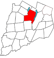
Otsego is a town in the north-central part of Otsego County, New York, United States. The population was 3,641 at the 2020 census. The town is named after Lake Otsego, which forms part of the town's eastern border.

Pulteney is a town in Steuben County, New York, United States. The population was 1,260 at the 2020 census. The name is derived from the name of the original pioneer tract of land.

<span class="mw-page-title-main">Ontario, New York</span> Town in Wayne County, New York, US

Ontario is a town in the northwest corner of Wayne County, New York, United States. The population was 9,778 at the 2000 census, and 10,136 at the 2010 census. The town is named after the Great Lake on its northern border.

<span class="mw-page-title-main">Benton, New York</span> Town in New York, United States

Benton is a town in Yates County, New York, United States. The population was 2,836 at the 2010 census. The town is named after an early resident, Levi Benton (1746-1820)

<span class="mw-page-title-main">Italy, New York</span> Town in New York, United States

Italy is a town located in Yates County, New York, United States. As of the 2010 census, the town had a total population of 1,141. The town takes its name from the country of Italy.

<span class="mw-page-title-main">Middlesex, New York</span> Town in New York, United States

Middlesex is a town in Yates County, New York, United States. The population was 1,495 at the 2010 census. The name originates from the county of Middlesex, England.

<span class="mw-page-title-main">Potter, New York</span> Town in New York, United States

Potter is a town in Yates County, New York, United States. The Town of Potter is located in the northwest part of the county and is south of Canandaigua. The population was 1,865 at the 2010 census.

<span class="mw-page-title-main">Rushville, New York</span> Village in New York, United States

Rushville is a village in Ontario and Yates Counties in the U.S. state of New York. The population was 655 in the 2019 American Community Survey. Most of the Village of Rushville is within the Town of Potter in Yates County and a small part is in the Town of Gorham in Ontario County. It is one of two villages in Ontario County that is split between two townships and the only village in Ontario split between two counties.

Canandaigua is a town in Ontario County, New York, United States. The population was 11,109 at the 2020 census.

<span class="mw-page-title-main">Naples, New York</span> Town in the United States

Naples is a town in Ontario County, New York, United States. The population was 2,417 at the 2020 census.

Victor is an incorporated town in Ontario County, New York, United States. The population was 15,969 at the time of the 2020 census. The town is named after Claudius Victor Boughton, an American hero of the War of 1812.

Lansing is a town in Tompkins County, New York, United States. The population was 11,565 at the 2020 census.

References

  1. "2016 U.S. Gazetteer Files". United States Census Bureau. Retrieved July 5, 2017.
  2. 1 2 3 4 Bureau, US Census. "City and Town Population Totals: 2020—2021". Census.gov. US Census Bureau. Retrieved October 12, 2022.
  3. Gannett, Henry (1905). The Origin of Certain Place Names in the United States. Govt. Print. Off. pp.  140.
  4. "Census of Population and Housing". Census.gov. Retrieved June 4, 2015.
  5. "U.S. Census website". United States Census Bureau . Retrieved January 31, 2008.

42°47′56″N77°07′54″W / 42.79889°N 77.13167°W / 42.79889; -77.13167