Phelps, New York

Last updated

Phelps
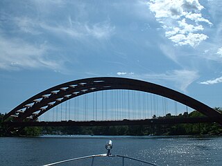
Phelps NY Park.JPG
Crooked Bridge Park
New York in United States (US48).svg
Location of New York in the United States
Coordinates: 42°57′27″N77°03′29″W / 42.957553°N 77.058073°W / 42.957553; -77.058073
CountryUnited States
State New York
County Ontario
Government
   Town Supervisor William Wellman(R)
  • Kent Ridley (R)
  • Ronald Allen (R)
  • Brent Ford (R)
  • John Duchesneau (R)
Area
[1]
  Total65.24 sq mi (168.98 km2)
  Land64.95 sq mi (168.22 km2)
  Water0.29 sq mi (0.76 km2)
Population
 (2020)
  Total6,637
  Density106.45/sq mi (41.10/km2)
Time zone EST
  Summer (DST) EDT
FIPS code 36-069-57529
Website http://www.phelpsny.com/

Phelps is a town in Ontario County, New York, United States. The population was 6,637 at the 2020 census. The Town of Phelps contains a village called Phelps. [2] Both are north of Geneva.

Contents

History

The town was part of the Phelps and Gorham Purchase. The region was first settled around 1788. The town was formed in 1796 and was formerly known as "Sullivan." The town of Phelps is named after one of the original proprietors. The community was incorporated in 1855. [3]

Geography

According to the United States Census Bureau, the town has a total area of 65.3 square miles (169.0 km2), of which 65.0 square miles (168.3 km2) is land and 0.3 square mile (0.7 km2) (0.43%) is water.

The eastern town line is the border of Seneca County and the northern town line is the border of Wayne County.

Demographics

Historical population
CensusPop.Note
1820 5,688
1830 4,798−15.6%
1840 5,56315.9%
1850 5,542−0.4%
1860 5,5860.8%
1870 5,130−8.2%
1880 5,1891.2%
1890 5,086−2.0%
1900 4,788−5.9%
1910 4,733−1.1%
1920 4,205−11.2%
1930 4,5909.2%
1940 4,425−3.6%
1950 4,89010.5%
1960 5,82519.1%
1970 6,3308.7%
1980 6,5223.0%
1990 6,7493.5%
2000 7,0174.0%
2010 7,0720.8%
2020 6,637−6.2%
U.S. Decennial Census [4]

As of the census [5] of 2020, there were 6,637 people, 2,659 households, and 1,957 families residing in the town. The population density was 108.0 inhabitants per square mile (41.7/km2). There were 2,817 housing units at an average density of 43.4 per square mile (16.8/km2). The racial makeup of the town was 98.09% White, 0.26% Black or African American, 0.14% Native American, 0.27% Asian, 0.46% from other races, and 0.78% from two or more races. Hispanic or Latino of any race were 1.23% of the population.

There were 2,659 households, out of which 34.9% had children under the age of 18 living with them, 60.6% were married couples living together, 8.6% had a female householder with no husband present, and 26.4% were non-families. 20.8% of all households were made up of individuals, and 8.8% had someone living alone who was 65 years of age or older. The average household size was 2.63 and the average family size was 3.03.

In the town, the population was spread out, with 27.1% under the age of 18, 6.3% from 18 to 24, 29.9% from 25 to 44, 25.1% from 45 to 64, and 11.6% who were 65 years of age or older. The median age was 38 years. For every 100 females, there were 97.7 males. For every 100 females age 18 and over, there were 94.3 males.

The median income for a household in the town was $47,246, and the median income for a family was $53,854. Males had a median income of $34,792 versus $26,498 for females. The per capita income for the town was $21,297. About 3.0% of families and 4.3% of the population were below the poverty line, including 4.8% of those under age 18 and 5.8% of those age 65 or over.

Arts and culture

Annual cultural events

The town of Phelps was formerly a major center for the production of sauerkraut, earning the distinction of sauerkraut capital of the world. The town holds a sauerkraut-themed festival every year during the first weekend of August. 2020 would have been the festival's 54th anniversary, if not for COVID-19.

Museums and other points of interest

The Phelps Community Historical Society and Howe House Museum . The First Baptist Church of Phelps, Harmon Cobblestone Farmhouse and Cobblestone Smokehouse, Dr. John Quincy Howe House, Phelps Town Hall, William Huffman Cobblestone House, St. John's Episcopal Church and Philetus Swift House are listed on the National Register of Historic Places. [6]

Transportation

The New York State Thruway (Interstate 90) passes through the town north of Phelps village and Clifton Springs. New York State Route 96 parallels the Thruway and intersects two north–south highways in the western part of the town: New York State Route 88 and New York State Route 488.

Notable people

Communities and locations in the Town of Phelps

Related Research Articles

<span class="mw-page-title-main">Scipio, New York</span> Town in New York, United States

Scipio is a town in Cayuga County, New York, United States. The population was 1,713 at the 2010 census. Scipio is centrally located in the southern half of the county, south of Auburn.

<span class="mw-page-title-main">Pavilion, New York</span> Town in New York, United States

Pavilion is a town in Genesee County, New York, United States. The population was 2,495 at the 2010 census. The town was named after a hotel in Saratoga Springs, New York, by an early resident. The town of Pavilion is in the southeastern corner of Genesee County and is southeast of the city of Batavia.

Conesus is a town in Livingston County, New York, United States. The population was 2,473 at the 2010 census. The name is derived from a native word meaning "berry place".

<span class="mw-page-title-main">Hartland, New York</span> Town in New York, United States

Hartland is a town in Niagara County, New York, United States. The population was 4,117 at the 2010 census. The town is named after Hartland, Vermont, the homeplace of some early settlers.

Hopewell is a town in Ontario County, New York, United States. The population was 3,931 at the 2020 census.

Seneca is a town in Ontario County, New York, United States. The population was 2,658 at the 2020 census. The town is named after a group of local natives.

<span class="mw-page-title-main">Gaines, New York</span> Town in New York, United States

Gaines is a town in Orleans County, New York, United States. The population was 3,378 at the 2010 census. The town is named after General Edmund P. Gaines, who defended the area during the War of 1812.
<span class="mw-page-title-main">Halfmoon, New York</span> Town in New York, United States

Halfmoon is a town in Saratoga County, New York, United States. The population was 25,662 at the 2020 census. The town is apparently named for the shape of the lower elevation land north of the junction of the Hudson and Mohawk Rivers. It is also said to be named for Henry Hudson's ship, the Halve Maen.

<span class="mw-page-title-main">Junius, New York</span> Town in New York, United States

Junius is a town in Seneca County, New York, United States. The population was 1,370 at the 2020 census.

<span class="mw-page-title-main">Clifton, New York</span> Town in New York, United States

Clifton is a town in St. Lawrence County, New York, United States. The population was 675 at the 2020 census. The town takes its name from a mining company.

<span class="mw-page-title-main">Galen, New York</span> Town in New York, United States

Galen is a town in Wayne County, New York, United States. The population was 4,290 at the 2010 census. The town is named after the classical physician Galen.

<span class="mw-page-title-main">Benton, New York</span> Town in New York, United States

Benton is a town in Yates County, New York, United States. The population was 2,836 at the 2010 census. The town is named after an early resident, Levi Benton (1746-1820)

<span class="mw-page-title-main">Starkey, New York</span> Town in New York, United States

Starkey is a town in Yates County, New York, United States. The population was 3,573 at the 2010 census. The town is in the southeastern section of the county and is south of Geneva.

Johnstown is a town located in Fulton County, New York, United States. As of the 2010 census, the town had a population of 7,098. The name of the town is from landowner William Johnson. The town of Johnstown is located on the southern border of the county. It borders on three sides the city of Johnstown and the city of Gloversville.

Leicester is a town in Livingston County, New York, United States. The population was 2,200 at the 2010 census. The town is named after Leicester Phelps, an early inhabitant.

Lima is a town in Livingston County, New York, United States. The population was 4,305 at the 2010 census. The town is in the northeast part of the county, south of Rochester. The village of Lima is located within the town.

Hamilton is a town in Madison County, New York, United States. The population was 6,379 at the 2020 census. The town is named after American Founding Father Alexander Hamilton, and is a college town, with Colgate University dominating the town's employment, culture and population.

<span class="mw-page-title-main">Wilson, New York</span> Town in New York, United States

Wilson is a town in Niagara County, New York, United States. The population was 5,993 at the 2010 census. The town was named after an early settler, Reuben Wilson, who built and dwelt in a log cabin on the shore of Lake Ontario at the site of what would become the Village of Wilson.

<span class="mw-page-title-main">Sodus, New York</span> Town in New York, United States

Sodus is a town in Wayne County, New York, United States. The population was 8,384 at the 2010 census. The town takes its name from a native word for the bay in the eastern part of the town: "Assorodus," meaning "silvery water."

Victor is an incorporated town in Ontario County, New York, United States. The population was 15,969 at the time of the 2020 census. The town is named after Claudius Victor Boughton, an American hero of the War of 1812.

References

  1. "2016 U.S. Gazetteer Files". United States Census Bureau. Retrieved July 5, 2017.
  2. "Profile for Phelps, New York, NY". ePodunk. Retrieved September 26, 2012.
  3. "Phelps, New York". City-Data.com. Retrieved September 26, 2012.
  4. "Census of Population and Housing". Census.gov. Retrieved June 4, 2015.
  5. "U.S. Census website". United States Census Bureau . Retrieved April 1, 2020.
  6. "National Register Information System". National Register of Historic Places . National Park Service. March 13, 2009.
  7. "Governor C.C. Stevenson". nvlibrarycoop.contentdm.oclc.org. Nevada Library Cooperative. Retrieved February 16, 2021.