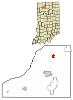
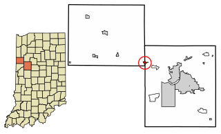
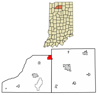
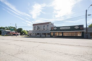
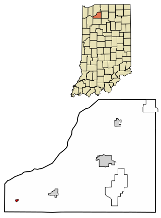
History
Hamlet was named after John Hamlet, who established the town in 1863.
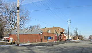
Two railroad lines once existed in Hamlet, one being a division of the former mainline of the Pennsylvania Railroad (PRR), running from Chicago, Illinois to Fort Wayne, Indiana, with the other line being the New York Central's (NYC) Kankakee Belt, running from Elkhart, Indiana to Kankakee, Illinois. In 1968, these two railroads merged to become the Penn Central Railroad. In 1976, Penn Central, along with several other languishing eastern railroads, were in bankruptcy, and was part of the Federal Government's takeover, creating Conrail. Both rail lines continued to see heavy use until the late 1970s under Conrail. By the early 1980s, the Kankakee Belt had been abandoned and removed, and the former PRR mainline's traffic had dropped dramatically, due to redundant east/west Conrail lines. Today, what remains of the former PRR mainline is operated by the Chicago, Fort Wayne & Eastern Railroad (CF&E), which services Hamlet's large CO-OP grain elevator during the fall harvest rush.
Hamlet was requested a Dollar General in 2020 and construction was completed in 2021. [4] The Hamlet post office is in operation since 1864. [5]
Demographics
2010 census
As of the census [8] of 2010, there were 800 people, 299 households, and 225 families living in the town. The population density was 824.7 inhabitants per square mile (318.4/km2). There were 332 housing units at an average density of 342.3 per square mile (132.2/km2). The racial makeup of the town was 96.6% White, 1.0% Native American, 0.1% Asian, 0.6% from other races, and 1.6% from two or more races. Hispanic or Latino of any race were 2.6% of the population.
There were 299 households, of which 37.1% had children under the age of 18 living with them, 48.8% were married couples living together, 18.7% had a female householder with no husband present, 7.7% had a male householder with no wife present, and 24.7% were non-families. 19.7% of all households were made up of individuals, and 7.3% had someone living alone who was 65 years of age or older. The average household size was 2.68 and the average family size was 3.01.
The median age in the town was 35 years. 27.6% of residents were under the age of 18; 11.4% were between the ages of 18 and 24; 25.1% were from 25 to 44; 23.6% were from 45 to 64; and 12.6% were 65 years of age or older. The gender makeup of the town was 49.5% male and 50.5% female.
2000 census
As of the census [3] of 2000, there were 820 people, 307 households, and 225 families living in the town. The population density was 849.5 inhabitants per square mile (328.0/km2). There were 336 housing units at an average density of 348.1 per square mile (134.4/km2). The racial makeup of the town was 98.05% White, 0.12% African American, 0.37% Native American, 0.49% Pacific Islander, 0.24% from other races, and 0.73% from two or more races. Hispanic or Latino of any race were 1.34% of the population.
There were 307 households, out of which 40.4% had children under the age of 18 living with them, 54.7% were married couples living together, 12.7% had a female householder with no husband present, and 26.4% were non-families. 21.2% of all households were made up of individuals, and 6.2% had someone living alone who was 65 years of age or older. The average household size was 2.67 and the average family size was 3.08.
In the town, the population was spread out, with 30.9% under the age of 18, 7.9% from 18 to 24, 31.8% from 25 to 44, 21.3% from 45 to 64, and 8.0% who were 65 years of age or older. The median age was 32 years. For every 100 females, there were 103.5 males. For every 100 females age 18 and over, there were 96.2 males.
The median income for a household in the town was $30,750, and the median income for a family was $36,389. Males had a median income of $28,036 versus $20,921 for females. The per capita income for the town was $12,811. About 15.4% of families and 17.3% of the population were below the poverty line, including 23.1% of those under age 18 and 15.0% of those age 65 or over.

Bonfield is a village in Kankakee County, Illinois, United States. Bonfield's population was 382 at the 2010 census. It is included in the Kankakee-Bradley, Illinois Metropolitan Statistical Area.

Buckingham is a village in Kankakee County, Illinois, United States. The population was 300 at the 2010 census, up from 237 at the 2000 census. The village is about 63.7 miles south west of Chicago Illinois. It is included in the Kankakee-Bradley, Illinois Metropolitan Statistical Area.

Ambia is a town in Hickory Grove Township, Benton County, Indiana, United States. The population was 239 at the 2010 census. It is part of the Lafayette, Indiana Metropolitan Statistical Area.

Boswell is a town in Grant Township, Benton County, Indiana, United States. The population was 778 at the 2010 census. It is part of the Lafayette, Indiana Metropolitan Statistical Area.

Earl Park is a town in Richland Township, Benton County, Indiana, United States. The population was 348 at the 2010 census. It is part of the Lafayette, Indiana Metropolitan Statistical Area.
Otterbein is a town in Shelby Township, Tippecanoe County and Bolivar Township, Benton County, Indiana, named for William Otterbein Brown who donated land for the town. As of the 2010 census, its population was 1,262.

Wheatfield is a town in Wheatfield Township, Jasper County, Indiana, United States. The population was 904 at the 2020 census.
Schneider is a town in West Creek Township, Lake County, Indiana, United States. The population was 277 at the 2010 census. It is the smallest incorporated town in Lake County by population. It sits in the Kankakee River Valley.
Koontz Lake is an unincorporated community and census-designated place in Starke and Marshall counties in Indiana. The population was 1,667 at the 2020 census.
LaPaz is a town in North Township, Marshall County, Indiana, United States. The population was 475 at the 2020 census, down from 561 in 2010.

Hebron is a town in Boone Township, Porter County, Indiana, United States. The population was 3,724 at the 2010 census.

Kouts is a town in Pleasant Township, Porter County, in the U.S. state of Indiana. The population was 2,028 at the 2020 census. Since 2010, Kouts has had a population growth of 7.90 percent.
Medaryville is a town in White Post Township, Pulaski County, in the U.S. state of Indiana. The population was 614 at the 2010 census.

Walkerton is a town in Lincoln Township, St. Joseph County, in the U.S. state of Indiana. The population was 2,144 at the 2010 Census. It is part of the South Bend–Mishawaka, IN-MI, Metropolitan Statistical Area.
Knox is a city in Center Township, Starke County, in the U.S. state of Indiana. The population was 3,704 at the 2010 census. The city is the county seat of Starke County.
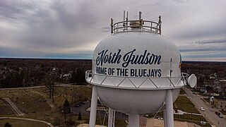
North Judson is a town in Wayne Township, Starke County, in the U.S. state of Indiana. The population was 1,857 as of the 2020 census.
San Pierre is a census-designated place (CDP) in Railroad Township, Starke County, in the U.S. state of Indiana. The population was 144 at the 2010 census.

Harmony is a town in Chautauqua County, New York, United States. The population was 2,108 at the 2020 census. The town is on the south border of the county and southwest of Jamestown.
Southport is a census-designated place (CDP) in the town of Southport in Chemung County, New York, United States. The population of the CDP was 7,238 at the 2010 census, out of a total population in the town of 10,940.

DeMotte is a town in Keener Township, Jasper County, Indiana, United States. The population was 3,814 at the 2010 census.