Related Research Articles

Ziebach County is a county in the U.S. state of South Dakota. As of the 2020 census, the population was 2,413. Its county seat is Dupree. It is the last county in the United States alphabetically.

Todd County is a county in the U.S. state of South Dakota. As of the 2020 census, the population was 9,319. Todd County does not have its own county seat. Instead, Winner in neighboring Tripp County serves as its administrative center. Its largest city is Mission. The county was created in 1909, although it remains unorganized. The county was named for John Blair Smith Todd, a delegate from Dakota Territory to the United States House of Representatives and a Civil War general.

Minnehaha County is a county on the eastern border of the state of South Dakota. As of the 2020 census, the population was 197,214, making it the state's most populous county. It contains over 20% of the state's population. Its county seat is Sioux Falls, South Dakota's most populous city. The county was created in 1862 and organized in 1868. Its name was derived from the Sioux word Mnihaha, meaning "rapid water," or "waterfall".

Jackson County is a county in the U.S. state of South Dakota. As of the 2020 census, the population was 2,806. Its county seat is Kadoka. The county was created in 1883, and was organized in 1915. Washabaugh County was merged into Jackson County in 1983.

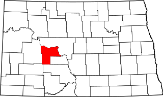
Bennett County is a county in the U.S. state of South Dakota. As of the 2020 census, the population was 3,381. Its county seat is Martin. The county lies completely within the exterior boundary of the Pine Ridge Indian Reservation. To the east is the Rosebud Indian Reservation, occupied by Sicangu Oyate, also known the Upper Brulé Sioux Nation and the Rosebud Sioux Tribe (RST), a branch of the Lakota people.

Sioux County is a county located along the southern border of the U.S. state of North Dakota. As of the 2020 census, the population was 3,898. Its eastern border is the Missouri River and its county seat is Fort Yates.

Oliver County is a county located in the U.S. state of North Dakota. As of the 2020 census, the population was 1,877. Its county seat and only city is Center.
Mercer County is a county in the U.S. state of North Dakota. As of the 2020 census, the population was 8,350. Its county seat is Stanton.

Benson County is a county in the U.S. state of North Dakota. As of the 2020 census, the population was 5,964. Its county seat is Minnewaukan. The county was created on March 9, 1883 by the Dakota Territory legislature, and was named for Bertil W. Benson, a Dakota Territory legislator at the time. The county government was organized on June 4, 1884, and its boundary lines were altered by two legislative actions in 1885.

Cherry County is a county located in the U.S. state of Nebraska. As of the 2020 United States Census, the population was 5,455. Its county seat is Valentine. The county was named for Lt. Samuel A. Cherry, an Army officer who was stationed at Fort Niobrara and who had been killed in South Dakota in 1881. Cherry County is in the Nebraska Sandhills. It is the largest county in the state at nearly 6,000 square miles (16,000 km2), larger than the state of Connecticut.

Lockesburg is a city in Sevier County, Arkansas, United States. The population was 739 at the 2010 census.
Allen is a census-designated place on the Pine Ridge Indian Reservation in Bennett County, South Dakota, United States, that was named for the Allen Township, which it encompasses. As of the 2020 census, the CDP had a population of 460. It is one of two places which are closest to the North American continental pole of inaccessibility.

Kyle is a census-designated place (CDP) in Oglala Lakota County, South Dakota, United States. Its population was 943 at the 2020 census. Located within the Pine Ridge Indian Reservation of the Oglala Lakota, it is one of two settlements which are closest to the North American continental pole of inaccessibility.

Canton is a village and county seat of St. Lawrence County, New York, United States. The village is centrally located in both the town of Canton and the county of St. Lawrence. The population was 7,155 at the 2020 census. The name comes from the Chinese city of Canton.
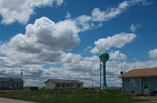
Tuthill is an unincorporated community in Bennett County, South Dakota, United States. Tuthill has been assigned the ZIP code of 57574.
Eagle Butte School District 20-1, is a school district with its headquarters in Eagle Butte, South Dakota. The district covers sections of Ziebach County and Dewey County.
Lugenbeel County was a former county in South Dakota, United States. The county's name originated from Pinkney Lugenbeel, a military commander in the area. Originally part of the Dakota Territory, the district in 1889 became a part of the state of South Dakota. The county existed until June 2, 1909, at which point both Lugenbeel County and Meyer County were absorbed into Bennett County, Todd County, and Mellette County, respectively.
Bad Wound is an unincorporated community in Bennett County, in the U.S. state of South Dakota.
Patricia is an unincorporated community in Bennett County, in the U.S. state of South Dakota.

Vetal is an unincorporated community in Bennett County, in the U.S. state of South Dakota.
References
- ↑ U.S. Geological Survey Geographic Names Information System: Harrington, South Dakota
- ↑ Federal Writers' Project (1940). South Dakota place-names, v.1-3. University of South Dakota. p. 40.
- ↑ "Bennett County". Jim Forte Postal History. Retrieved January 30, 2015.
- ↑ "2020 CENSUS - SCHOOL DISTRICT REFERENCE MAP: Bennett County, SD" (PDF). U.S. Census Bureau . Retrieved August 11, 2021.
Municipalities and communities of Bennett County, South Dakota, United States | ||
|---|---|---|
| City |  | |
| CDP | ||
| Unorganized territories | ||
| Unincorporated communities | ||
| Indian reservation | ||
| Footnotes | ‡This populated place also has portions in an adjacent county or counties | |
43°10′16″N101°15′17″W / 43.17111°N 101.25472°W
| | This South Dakota state location article is a stub. You can help Wikipedia by expanding it. |