Hartsburg, Missouri

Last updated

Hartsburg, Missouri
Village of Hartsburg
HackmanBuilding.jpg
Hackman Building
Boone County Missouri Incorporated and Unincorporated areas Hartsburg Highlighted.svg
Location of Hartsburg, Missouri
Coordinates: 38°41′50″N92°18′25″W / 38.69722°N 92.30694°W / 38.69722; -92.30694 [1]
Country United States
State Missouri
County Boone
Area
[2]
  Total0.21 sq mi (0.56 km2)
  Land0.21 sq mi (0.56 km2)
  Water0.00 sq mi (0.00 km2)
Elevation
[1]
591 ft (180 m)
Population
 (2020)
  Total133
  Density618.60/sq mi (238.73/km2)
Time zone UTC-6 (Central (CST))
  Summer (DST) UTC-5 (CDT)
ZIP code
65039
Area code 573
FIPS code 29-30718 [3]
GNIS feature ID2396989 [1]
Website www.hartsburgpumpkinfest.com

Hartsburg is a village in southern Boone County, Missouri, United States. It is part of the Columbia, Missouri Metropolitan Statistical Area. The population was 133 per the 2020 census.

Contents

History

Hartsburg was named for Luther D. Hart, a pioneer settler. [4]

Geography

Hartsburg is located above the Missouri River bottom on Missouri Route A. The city of Marion in Cole County lies due west across the Missouri River. The community of Ashland lies about six miles to the northeast on U.S. Route 63. Hart Creek flows past the west side of the community. [5]

According to the United States Census Bureau, the village has a total area of 0.21 square miles (0.54 km2), all land. [6]

Demographics

Historical population
CensusPop.Note
1910 175
1920 21120.6%
1930 155−26.5%
1940 154−0.6%
1950 17111.0%
1960 158−7.6%
1970 120−24.1%
1980 118−1.7%
1990 13111.0%
2000 108−17.6%
2010 103−4.6%
2020 13329.1%
U.S. Decennial Census [7]

2010 census

As of the census [8] of 2010, there were 103 people, 48 households, and 20 families living in the village. The population density was 490.5 inhabitants per square mile (189.4/km2). There were 59 housing units at an average density of 281.0 per square mile (108.5/km2). The racial makeup of the village was 94.2% White, 2.9% African American, 1.0% Native American, 1.0% Asian, and 1.0% from two or more races. Hispanic or Latino of any race were 1.9% of the population.

There were 48 households, of which 20.8% had children under the age of 18 living with them, 35.4% were married couples living together, 6.3% had a female householder with no husband present, and 58.3% were non-families. 52.1% of all households were made up of individuals, and 16.7% had someone living alone who was 65 years of age or older. The average household size was 2.15 and the average family size was 3.30.

The median age in the village was 41.6 years. 18.4% of residents were under the age of 18; 7.9% were between the ages of 18 and 24; 29.1% were from 25 to 44; 24.3% were from 45 to 64; and 20.4% were 65 years of age or older. The gender makeup of the village was 51.5% male and 48.5% female.

2000 census

As of the census [3] of 2000, there were 108 people, 54 households, and 30 families living in the town. The population density was 1,327.0 inhabitants per square mile (512.4/km2). There were 59 housing units at an average density of 724.9 per square mile (279.9/km2). The racial makeup of the town was 89.81% White, 0.93% Native American, 2.78% from other races, and 6.48% from two or more races. Hispanic or Latino of any race were 2.78% of the population.

There were 54 households, out of which 20.4% had children under the age of 18 living with them, 46.3% were married couples living together, 5.6% had a female householder with no husband present, and 44.4% were non-families. 38.9% of all households were made up of individuals, and 20.4% had someone living alone who was 65 years of age or older. The average household size was 2.00 and the average family size was 2.67.

In the town the population was spread out, with 16.7% under the age of 18, 5.6% from 18 to 24, 26.9% from 25 to 44, 29.6% from 45 to 64, and 21.3% who were 65 years of age or older. The median age was 45 years. For every 100 females, there were 120.4 males. For every 100 females age 18 and over, there were 95.7 males.

The median income for a household in the town was $32,500, and the median income for a family was $52,917. Males had a median income of $30,000 versus $21,875 for females. The per capita income for the town was $16,739. There were no families and 5.8% of the population living below the poverty line, including no under eighteens and 9.5% of those over 64.

Recreation

The Hartsburg Pumpin Festival in 2015 Hartsburg Pumpin Festival.jpg
The Hartsburg Pumpin Festival in 2015

The Katy Trail, a 240-mile-long bike path stretching across the state of Missouri, runs along the edge of the Missouri River floodplain past Hartsburg. [5]

The Hartsburg Pumpkin Festival is held each year on the second Saturday and Sunday of October, which includes games, foods, and crafts. Each year during the festival tens of thousands come to eat and shop at the numerous venues and food booths.[ citation needed ]

Notable sites

Notable people

See also

Related Research Articles

<span class="mw-page-title-main">Hartsburg, Illinois</span> Village in Illinois, United States

Hartsburg is a village in Logan County, Illinois, United States. The population was 314 at the 2010 census.

<span class="mw-page-title-main">Passaic, Missouri</span> Town in Missouri, United States

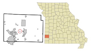
Passaic is a town in Bates County, Missouri, and is part of the Kansas City metropolitan area within the United States.

<span class="mw-page-title-main">Lewis and Clark Village, Missouri</span> Village in Missouri, United States

Lewis and Clark Village is a village in Buchanan County, Missouri, United States. The population was 96 at the 2020 census. It is part of the St. Joseph, MO–KS Metropolitan Statistical Area.

<span class="mw-page-title-main">Rushville, Missouri</span> Village in Missouri, United States

Rushville is a village in western Buchanan County, Missouri, United States. The population was 225 at the 2020 census. It is part of the St. Joseph, MO–KS Metropolitan Statistical Area.

<span class="mw-page-title-main">Brooklyn Heights, Missouri</span> Village in Missouri, United States

Brooklyn Heights is a village in Jasper County, Missouri, United States. The population was 101 at the 2020 census. It is part of the Joplin, Missouri Metropolitan Statistical Area.

<span class="mw-page-title-main">Ludlow, Missouri</span> Village in Missouri, United States

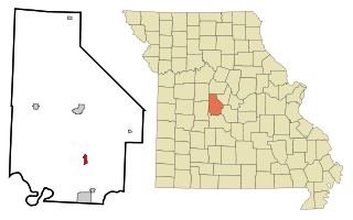
Ludlow is a village in southwest Livingston County, Missouri, United States. The population was 111 at the 2020 census. The median income in Ludlow is $30,833 and the median home value is $33,500.

<span class="mw-page-title-main">Brumley, Missouri</span> Town in Missouri, United States

Brumley is a town in Miller County, Missouri, United States. The population was 69 at the 2020 census, down from 91 in 2010.

<span class="mw-page-title-main">Tuscumbia, Missouri</span> Town in Missouri, United States

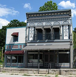
Tuscumbia is a village in and the county seat of Miller County, Missouri, United States. The population was 188 at the 2020 census.

<span class="mw-page-title-main">Gravois Mills, Missouri</span> Town in Missouri, United States

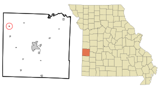
Gravois Mills is a town in Morgan County, Missouri, United States. The population was 129 at the 2020 census.

<span class="mw-page-title-main">Grand Falls Plaza, Missouri</span> Village in Missouri, United States

Grand Falls Plaza is a village in Newton County, Missouri, United States. The population was 114 at the 2010 census, at which time it was a town. It is part of the Joplin, Missouri Metropolitan Statistical Area.

<span class="mw-page-title-main">Arbela, Missouri</span> Village in Missouri, United States

Arbela is a village in Scotland County, Missouri, United States. As of the 2020 census, its population was 24.

<span class="mw-page-title-main">Grantwood Village, Missouri</span> Town in Missouri, United States

Grantwood Village is a town in St. Louis County, Missouri, United States. The population was 863 at the 2010 census.

<span class="mw-page-title-main">Norwood Court, Missouri</span> Village in Missouri, United States

Norwood Court is a village in St. Louis County, Missouri, United States. The population was 959 at the 2010 census.

<span class="mw-page-title-main">Harwood, Missouri</span> Village in Missouri, United States

Harwood is a village in northeast Vernon County, Missouri, United States. The population was 47 at the 2010 census. It was estimated to be 45 by the City of Harwood as of July 1, 2019.

<span class="mw-page-title-main">Moundville, Missouri</span> Village in Missouri, United States

Moundville is a village in southwest Vernon County, Missouri, United States. The population was 124 at the 2010 census.

<span class="mw-page-title-main">Richards, Missouri</span> Village in Missouri, United States

Richards is a village in northwest Vernon County, Missouri, United States. The population was 96 at the 2010 census.

<span class="mw-page-title-main">Stotesbury, Missouri</span> Village in Missouri, United States

Stotesbury is a village in northwest Vernon County, Missouri, United States. The population was 18 at the 2010 census.

<span class="mw-page-title-main">Raymondville, Missouri</span> Town in Missouri, United States

Raymondville is a town in Texas County, Missouri, United States. The population was 345 at the 2020 census.

<span class="mw-page-title-main">Ionia, Missouri</span> Village in Missouri, United States

Ionia is a village in northern Benton and southern Pettis counties in the U.S. state of Missouri. The population was 88 at the 2010 census.

<span class="mw-page-title-main">Argyle, Missouri</span> Town in Missouri, United States

Argyle is a town in Osage and Maries counties in the U.S. state of Missouri. The population was 144 at the 2020 census.

References

  1. 1 2 3 U.S. Geological Survey Geographic Names Information System: Hartsburg, Missouri
  2. "ArcGIS REST Services Directory". United States Census Bureau. Retrieved August 28, 2022.
  3. 1 2 "U.S. Census website". United States Census Bureau . Retrieved January 31, 2008.
  4. Eaton, David Wolfe (1916). How Missouri Counties, Towns and Streams Were Named. The State Historical Society of Missouri. pp.  212.
  5. 1 2 Missouri Atlas & Gazetteer, DeLorme, 1998, First edition, p. 37, ISBN   0-89933-224-2
  6. "US Gazetteer files 2010". United States Census Bureau . Retrieved July 8, 2012.
  7. "Census of Population and Housing". Census.gov. Retrieved June 4, 2015.
  8. "U.S. Census website". United States Census Bureau . Retrieved July 8, 2012.