
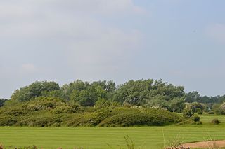
Smokejack Clay Pit is a 56-hectare (140-acre) geological Site of Special Scientific Interest east of Cranleigh in Surrey. It is a Geological Conservation Review site.

Abbey Wood is a 6.3-hectare (16-acre) geological Site of Special Scientific Interest in Abbey Wood in the London Borough of Bexley. It is located in Lesnes Abbey Woods south-east of the ruins of Lesnes Abbey. Members of the public can dig for fossils in a small area designated as the Fossil Bed with the permission of the Lesnes Abbey ranger.
Elmstead Pit is a geological Site of Special Scientific Interest in Elmstead in the London Borough of Bromley. Formerly known as Rock Pits, it is a small area of 0.05 hectare. It is a Geological Conservation Review site.

Hornchurch Cutting is an 0.8-hectare geological Site of Special Scientific Interest in Hornchurch in the London Borough of Havering. It is also a Geological Conservation Review site.

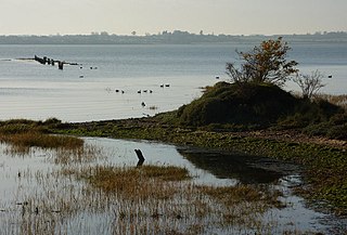
Hamford Water is a 2,185.8-hectare (5,401-acre) biological Site of Special Scientific Interest between Walton-on-the-Naze and Harwich in Essex. The site is a tidal inlet which has marsh grasslands, creeks, mud and sand flats, salt marshes, islands and beaches. It is described by Natural England as "of international importance for breeding little terns and wintering dark-bellied brent geese, wildfowl and waders, and of national importance for many other bird species." Rare plants include hog's fennel and slender hare's-ear. The main invertebrates are worms and thin-shelled molluscs. The largest island, Horsey Island, can be reached on foot at low tide across The Wade from Kirby-le-Soken.
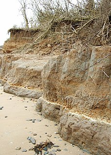
Clacton Cliffs and Foreshore is a 26.1-hectare (64-acre) geological Site of Special Scientific Interest in Clacton-on-Sea in Essex. It is a Geological Conservation Review site.

The Cliff, Burnham-on-Crouch is a 4 hectare geological Site of Special Scientific Interest (SSSI) on the bank of the River Crouch between Burnham-on-Crouch and North Fambridge in Essex. It is also part of the biological SSSI, Crouch and Roach Estuaries. It is a Geological Conservation Review site both for its fossil birds and for its fishes and amphibians.

Little Oakley Channel Deposit is a three-hectare geological Site of Special Scientific Interest in Little Oakley in Essex, England. It is a Geological Conservation Review site.
Marks Tey Brickpit is a 29.5-hectare (73-acre) geological Site of Special Scientific Interest in Marks Tey in Essex. It is a Geological Conservation Review site.

Lofts Farm Pit is a 4.5-hectare (11-acre) geological Site of Special Scientific Interest in Heybridge, a suburb of Maldon in Essex. It is a Geological Conservation Review site.
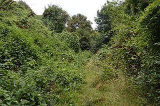
Lion Pit is a 2.5-hectare (6.2-acre) geological Site of Special Scientific Interest in Grays in Essex. It is a Geological Conservation Review site, and part of the Chafford Gorges Nature Park, which is managed by the Essex Wildlife Trust.
The Naze SSSI is a 22 hectare geological Site of Special Scientific Interest on The Naze peninsula north of Walton-on-the-Naze in Essex. It is a Geological Conservation Review site both for its Pleistocene fossils and for its birds. It is part of The Naze Nature Reserve, which is managed by the Essex Wildlife Trust.
Stour Estuary is a 2,523 hectare biological and geological Site of Special Scientific Interest which stretches from Manningtree to Harwich in Essex and Suffolk. It is also an internationally important wetland Ramsar site, a Special Protection Area and a Nature Conservation Review site. It is part of the Suffolk Coast and Heaths Area of Outstanding Natural Beauty, and there are Geological Conservation Review sites in Wrabness, Stutton, and Harwich Part of the site is managed by the Royal Society for the Protection of Birds, and a small area is Wrabness Nature Reserve, a Local Nature Reserve managed by the Essex Wildlife Trust.

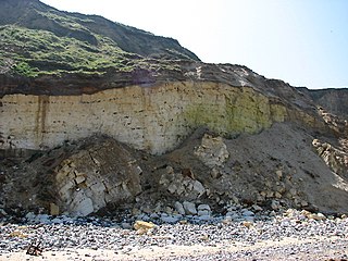
Sheppey Cliffs and Foreshore is a 303.6-hectare (750-acre) biological and geological Site of Special Scientific Interest which stretches between Minster and Leysdown-on-Sea in Kent. It includes five Geological Conservation Review sites. This site exposes Eocene London Clay with well-preserved fossil fauna and flora, which have been studied since the eighteenth century.
East Runton Cliffs is a 20.6-hectare (51-acre) geological Site of Special Scientific Interest west of Cromer in Norfolk. It is a Geological Conservation Review site.

Bognor Reef is a 39.7-hectare (98-acre) biological and geological Site of Special Scientific Interest which stretches along the foreshore of Bognor Regis in West Sussex. It is a Geological Conservation Review site.

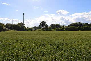
Warnham SSSI is a 28.5-hectare (70-acre) geological Site of Special Scientific Interest north of Horsham in West Sussex. It is a Geological Conservation Review site.

Lee-on-The Solent to Itchen Estuary is a 585.9-hectare (1,448-acre) biological and geological Site of Special Scientific Interest which stretches along the coast between Southampton and Gosport in Hampshire. It is a Geological Conservation Review site. It is part of Solent and Southampton Water Ramsar site and Special Protection Area, and of Solent Maritime Special Area of Conservation. Three areas are Local Nature Reserves, Chessel Bay, Hook with Warsash and Mercury Marshes. One area is Hamble Common Camp, a Scheduled Monument.

North Solent is a 1,186.7-hectare (2,932-acre) biological and geological Site of Special Scientific Interest along the north bank of the Solent between East End and Calshot in Hampshire. It is a Nature Conservation Review site, Grade I. Part of it is in North Solent National Nature Reserve and two areas are Geological Conservation Review sites. It is part of Solent and Southampton Water Ramsar site and Special Protection Area, and of Solent Maritime Special Area of Conservation. Boldre Foreshore is a local nature reserve.
