Herbst, Indiana

Last updated

Herbst, Indiana
Grant County Indiana Incorporated and Unincorporated areas Herbst Highlighted 1833178.svg
Location of Herbst in Grant County, Indiana.
USA Indiana location map.svg
Red pog.svg
Herbst
Usa edcp location map.svg
Red pog.svg
Herbst
Coordinates: 40°30′50″N85°47′15″W / 40.51389°N 85.78750°W / 40.51389; -85.78750
Country United States
State Indiana
County Grant
Township Franklin
Area
[1]
  Total0.14 sq mi (0.35 km2)
  Land0.14 sq mi (0.35 km2)
  Water0.00 sq mi (0.00 km2)
Elevation
[2]
856 ft (261 m)
Population
 (2020)
  Total99
  Density727.94/sq mi (281.19/km2)
ZIP code
46953
FIPS code 18-33178 [3]
GNIS feature ID2583455 [2]

Herbst is an unincorporated census-designated place in Franklin Township, Grant County, Indiana, in the United States. As of the 2010 census, the population was 112. [4]

Contents

History

A post office was established at Herbst in 1880, and remained in operation until it was discontinued in 1962. [5] August H. Herbst served as the first postmaster. [6]

Geography

Herbst is located in western Grant County 9 miles (14 km) southwest of Marion, the county seat, and 2 miles (3 km) east of Swayzee.

According to the U.S. Census Bureau, the Herbst CDP has an area of 1.31 square miles (3.38 km2), all of it land. [4]

Demographics

Historical population
CensusPop.Note
2020 99
U.S. Decennial Census [7]

Related Research Articles

<span class="mw-page-title-main">Mexico, Indiana</span> Census-designated place in Indiana, United States

Mexico is an unincorporated community and census-designated place (CDP) in Jefferson Township, Miami County, in the U.S. state of Indiana. The population was 915 at the 2020 census.

<span class="mw-page-title-main">Carp Lake, Michigan</span> Census-designated place & unincorporated community in Michigan, United States

Carp Lake is an unincorporated community and census-designated place (CDP) in Emmet County in the U.S. state of Michigan. As of the 2010 census, the CDP had a population of 357. It is located within Carp Lake Township.

<span class="mw-page-title-main">Coalmont, Indiana</span> Census-designated place in Indiana, United States

Coalmont is an unincorporated community and census-designated place in Lewis Township, Clay County, Indiana, United States. It is part of the Terre Haute Metropolitan Statistical Area. As of the 2010 census it had a population of 402.

<span class="mw-page-title-main">Raglesville, Indiana</span> Census-designated place in Indiana, United States

Raglesville is an unincorporated community and census-designated place (CDP) in Van Buren Township, Daviess County, Indiana, United States. As of the 2010 census it had a population of 141.

<span class="mw-page-title-main">Dubois, Indiana</span> Census-designated place in Indiana, United States

Dubois is an unincorporated community and census-designated place (CDP) in Dubois County, Indiana, United States. Its population at the 2010 census was 488.

<span class="mw-page-title-main">Point Isabel, Indiana</span> Census-designated place in Indiana, United States

Point Isabel is an unincorporated community and census-designated place (CDP) in central Green Township, Grant County, Indiana, United States. It lies at the intersection of State Roads 13 and 26. As of the 2010 census it had a population of 91.

<span class="mw-page-title-main">New Trenton, Indiana</span> Census-designated place in Indiana, United States

New Trenton is an unincorporated community and census-designated place (CDP) in Whitewater Township, Franklin County, Indiana. As of the 2010 census it had a population of 252. It has a ZIP code 47035.

<span class="mw-page-title-main">Jalapa, Indiana</span> Census-designated place in Indiana, United States

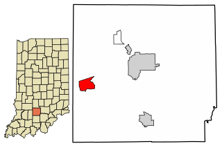
Jalapa is an unincorporated community and census-designated place (CDP) in Pleasant Township, Grant County, Indiana, United States. As of the 2010 census it had a population of 171. The site of the Battle of the Mississinewa, fought during the War of 1812, is nearby.

<span class="mw-page-title-main">Sims, Indiana</span> Census-designated place in Indiana, United States

Sims is an unincorporated community and census-designated place (CDP) in Sims Township, Grant County, Indiana. In 2010 it had a population of 156.

<span class="mw-page-title-main">Owensburg, Indiana</span> Census-designated place in Indiana, United States

Owensburg is an unincorporated community and census-designated place (CDP) in Jackson Township, Greene County, Indiana, United States. It was named in honor of the Owens family of early settlers. As of the 2010 census it had a population of 406.

<span class="mw-page-title-main">Scotland, Indiana</span> Census-designated place in Indiana, United States

Scotland is an unincorporated community and census-designated place (CDP) in Taylor Township, Greene County, Indiana, United States. As of the 2010 census it had a population of 134.

<span class="mw-page-title-main">Westphalia, Indiana</span> Census-designated place in Indiana, United States

Westphalia is an unincorporated community and census-designated place (CDP) in Vigo Township, Knox County, Indiana. As of the 2010 census it had a population of 202.

<span class="mw-page-title-main">Hanna, Indiana</span> Census-designated place in Indiana, United States

Hanna is an unincorporated community and census-designated place in Hanna Township, LaPorte County, Indiana, United States. It had a population of 463 at the 2010 census.

<span class="mw-page-title-main">Avoca, Indiana</span> Census-designated place in Indiana, United States

Avoca is an unincorporated community and census-designated place in Marshall Township, Lawrence County, Indiana, United States. As of the 2010 census the population was 583.

<span class="mw-page-title-main">Williams, Lawrence County, Indiana</span> Census-designated place in Indiana, United States

Williams is an unincorporated community and census-designated place in Spice Valley Township, Lawrence County, Indiana, United States. As of the 2010 census, the population was 286.

<span class="mw-page-title-main">Jennings, Michigan</span> Census-designated place & unincorporated community in Michigan, United States

Jennings is an unincorporated community and census-designated place (CDP) in Missaukee County in the U.S. state of Michigan. The population was 229 at the 2020 census, down from 264 in 2010. The CDP is located mostly in Lake Township with a small portion extending north into Caldwell Township.

<span class="mw-page-title-main">Lake Santee, Indiana</span> Census-designated place in Indiana, United States

Lake Santee is an unincorporated town and census-designated place in Decatur and Franklin counties, Indiana, United States. As of the 2010 census, it had a population of 820.

<span class="mw-page-title-main">Aberdeen, Porter County, Indiana</span> Census-designated place in Indiana, United States

Aberdeen is a census-designated place (CDP) in Center Township, Porter County, in the U.S. state of Indiana. The community centers on The Course at Aberdeen, a golf course. The population of the CDP was 1,875 at the 2010 census.

<span class="mw-page-title-main">Landess, Indiana</span> Census-designated place in Indiana, United States

Landess is an unincorporated community and census-designated place (CDP) in Washington and Van Buren townships, Grant County, Indiana, in the United States. As of the 2010 census it had a population of 188.

<span class="mw-page-title-main">Mier, Indiana</span> Census-designated place in Indiana, United States

Mier is an unincorporated community and census-designated place (CDP) in Richland Township, Grant County, Indiana, in the United States. As of the 2010 census it had a population of 78.

References

  1. "2020 U.S. Gazetteer Files". United States Census Bureau. Retrieved March 16, 2022.
  2. 1 2 U.S. Geological Survey Geographic Names Information System: Herbst, Indiana
  3. "U.S. Census website". United States Census Bureau . Retrieved January 31, 2008.
  4. 1 2 "Geographic Identifiers: 2010 Demographic Profile Data (G001): Herbst CDP, Indiana". American Factfinder. U.S. Census Bureau. Retrieved December 2, 2016.[ dead link ]
  5. "Grant County". Jim Forte Postal History. Retrieved September 12, 2014.
  6. Baker, Ronald L. (October 1995). From Needmore to Prosperity: Hoosier Place Names in Folklore and History . Indiana University Press. p.  162. ISBN   978-0-253-32866-3. ...August H. Herbst, the first storekeeper and postmaster...
  7. "Census of Population and Housing". Census.gov. Retrieved June 4, 2016.