Mier, Indiana

Last updated

Mier, Indiana
Grant County Indiana Incorporated and Unincorporated areas Mier Highlighted 1849212.svg
Location of Mier in Grant County, Indiana.
USA Indiana location map.svg
Red pog.svg
Mier
Usa edcp location map.svg
Red pog.svg
Mier
Coordinates: 40°34′29″N85°49′24″W / 40.57472°N 85.82333°W / 40.57472; -85.82333
Country United States
State Indiana
County Grant
Township Richland
Area
[1]
  Total0.24 sq mi (0.62 km2)
  Land0.24 sq mi (0.62 km2)
  Water0.00 sq mi (0.00 km2)
Elevation
[2]
833 ft (254 m)
Population
 (2020)
  Total67
  Density280.33/sq mi (108.12/km2)
ZIP code
46919 [3]
Area code 765
FIPS code 18-49212 [4]
GNIS feature ID2583459 [2]

Mier is an unincorporated community and census-designated place (CDP) in Richland Township, Grant County, Indiana, in the United States. [2] As of the 2010 census it had a population of 78. [4]

Contents

History

The community was named after Ciudad Mier, in Mexico. [5] A post office was established at Mier in 1849, and remained in operation until it was discontinued in 1928. [6]

Geography

Mier is located in northwestern Grant County, crossed by State Roads 13, 18, and 19. State Road 18 leads east 3 miles (5 km) to Sweetser and west 2.5 miles (4.0 km) to Converse, while State Road 13 leads north 6.5 miles (10.5 km) to Somerset and south 4.5 miles (7.2 km) to Swayzee. State Road 19 follows State Road 13 south from Mier and State Road 18 west from it. Marion, the Grant County seat, is 9 miles (14 km) to the east via State Road 18.

According to the U.S. Census Bureau, the Mier CDP has an area of 0.23 square miles (0.6 km2), all of it land. [4]

Demographics

Historical population
CensusPop.Note
2020 67
U.S. Decennial Census [7]

Related Research Articles

<span class="mw-page-title-main">Okahumpka, Florida</span> Census-designated place in Florida

Okahumpka is an unincorporated community and census-designated place (CDP) in Lake County, Florida, United States. The population was 267 at the 2010 census. It is part of the Orlando–Kissimmee Metropolitan Statistical Area.

<span class="mw-page-title-main">Converse, Indiana</span> Town in Indiana, United States

Converse is a town in Richland Township, Grant County, and Jackson Township, Miami County, in the U.S. state of Indiana. The population was 1,161 at the 2020 census.

<span class="mw-page-title-main">Roselawn, Indiana</span> Census-designated place in Indiana, United States

Roselawn is a census-designated place (CDP) in Newton and Jasper counties in the U.S. state of Indiana. The population was 4,131 at the 2010 census.

<span class="mw-page-title-main">Koontz Lake, Indiana</span> Census-designated place in Indiana, United States

Koontz Lake is an unincorporated community and census-designated place (CDP) in Starke and Marshall counties, in the U.S. state of Indiana. The population was 1,667 at the 2020 census.

<span class="mw-page-title-main">Mexico, Indiana</span> Census-designated place in Indiana, United States

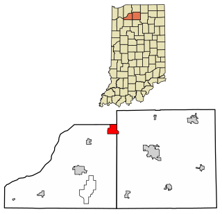
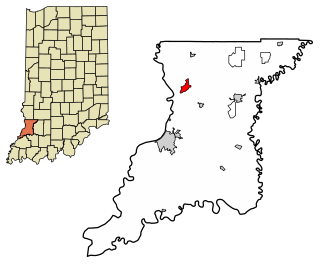
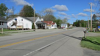
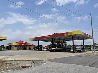
Mexico is an unincorporated community and census-designated place (CDP) in Jefferson Township, Miami County, in the U.S. state of Indiana. The population was 915 at the 2020 census.

<span class="mw-page-title-main">Argentine, Michigan</span> Census-designated place & unincorporated community in Michigan, United States

Argentine is an unincorporated community and census-designated place (CDP) in Argentine Township, Genesee County, in the U.S. state of Michigan. The population was 2,685 as of the 2020 census, up from 2,525 at the 2010 census. It was first settled in 1836.

<span class="mw-page-title-main">Ridgefield (CDP), Connecticut</span> Census-designated place in Connecticut, United States

Ridgefield is a census-designated place (CDP) in Fairfield County, Connecticut, United States. It consists of the primary central village in the town of Ridgefield and surrounding residential areas. As of the 2020 census, the population of the CDP was 7,596, out of 25,053 in the entire town.

<span class="mw-page-title-main">Point Isabel, Indiana</span> Census-designated place in Indiana, United States

Point Isabel is an unincorporated community and census-designated place (CDP) in central Green Township, Grant County, Indiana, United States. It lies at the intersection of State Roads 13 and 26. As of the 2010 census it had a population of 91.

<span class="mw-page-title-main">Owensburg, Indiana</span> Census-designated place in Indiana, United States

Owensburg is an unincorporated community and census-designated place (CDP) in Jackson Township, Greene County, Indiana, United States. It was named in honor of the Owens family of early settlers. As of the 2010 census it had a population of 406.

<span class="mw-page-title-main">Scotland, Indiana</span> Census-designated place in Indiana, United States

Scotland is an unincorporated community and census-designated place (CDP) in Taylor Township, Greene County, Indiana, United States. As of the 2010 census it had a population of 134.

<span class="mw-page-title-main">Emison, Indiana</span> Census-designated place in Indiana, United States

Emison is an unincorporated community and census-designated place (CDP) in Busseron Township, Knox County, Indiana. Its population was 154 at the 2010 census.

<span class="mw-page-title-main">Fish Lake, Indiana</span> Census-designated place in Indiana, United States

Fish Lake is an unincorporated community and census-designated place in Lincoln Township, LaPorte County, Indiana, United States. It is located where Indiana State Road 4 passes between Upper Fish Lake and Lower Fish Lake. These lakes feed the Kankakee River. As of the 2010 census, the population of the community was 1,016.

<span class="mw-page-title-main">Avoca, Indiana</span> Census-designated place in Indiana, United States

Avoca is an unincorporated community and census-designated place in Marshall Township, Lawrence County, Indiana, United States. As of the 2010 census the population was 583.

<span class="mw-page-title-main">Harrodsburg, Indiana</span> Census-designated place in Indiana, United States

Harrodsburg is an unincorporated community and census-designated place (CDP) in Clear Creek Township, Monroe County, in the U.S. state of Indiana. Its population was 656 at the 2020 census.

<span class="mw-page-title-main">Libertytown, Maryland</span> Census-designated place in Maryland, United States

Libertytown is an unincorporated community and census-designated place (CDP) in Frederick County, in the U.S. state of Maryland. As of the 2010 census it had a population of 950. The Abraham Jones House was listed on the National Register of Historic Places in 1973.

<span class="mw-page-title-main">Bennetts Switch, Indiana</span> Census-designated place in Indiana, United States

Bennetts Switch is an unincorporated community and census-designated place (CDP) in Deer Creek Township, Miami County, in the U.S. state of Indiana.

<span class="mw-page-title-main">Landess, Indiana</span> Census-designated place in Indiana, United States

Landess is an unincorporated community and census-designated place (CDP) in Washington and Van Buren townships, Grant County, Indiana, in the United States. As of the 2010 census it had a population of 188.

<span class="mw-page-title-main">Painted Hills, Indiana</span> Census-designated place in Indiana, United States

Painted Hills is an unincorporated community and census-designated place (CDP) in Jackson Township, Morgan County, in the U.S. state of Indiana. Its population was 766 as of the 2020 census, up from 677 in 2010. The community is located on the shores of Lake Holiday and Lake Nebo southeast of Martinsville, the Morgan county seat. The two lakes are a combined 196 acres (79 ha) in size.

<span class="mw-page-title-main">Smithville-Sanders, Indiana</span> Census-designated place in Indiana, United States

Smithville-Sanders is a census-designated place (CDP) encompassing the communities of Smithville and Sanders in Monroe County, Indiana, United States. Its population was 3,323 as of the 2020 census.

Valle Vista is an unincorporated community and census-designated place (CDP) in Santa Fe County, New Mexico, United States. It was first listed as a CDP prior to the 2020 census.

References

  1. "2020 U.S. Gazetteer Files". United States Census Bureau. Retrieved March 16, 2022.
  2. 1 2 3 U.S. Geological Survey Geographic Names Information System: Mier, Indiana
  3. "Mier IN ZIP Code". zipdatamaps.com. 2023. Retrieved December 7, 2023.
  4. 1 2 3 "Geographic Identifiers: 2010 Demographic Profile Data (G001): Mier CDP, Indiana". American Factfinder. U.S. Census Bureau. Retrieved December 5, 2016.[ dead link ]
  5. Baker, Ronald L. (October 1995). From Needmore to Prosperity: Hoosier Place Names in Folklore and History . Indiana University Press. p.  219. ISBN   978-0-253-32866-3. ...and named for Mier, Mexico...
  6. "Grant County". Jim Forte Postal History. Retrieved September 12, 2014.
  7. "Census of Population and Housing". Census.gov. Retrieved June 4, 2016.