
Transhumance is a type of pastoralism or nomadism, a seasonal movement of livestock between fixed summer and winter pastures. In montane regions, it implies movement between higher pastures in summer and lower valleys in winter. Herders have a permanent home, typically in valleys. Generally only the herds travel, with a certain number of people necessary to tend them, while the main population stays at the base. In contrast, horizontal transhumance is more susceptible to being disrupted by climatic, economic, or political change.

Dordrecht is a town situated in the Eastern Cape Province of South Africa. Dordrecht was founded in 1856 by Baron Smiddolff, a minister of the Dutch Reformed Church. The town was named for the city of the same name in the South-Western Netherlands and had a population of about 8,741 people in 2001.

Dannhauser is a former coal mining town in KwaZulu-Natal, South Africa. Cattle and sheep farming take place in the district. The town of Dannhauser was named after Renier Dannhauser, a German settler, who purchased the farm Palmietfontein from the Natal Government in 1872. It was proclaimed a village in 1937.
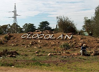
Clocolan, established in 1906, is a small town in the Free State Province of South Africa. The Basotho called the place Hlohlolwane. New inhabitants mispronounced the name and called it Clocolan.

Lückhoff is a small merino sheep farming town in the Free State province of South Africa. It was established on the farm Koffiekuil in 1892 and named after a Dutch Reformed Church minister Reverend HJ Luckhoff.

Reddersburg is a small sheep and cattle farming town in the Free State province of South Africa on the N6 National Route 60 kilometres south of Bloemfontein.

Springfontein is a small mixed farming town in the Free State province of South Africa.

Ermelo is the educational, industrial and commercial town of the 7,750 km2 Gert Sibande District Municipality in Mpumalanga province, Republic of South Africa. It is both a mixed agriculture and mining region. It is located 210 km east of Johannesburg.

Bethal is a farming town in Mpumalanga, South Africa. The farms in the region produce maize, sunflower seeds, sorghum, rye and potatoes. The town lies 155 km east of Johannesburg.

Delareyville is a maize- and peanut-farming town situated in North West Province of South Africa. The town is 96 km south-west of Lichtenburg, 82 km north-east of Vryburg, 114 km north-west of Wolmaransstad, and 61 km north of Schweizer-Reneke.

Britstown is a small farming town situated in the Northern Cape province of South Africa, in the Pixley ka Seme District Municipality, Emthanjeni Local Municipality. The town is named after Hans Brits who settled here after he accompanied David Livingstone on a venture into the interior.

Pastoral farming is aimed at producing livestock, rather than growing crops. Examples include dairy farming, raising beef cattle, and raising sheep for wool. In contrast, arable farming concentrates on crops rather than livestock. Finally, Mixed farming incorporates livestock and crops on a single farm. Some mixed farmers grow crops purely as fodder for their livestock; some crop farmers grow fodder and sell it. In some cases pastoral farmers are known as graziers, and in some cases pastoralists. Pastoral farming is a non-nomadic form of pastoralism in which the livestock farmer has some form of ownership of the land used, giving the farmer more economic incentive to improve the land. Unlike other pastoral systems, pastoral farmers are sedentary and do not change locations in search for fresh resources. Rather, pastoral farmers adjust their pastures to fit the needs of their animals. Improvements include drainage, stock tanks, irrigation and sowing clover.

The Mineral Revolution is a term used by historians to refer to the rapid industrialisation and economic changes which occurred in South Africa from the 1870s onwards. The Mineral Revolution was largely driven by the need to create a permanent workforce to work in the mining industry, and saw South Africa transformed from a patchwork of agrarian states to a unified, industrial nation. In political terms, the Mineral Revolution had a significant impact on diplomacy and military affairs. Finally, the policies and events of the Mineral Revolution had an increasingly negative impact on race relations in South Africa, and formed the basis of the apartheid system, which dominated South African society for a century.

Bredasdorp is a town in the Southern Overberg region of the Western Cape, South Africa, and the main economic and service hub of that region. It lies on the northern edge of the Agulhas Plain, about 160 kilometres (100 mi) south-east of Cape Town and 35 kilometres (22 mi) north of Cape Agulhas, the southernmost tip of Africa.
Mixed farming is a type of farming which involves both the growing of crops and the raising of livestock. Such agriculture occurs across Asia and in countries such as India, Malaysia, Indonesia, Afghanistan, South Africa, China, Central Europe, Canada, and Russia. Though at first it mainly served domestic consumption, countries such as the United States and Japan now use it for commercial purposes.

Colesberg is a town with 17,354 inhabitants in the Northern Cape province of South Africa, located on the main N1 road from Cape Town to Johannesburg.
Yanakie is a small, coastal township and district on the Yanakie Isthmus in South Gippsland, in the state of Victoria, south-eastern Australia.

Marydale is a town in the Northern Cape province in western South Africa. Established in 1903 by the Dutch Reformed Church, Marydale was named after Mary Snyman, the wife of Mr GP Snyman, owner of the farm on which the town was laid out. The town is 76 km north-west of Prieska and lies near the N10 national road.

Livestock is commonly defined as domesticated animals raised in an agricultural setting to produce labor and commodities such as meat, eggs, milk, fur, leather, and wool. The term is sometimes used to refer solely to those that are bred for consumption, while other times it refers only to farmed ruminants, such as cattle, sheep and goats. Horses are considered livestock in the United States. The USDA classifies pork, veal, beef, and lamb as livestock and all livestock as red meat. Poultry and fish are not included in the category.

Agriculture in Wales has in the past been a major part of the economy of Wales, a largely rural country that forms part of the United Kingdom. Wales is mountainous and has a mild, wet climate. This results in only a small proportion of the land area being suitable for arable cropping, but grass for the grazing of livestock is present in abundance. As a proportion of the national economy, the importance of agriculture has become much reduced; a high proportion of the population now live in the towns and cities in the south of the country and tourism has become an important form of income in the countryside and on the coast. Arable cropping is limited to the flatter parts and elsewhere dairying and livestock farming predominate.


