
Apache Junction is a city in Pinal and Maricopa counties in the state of Arizona. As of the 2020 census, the population was 38,499, most of whom lived in Pinal County. It is named for the junction of the Apache Trail and Old West Highway. The area where Apache Junction is located used to be known as Youngberg. Superstition Mountain, the westernmost peak of the Superstition Mountains, is to the east.

Goldfield is an unincorporated small desert city and the county seat of Esmeralda County, Nevada.

The Free State, formerly known as the Orange Free State, is a province of South Africa. Its capital is Bloemfontein, which is also South Africa's judicial capital. Its historical origins lie in the Boer republic called the Orange Free State and later the Orange Free State Province.

Johannesburg is a large city in Gauteng Province of South Africa. It was established as a small village controlled by a Health Committee in 1886 with the discovery of an outcrop of a gold reef on the farm Langlaagte. The population of the city grew rapidly, becoming a municipality in 1898. In 1928 it became a city making Johannesburg the largest city in South Africa. In 2002 it joined ten other municipalities to form the City of Johannesburg Metropolitan Municipality. Today, it is a centre for learning and entertainment for all of South Africa. It is also the capital city of Gauteng.
Virginia is a gold mining town located in the Lejweleputswa District Municipality and on goldfields of the Free State province in South Africa about 140 km (90 mi) northeast of Bloemfontein, the provincial capital.

Welkom is the second-largest city in the Free State province of South Africa, located about 140 kilometres (90 mi) northeast of Bloemfontein, the provincial capital. Welkom is also known as Circle City, City Within A Garden, Mvela and Matjhabeng. The city's Sesotho name, Matjhabeng means 'where nations meet', derived from the migrant labour system, where people of various countries such as Lesotho, Malawi and Mozambique etc. met to work in the mines of the gold fields.
Dobsonville is a township in greater Soweto, Johannesburg, South Africa. It lies to the west of Meadowlands, a part of Diepmeadow, and is adjacent to Mofolo North and Zondi, which are suburbs of Soweto on its southern border.

Randfontein is a gold mining town in the West Rand, Gauteng, South Africa, 40 km (25 mi) west of Johannesburg. With the Witwatersrand gold rush in full swing, mining financier JB Robinson bought the farm Randfontein and, in 1889, floated the Randfontein Estates Gold Mining Company. The town was established in 1890 to serve the new mine and was administered by Krugersdorp until it became a municipality in 1929. Apart from having the largest stamp mill in the world, Randfontein, like many of the other outlying areas of Johannesburg, is essentially a rural collection of farms and small holdings in a particularly beautiful part of Gauteng.

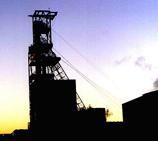
Allanridge is a gold-mining town in the Lejweleputswa District Municipality of the Free State province in South Africa. It is the main centre of the Loraine Gold Mining Company and is dominated by the tall headgear and complex reduction works that processes thousands of tons of gold-bearing ore every month.
Hennenman is a small town in the Free State Goldfields in the Lejweleputswa District Municipality of the Free State province of South Africa. The settlement is unusual for the district being supported by agriculture rather than the mining industry which is common in other towns. There are two schools in Hennenman, Hoerskool Hennenman and Hennenman Priemêre Skool.

Ventersburg is a small town in the Lejweleputswa District Municipality of the Free State province in South Africa, 148 km north of Bloemfontein.
The following lists events that happened during 1952 in South Africa.

The R30 is a provincial route in South Africa that connects Bloemfontein with Rustenburg via Brandfort, Welkom, Bothaville, Klerksdorp and Ventersdorp. The southern part of the route is tolled, as the R30 forms the first section of the ZR Mahabane Toll Route, with the Brandfort Toll Plaza found 10 kilometres north of its southern terminus junction with the N1 national route. The tolled portion ends at the junction with the R730.
Shurugwi, originally known as Selukwe, is a small town and administrative centre in Midlands Province, southern Zimbabwe, located about 350 km south of Harare, with a population of 22,900 according to the 2022 census. The town was established in 1899 on the Selukwe Goldfield, which itself was discovered in the early 1890s not long after the annexation of Rhodesia by the Pioneer Column.
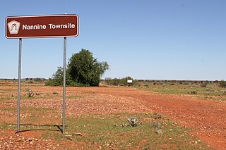
Nannine is a ghost town in the Mid West region of Western Australia. It is located on the northern bank of Lake Anneen, approximately 35 kilometres (22 mi) south-southwest of Meekatharra, and 735 kilometres (457 mi) north-northeast of Perth.

Phakisa Freeway is a motor racing circuit located between Welkom and Odendaalsrus, South Africa. It is one of the few oval speedways outside of the United States and the only one in Africa.

Matjhabeng Municipality is a local municipality within the Lejweleputswa District Municipality, in the Free State province of South Africa. The municipality includes Welkom, Virginia, Odendaalsrus and Allanridge. Matjhabeng is a Sesotho word meaning "where nations meet". It is derived from the migrant labour system where people from various countries like Lesotho, Mozambique, etc. met to work in the mines.

Riebeeckstad is a suburb 5 km east of the city of Welkom located in the Lejweleputswa District Municipality of the Free State province of South Africa.
Thabong is the second largest township after Botshabelo in the Free State province of South Africa. The township was established during the years of segregation of black people as well as the township of Bronville for coloured people adjacent to the city of Welkom, to accommodate workers at the world's richest gold mines.
The Free State Gold Rush was a gold rush in Free State, South Africa. It began after the end of World War II, even though gold had been discovered in the area around the year 1934. It drove major development in the region until the mid–to–late 1980s as part of the mineral revolution in South Africa.


