
Leon County is a county located in the Panhandle of the U.S. state of Florida. It was named after the Spanish explorer Juan Ponce de León. As of the 2010 Census, the population was 275,487.

Wakulla County is a county located in the U.S. state of Florida. As of the 2010 census, the population was 30,776. Its county seat is Crawfordville.

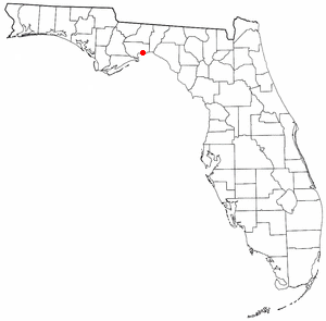
St. Marks is a city in Wakulla County, Florida, United States. It is part of the Tallahassee metropolitan area. The population was 272 at the 2000 census. As of 2004, the population estimated by the U.S. Census Bureau is 299.
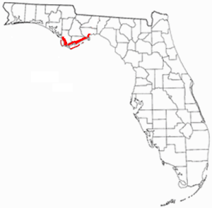
State Road 363 is a north–south route in the Big Bend region of Florida.
Shell Point is an unincorporated community in Wakulla County, Florida, United States. Shell Point is located on the northern edge of Apalachee Bay, approximately 30 miles south of Tallahassee. Most notable for its family-oriented beach, Shell Point Beach was previously privately owned. After a petition by local groups to the state of Florida in 1995, the beach is funded by grants from the state and managed by the Wakulla County Department of Parks and Recreation services. Shell Point Beach is located in an Opportunity Zone, which is a federal tax incentive for investment in such designated areas.

Newport is a small unincorporated community in Wakulla County, Florida, United States of America, situated where U.S. Highway 98 meets State Road 267.

Wakulla Springs is located 14 miles (23 km) south of Tallahassee, Florida and 5 miles (8.0 km) east of Crawfordville in Wakulla County, Florida at the crossroads of State Road 61 and State Road 267. It is protected in the Edward Ball Wakulla Springs State Park.
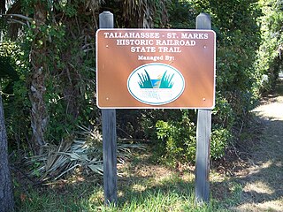
Tallahassee-St. Marks Historic Railroad State Trail is a rail trail and Florida State Park located on 16 miles (26 km) of the historic railbed of the Tallahassee Railroad, which ran between Tallahassee and St. Marks, Florida. The trail ends near the confluence of the St. Marks and Wakulla Rivers. The portion of the trail south of US 98 is designated as a portion of the Florida National Scenic Trail. A paved extension of the trail extends north for approximately 4 miles (6.4 km) into the City of Tallahassee.

St. Marks National Wildlife Refuge is one of the oldest wildlife refuges in the United States. Established in 1931 as a wintering ground for migratory birds, it encompasses 68,000 acres (280 km2) spread between Wakulla, Jefferson, and Taylor Counties in the state of Florida.
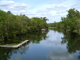
The St. Marks River is a river in the Big Bend region of Florida. It has been classified by the Florida Department of Environmental Protection as an Outstanding Florida Water, and is the easternmost river within the Northwest Florida Water Management District.
Florida's Forgotten Coast is a registered trademark, coined in the early 1990s, by the Apalachicola Bay Chamber of Commerce. The name is most commonly used to refer to a relatively quiet, undeveloped and largely uninhabited section of coastline stretching from Mexico Beach on the Gulf of Mexico to St. Marks on Apalachee Bay in the U.S. state of Florida. The nearest major cities are Tallahassee, about 90 miles (145 km) northeast of Apalachicola, and Panama City, home of Tyndall Air Force Base, about 60 miles (95 km) to the northwest.

The Tallahassee metropolitan area is the metropolitan area centered on Tallahassee, Florida.

Wakulla Beach is an unincorporated community in Wakulla County, Florida, United States. It is located on the northern shore of Goose Creek Bay, near the Gulf of Mexico.

The Big Bend region of Florida, United States, is an informal region of the state. Different definitions of the region include counties stretching across northern Florida from the Apalachicola River to the St. Johns River. The Big Bend Coast, however, is the marshy coast without barrier islands that extends along the Gulf of Mexico coast of Florida from the Ocklockonee River to Anclote Key.
The Wakulla State Forest is in the U.S. state of Florida. The 4,219-acre (17 km2) forest is located in the panhandle, near Tallahassee.

Wakulla was a steam cargo ship built in 1918-1919 by Los Angeles Shipbuilding & Dry Dock Company of San Pedro for the United States Shipping Board as part of the wartime shipbuilding program of the Emergency Fleet Corporation (EFC) to restore the nation's Merchant Marine.
The Tallahassee Democrat is a daily broadsheet newspaper. It covers the area centered on Tallahassee in Leon County, Florida, as well as adjacent Gadsden County, Jefferson County, and Wakulla County. The newspaper is owned by Gannett Co., Inc., which also owns the Pensacola News Journal, the Fort Myers News-Press, and Florida Today, along with many other news outlets.
Edward Ball Wakulla Springs State Park is a Florida State Park in Wakulla County, Florida, United States. This 6,000 acre (24 km2) wildlife sanctuary, located south of Tallahassee, is listed on the National Register of Historic Places, and designated a National Natural Landmark. It has three nature trail systems which lead the visitor through pine forests, bald cypress wetlands and hardwood hammock. Hikers, bicyclists and horse riders are welcome. The wildlife found in the forest includes white-tailed deer, wild turkey, and many other bird species, while American alligators, bass, gar, various snakes, and West Indian manatee populate the springs, swamps, and river.

Wakulla is a census-designated place (CDP) in Robeson County, North Carolina. During the 2010 census the population was reported to be 105.


