Franklin County is a county along the Gulf of Mexico in the panhandle of the U.S. state of Florida. As of the 2020 census, the population was 12,451, making it the third-least populous county in Florida. The county seat is Apalachicola.

Gadsden County is a county located in the panhandle of the U.S. state of Florida. As of the 2020 census, the population was 43,826. Its county seat is Quincy. Gadsden County is included in the Tallahassee, FL Metropolitan Statistical Area. Gadsden County is the only majority African-American county in Florida.

Jefferson County is a county located in the Big Bend region in the northern part of the U.S. state of Florida. As of the 2010 census, the population was 14,761. Its county seat is Monticello.

Leon County is a county in the Panhandle of the U.S. state of Florida. It was named after the Spanish explorer Juan Ponce de León. As of the 2020 census, the population was 292,198.

Wakulla County is a county located in the Big Bend region in the northern portion of the U.S. state of Florida. As of the 2020 census, the population was 33,764. Its county seat is Crawfordville.

St. Marks is a city in Wakulla County, Florida, United States. It is part of the Tallahassee metropolitan area. The population was 293 at the 2010 census. As of 2018, the population estimated by the U.S. Census Bureau is 319.

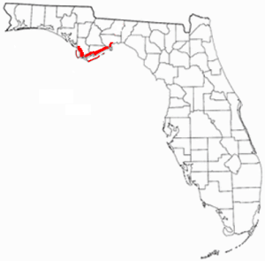
The Florida Panhandle is the northwestern part of the U.S. state of Florida; it is a salient roughly 200 miles (320 km) long and 50 to 100 miles wide, lying between Alabama on the north and the west, Georgia on the north, and the Gulf of Mexico to the south. Its eastern boundary is arbitrarily defined. In terms of population, major communities include Tallahassee, Pensacola, and Panama City.
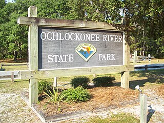
Ochlockonee River State Park is a Florida State Park located in Wakulla County, Florida, south of the town of Sopchoppy in the Florida Panhandle. Located off of U.S. 319 on the Ochlockonee River, just north of the Gulf of Mexico coast, it is surrounded by the Apalachicola National Forest and the St. Marks National Wildlife Refuge and provides important habitat for the endangered red-cockaded woodpecker.

Tallahassee Community College (TCC) is a public community college in Tallahassee, Florida. It is part of the Florida College System and is accredited by the Southern Association of Colleges and Schools. As of fall 2017, TCC reported 24,639 students.

Panacea is an unincorporated community in Wakulla County, Florida, United States.

Newport is a small unincorporated community in Wakulla County, Florida, United States of America, situated where U.S. Highway 98 meets State Road 267.

Wakulla Springs is located 14 miles (23 km) south of Tallahassee, Florida and 5 miles (8.0 km) east of Crawfordville in Wakulla County, Florida at the crossroads of State Road 61 and State Road 267. It is protected in the Edward Ball Wakulla Springs State Park.
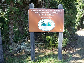
Tallahassee-St. Marks Historic Railroad State Trail is a rail trail and Florida State Park located on 16 miles (26 km) of the historic railbed of the Tallahassee Railroad, which ran between Tallahassee and St. Marks, Florida. The trail ends near the confluence of the St. Marks and Wakulla Rivers. The portion of the trail south of US 98 is designated as a portion of the Florida National Scenic Trail. A paved extension of the trail extends north for approximately 4 miles (6.4 km) into the City of Tallahassee.
St. Marks National Wildlife Refuge is one of the oldest wildlife refuges in the United States. Established in 1931 as a wintering ground for migratory birds, it encompasses 68,000 acres (280 km2) spread between Wakulla, Jefferson, and Taylor Counties in the state of Florida.
The Forgotten Coast refers to a largely untouched and uninhabited area of coastline in the panhandle of the US state of Florida. The term, also a trademark, was first used in 1992, but the Forgotten Coast's exact location is not agreed upon.

The Tallahassee Metropolitan Statistical area is the metropolitan area centered on Tallahassee, Florida.

The Wakulla State Forest is in the U.S. state of Florida. The 4,897-acre (20 km2) forest is located in the panhandle, near Tallahassee; it includes a major tract in Wakulla County and a small tract, the former Woodville State Forest, in Leon County. The forest is also a Wildlife Management Area managed by the Florida Fish and Wildlife Conservation Commission.

WHBX, or 96.1 Jamz, is an urban adult contemporary radio station in the Tallahassee, Florida market owned by Cumulus Licensing, LLC. According to AllAccess.com, WHBX is the highest rated station in the Tallahassee, FL market, joining sister stations Blazin 102.3 and Star 98 as the market's highest rated stations. Its studios are located in the westside of Tallahassee and its transmitter is based near Wakulla State Forest, south of the city.

The 1936 Florida gubernatorial election was held on November 3, 1936. Democratic nominee Fred P. Cone defeated Republican nominee E.E. Callaway with 80.91% of the vote.