Franklin County is a county along the Gulf of Mexico in the panhandle of the U.S. state of Florida. As of the 2020 census, the population was 12,451, making it the third-least populous county in Florida. The county seat is Apalachicola.

Liberty County is a county located in the state of Florida. As of the 2020 census, the population was 7,974, making it the least populous county in Florida. Its county seat is Bristol. Liberty County is one of only two dry counties in Florida.

Wakulla County is a county located in the Big Bend region in the northern portion of the U.S. state of Florida. As of the 2020 census, the population was 33,764. Its county seat is Crawfordville.

Sopchoppy is a city in Wakulla County, Florida, United States. It is part of the Tallahassee, Florida Metropolitan Statistical Area. The population was 457 at the 2010 census. As of 2018, the population was estimated by the U.S. Census Bureau to be 482. Ochlockonee River State Park is nearby.

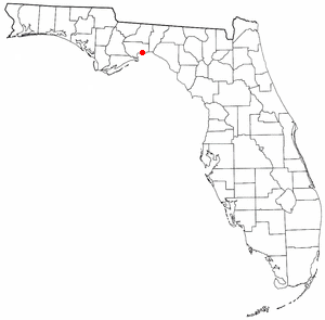
St. Marks is a city in Wakulla County, Florida, United States. It is part of the Tallahassee metropolitan area. The population was 293 at the 2010 census. As of 2018, the population estimated by the U.S. Census Bureau is 319.

Evergreen is a town in Avoyelles Parish, Louisiana, United States. The population was 310 at the 2010 census. Evergreen is located east of Bunkie.

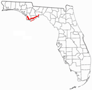
The Florida Panhandle is the northwestern part of the U.S. state of Florida. It is a salient roughly 200 miles long, bordered by Alabama on the north and the west, Georgia on the north, and the Gulf of Mexico to the south. Its eastern boundary is arbitrarily defined. It is defined by its southern culture and rural geography relative to the rest of Florida, as well as closer cultural links to French-influenced Louisiana, Mississippi, and Alabama. Its major communities include Pensacola, Navarre, Destin, Panama City Beach, and Tallahassee.

San Marcos de Apalache Historic State Park is a Florida State Park in Wakulla County, Florida organized around the historic site of a Spanish colonial fort, which was used by succeeding nations that controlled the area. The Spanish first built wooden buildings and a stockade in the late 17th and early 18th centuries here, which were destroyed by a hurricane.
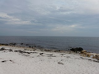
Shell Point is an unincorporated community in Wakulla County, Florida, United States. Shell Point is located on the northern edge of Apalachee Bay, approximately 30 miles south of Tallahassee. Most notable for its family-oriented beach, Shell Point Beach was previously privately owned. After a petition by local groups to the state of Florida in 1995, the beach is funded by grants from the state and managed by the Wakulla County Department of Parks and Recreation services. Shell Point Beach is located in an Opportunity Zone, which is a federal tax incentive for investment in such designated areas.

Newport is a small unincorporated community in Wakulla County, Florida, United States of America, situated where U.S. Highway 98 meets State Road 267.

The Leon Sinks Geological Area is located on the Woodville Karst Plain in southern and southwestern Leon County, Florida, United States. It is a mature karstic area on the Upper Floridan Aquifer. It is one of the most extensive underwater cave systems in the world and connects to Wakulla Springs.
St. Marks National Wildlife Refuge, in Wakulla County, Florida, is one of the oldest wildlife refuges in the United States. Established in 1931 as a wintering ground for migratory birds, it encompasses more than 83,000 acres spread between Wakulla, Jefferson, and Taylor Counties in the state of Florida.
The Forgotten Coast refers to a largely untouched and uninhabited area of coastline in the panhandle of the US state of Florida. The term, also a trademark, was first used in 1992, but the Forgotten Coast's exact location is not agreed upon.

The Tallahassee Metropolitan Statistical area is the metropolitan area centered on Tallahassee, Florida.

Port Leon, Florida, was a river port town located in what is now Wakulla County, Florida. The town existed for only about six years in the first half of the 19th century. Port Leon is classified as an "extinct city" by the State Library and Archives of Florida, and only remnants can be found today.

Wakulla High School is the only public four year high school located in Wakulla County, Florida, United States. It is part of the Wakulla County Public Schools network. The Florida Department of Education has labeled Wakulla High School as a "School of Excellence" in their school accountability reports for the years 2020 and 2021.

The Wakulla State Forest is in the U.S. state of Florida. The 4,897-acre (20 km2) forest is located in the panhandle, near Tallahassee; it includes a major tract in Wakulla County and a small tract, the former Woodville State Forest, in Leon County. The forest is also a Wildlife Management Area managed by the Florida Fish and Wildlife Conservation Commission.
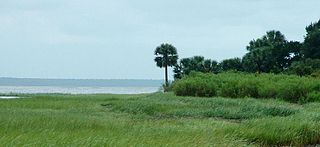
Ochlockonee Bay is an unincorporated community in Wakulla County, Florida, United States, located at the intersection of U.S. Highway 98 and County Road 372, south of Panacea. Situated on the north shore of Ochlockonee Bay, it is also recognized by the U.S. Postal Service as Ochlockonee.