Related Research Articles

Day County is a county in the U.S. state of South Dakota. As of the 2020 census, the population was 5,449. Its county seat is Webster. The county is named for Merritt H. Day, pioneer and 1879 Dakota Territory legislator.
Napi Headquarters is a census-designated place (CDP) in San Juan County, New Mexico, United States. The population was 706 at the 2000 census.

Blenheim is a town in Marlboro County, South Carolina, United States. The population was 154 at the 2010 census. It is named for Blenheim Palace in Oxfordshire, England. Blenheim Palace was the residence of the Duke of Marlborough, after whom Marlboro County is named.

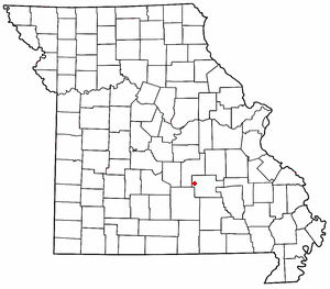
Lenox is an unincorporated community in western Dent County, Missouri, United States. The community is located approximately twelve miles west of Salem at the intersection of routes H and C. Edgar Springs is approximately four miles to the northwest in adjacent Phelps County and the community of Maples is 4.5 miles to the south in Texas County.
There are over a dozen lakes named Mud Lake within the U.S. state of South Dakota. According to the Federal Writers' Project, these lakes were so named on account of the muddy condition of the lake bed or lake shore.

The Lake Traverse Indian Reservation is the homeland of the federally recognized Sisseton Wahpeton Oyate, a branch of the Santee Dakota group of Native Americans. Most of the reservation covers parts of five counties in northeastern South Dakota, while smaller parts are in two counties in southeastern North Dakota, United States.
Enemy Swim Lake is a lake in the glacial lake region of northeastern South Dakota located on the Lake Traverse Indian Reservation in Day County, United States. Its coordinates are 45.4394°N 97.2662°W and the elevation is 1,854 feet.
Kidder is a census-designated place in Marshall County, South Dakota, United States. Its population was 25 at the 2020 census.
Elrod is an unincorporated community in Clark County, in the U.S. state of South Dakota.
Eifort is an unincorporated community in Lawrence and Scioto counties, Ohio, United States.
Crandall is an unincorporated community in Day County, in the U.S. state of South Dakota.
Hammer is an unincorporated community in Roberts County, in the U.S. state of South Dakota.
Hillhead is an unincorporated community in Marshall County, in the U.S. state of South Dakota. Hillhead is located approximately 2 kilometers northeast of Abraham Lake.
Kingsburg is an unincorporated community in Bon Homme County, in the U.S. state of South Dakota.
Maurine is an unincorporated community in Meade County, in the U.S. state of South Dakota.
Melham is an unincorporated community in Clark County, in the U.S. state of South Dakota.
Newark is an unincorporated community in Marshall County, in the U.S. state of South Dakota.
Osceola is an unincorporated community in western Kingsbury County, in the U.S. state of South Dakota. The community is located on the South Fork Pearl River and is approximately six miles southwest of Bancroft.
Spain is an unincorporated community in Marshall County, in the U.S. state of South Dakota.
Antelope Creek is a stream in the U.S. state of South Dakota.
References
- ↑ U.S. Geological Survey Geographic Names Information System: Holmquist, South Dakota
- ↑ "Day County". Jim Forte Postal History. Retrieved January 31, 2015.
- ↑ Federal Writers' Project (1940). South Dakota place-names, v.1-3. University of South Dakota. p. 43.
45°20′22″N97°39′11″W / 45.33944°N 97.65306°W
