Lily, South Dakota

Last updated

Lily, South Dakota
Day County South Dakota Incorporated and Unincorporated areas Lily Highlighted.svg
Location in Day County and the state of South Dakota
Coordinates: 45°10′54″N97°41′01″W / 45.18167°N 97.68361°W / 45.18167; -97.68361
Country United States
State South Dakota
County Day
Area
[1]
  Total0.30 sq mi (0.78 km2)
  Land0.30 sq mi (0.78 km2)
  Water0 sq mi (0 km2)
Elevation
[2]
1,857 ft (566 m)
Population
 (2010) [3]
  Total4
  Estimate 
(2013) [4]
4
  Density13.3/sq mi (5.1/km2)
Time zone UTC-6 (Central (CST))
  Summer (DST) UTC-5 (CDT)
ZIP code
57274
Area code 605
FIPS code 46-37140
GNIS feature ID1267463 [2]

Lily is a former town in Day County, South Dakota, United States. The population was 4 at the 2010 census. The town was dissolved in March 2017 by the Day County court due to the population reaching zero. [5]

Contents

History

Lily was a depot served by the Chicago, Milwaukee, St. Paul and Pacific Railroad [6] from 1898 until 1979. The town was named by its first postmaster, Ross Parks, after his sister, Lily. Mr. Parks and his sister homesteaded here in 1883. [7] The post office is dated July 13, 1883. [8]

Notable people

In 1889 Vice President Hubert Humphrey’s maternal grandfather, Andrew Gutorm Sannes, settled his family in Lily. With his wife, Tomina Larson, and five children (including Kristine - b. 1883, Norway, mother of the future vice president), they moved here, where they had 6 more children. Andrew Sannes, an immigrant Norwegian sea captain (with the dashed dream of being a Mississippi River boat captain), opened a drugstore in the corner of the general store. Their third child, Sophia, was their first-borne in the U.S., in Lily (December 1891); and their last child born in Lily was Thorvald, on September 18, 1900. [9]

Hubert Humphrey, Sr., after graduating from the Drew School of Pharmacy in Minneapolis, Minnesota, moved to Lily in 1903 and opened his first drugstore. (Today a small white sign cryptically marks the empty corner lot where the store had stood.) Here, he met Kristine Sannes, the woman who would become his wife. They married on April 16, 1906, in Lily. [10]

In 1907 they moved to Wallace, South Dakota, where Hubert Humphrey, Jr., the notable politician, was born on May 27, 1911, in a bedroom over his father’s drugstore. Hubert Humphrey, Jr., states, "I was baptized in the Highland Lutheran church in a rural section just north of Lily, South Dakota." [11]

In 2010, a video detailing the history of Lily was created by the McQuillen Creative Group. [12] This video Memories of Lily - A Letter to Oprah submitted to Oprah Winfrey (who sponsored the contest to raise awareness of rural towns) depicts the essence of current day Lily. [13]

Geography

According to the United States Census Bureau, the town has a total area of 0.30 square miles (0.78 km2), all land. [1]

Demographics

Historical population
CensusPop.Note
1910 175
1920 1876.9%
1930 135−27.8%
1940 15817.0%
1950 139−12.0%
1960 119−14.4%
1970 62−47.9%
1980 38−38.7%
1990 26−31.6%
2000 21−19.2%
2010 4−81.0%
2019 (est.)4 [14] 0.0%
U.S. Decennial Census [15]
2013 Estimate [4]

2010 census

As of the census [3] of 2010, there were 4 people, 2 households, and 1 family residing in the town. The population density was 13.3 inhabitants per square mile (5.1/km2). There were 13 housing units at an average density of 43.3 per square mile (16.7/km2). The racial makeup of the town was 100.0% White.

There were 2 households, of which 50.0% were married couples living together and 50.0% were non-families. 50.0% of all households were made up of individuals, and 50% had someone living alone who was 65 years of age or older. The average household size was 2.00 and the average family size was 3.00.

The median age in the town was 55.5 years. 0.0% of residents were under the age of 18; 25% were between the ages of 18 and 24; 0.0% were from 25 to 44; 50% were from 45 to 64; and 25% were 65 years of age or older. The gender makeup of the town was 25.0% male and 75.0% female.

2000 census

As of the census of 2000, there were 21 people, 10 households, and 5 families residing in the town. The population density was 69.2 inhabitants per square mile (26.7/km2). There were 14 housing units at an average density of 46.1 per square mile (17.8/km2). The racial makeup of the town was 100.00% White.

There were 10 households, out of which 30.0% had children under the age of 18 living with them, 40.0% were married couples living together, and 50.0% were non-families. 50.0% of all households were made up of individuals, and 40.0% had someone living alone who was 65 years of age or older. The average household size was 2.10 and the average family size was 3.00.

In the town, the population was spread out, with 28.6% under the age of 18, 4.8% from 18 to 24, 14.3% from 25 to 44, 9.5% from 45 to 64, and 42.9% who were 65 years of age or older. The median age was 54 years. For every 100 females, there were 75.0 males. For every 100 females age 18 and over, there were 114.3 males.

The median income for a household in the town was $16,250, and the median income for a family was $23,750. Males had a median income of $0 versus $0 for females. The per capita income for the town was $7,938. There were no families and 12.5% of the population living below the poverty line, including no under eighteens and none of those over 64.

Related Research Articles

<span class="mw-page-title-main">New Salem, North Dakota</span> City in North Dakota, United States

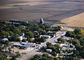
New Salem is a city in Morton County, North Dakota, United States. It is part of the "Bismarck, ND Metropolitan Statistical Area" or "Bismarck-Mandan". The population was 973 at the 2020 census. New Salem was founded in 1883.

<span class="mw-page-title-main">Taylor, North Dakota</span> City in North Dakota, United States

Taylor is a city in Stark County, North Dakota, United States. The population was 230 at the 2020 census. It is part of the Dickinson Micropolitan Statistical Area.

<span class="mw-page-title-main">Yale, South Dakota</span> Town in South Dakota, United States

Yale is an incorporated town in Beadle County, South Dakota, United States. The population was 112 at the 2020 census.

<span class="mw-page-title-main">Artas, South Dakota</span> Town in South Dakota, United States

Artas is a town in Campbell County, South Dakota, United States. The population was 7 at the 2020 census.

<span class="mw-page-title-main">Naples, South Dakota</span> Town in South Dakota, United States

Naples is a town in Clark County, South Dakota, United States. The population was 38 at the 2020 census.

<span class="mw-page-title-main">Wallace, South Dakota</span> Town in South Dakota, United States

Wallace is a town in Codington County, South Dakota, United States. The population was 91 at the 2020 census. It is part of the Watertown, South Dakota Micropolitan Statistical Area.

<span class="mw-page-title-main">Fairburn, South Dakota</span> Town in South Dakota, United States

Fairburn is a town in Custer County, South Dakota, United States. The population was 60 at the 2020 census.

<span class="mw-page-title-main">Hermosa, South Dakota</span> Town in South Dakota, United States

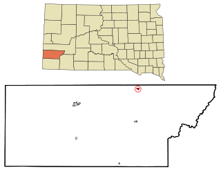
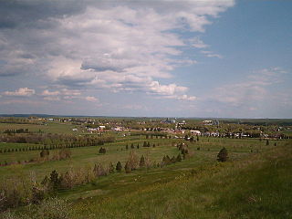
Hermosa is a town near the northern edge of Custer County, South Dakota, United States. The population was 382 at the 2020 census.

<span class="mw-page-title-main">Pierpont, South Dakota</span> Town in South Dakota, United States

Pierpont is a town in northwestern Day County, South Dakota, United States. The population was 129 at the 2020 census.

<span class="mw-page-title-main">Albee, South Dakota</span> Unincorporated community in South Dakota, United States

Albee is a town in Grant County, South Dakota, United States. The population was 7 at the 2020 census.

<span class="mw-page-title-main">Farmer, South Dakota</span> Town in South Dakota, United States

Farmer is a town in Hanson County, South Dakota, United States. It is part of the Mitchell, South Dakota Micropolitan Statistical Area. The population was 15 at the 2020 census.

<span class="mw-page-title-main">Cottonwood, South Dakota</span> Town in the United States

Cottonwood is a small rural hamlet in Jackson County, South Dakota, United States. The population was 12 at the 2020 census. There are no businesses or services at Cottonwood.

<span class="mw-page-title-main">Lake City, South Dakota</span> Town in South Dakota, United States

Lake City is a town in Marshall County, South Dakota, United States. The population was 45 at the 2020 census. Fort Sisseton Historic State Park, whose fort is listed on the National Register of Historic Places, is located nearby.

<span class="mw-page-title-main">Long Lake, South Dakota</span> Town in South Dakota, United States

Long Lake is a town in McPherson County, South Dakota, United States. The population was 27 at the 2020 census.

<span class="mw-page-title-main">Trent, South Dakota</span> Town in South Dakota, United States

Trent is a town in Moody County, South Dakota, United States. The population was 206 at the 2020 census.

<span class="mw-page-title-main">Tolstoy, South Dakota</span> Town in South Dakota, United States

Tolstoy is a town in Potter County, South Dakota, United States. The population was 35 at the 2020 census.

<span class="mw-page-title-main">Ortley, South Dakota</span> Town in South Dakota, United States

Ortley is a town in Roberts County, South Dakota, United States. The population was 50 according to the 2020 census.

<span class="mw-page-title-main">Doland, South Dakota</span> City in South Dakota, United States

Doland is a city in eastern Spink County, South Dakota, United States. The population was 199 at the 2020 census.

<span class="mw-page-title-main">Turton, South Dakota</span> Town in South Dakota, United States

Turton is a town in Spink County, South Dakota, United States. The population was 55 at the 2020 census. The town was served by Turton High School from 1915 to 1956; students attended Doland High School thereafter.

<span class="mw-page-title-main">Davis, South Dakota</span> Town in South Dakota, United States

Davis is a town in Turner County, South Dakota, United States. The population was 54 at the 2020 census.

References

  1. 1 2 "US Gazetteer files 2010". United States Census Bureau. Archived from the original on January 25, 2012. Retrieved June 21, 2012.
  2. 1 2 U.S. Geological Survey Geographic Names Information System: Lily, South Dakota
  3. 1 2 "U.S. Census website". United States Census Bureau . Retrieved June 21, 2012.
  4. 1 2 "Population Estimates". United States Census Bureau. Archived from the original on May 22, 2014. Retrieved July 20, 2014.
  5. Lusk, Victoria. "History, memories bond as 130-year-old town dissolves". Farm Forum. Aberdeen News Co. Retrieved September 19, 2017.
  6. Report of the Public Utilities Commission. South Dakota Public Utilities Commission. 1906. p. 120.
  7. "History of Day County, 1873-1926, by L. G. Ochsenreiter".
  8. "Archived copy" (PDF). Archived from the original (PDF) on February 10, 2010. Retrieved February 14, 2010.{{cite web}}: CS1 maint: archived copy as title (link)
  9. rodovid.org
  10. The Education of a Public Man: My Life and Politics by Hubert Horatio Humphrey
  11. letter to Rev. Tenner Thompson, March 1945
  12. "McQuillen Creative Group, Inc. | Websites, Video Production, Graphic Design, Logos". mcquillencreative.com. May 8, 2014.
  13. Archived at Ghostarchive and the Wayback Machine : Memories of Lily - A Letter to Oprah. YouTube .
  14. "Population and Housing Unit Estimates". United States Census Bureau. May 24, 2020. Retrieved May 27, 2020.
  15. United States Census Bureau. "Census of Population and Housing" . Retrieved September 23, 2013.