Related Research Articles
Bynumville is an unincorporated community in eastern Chariton County, Missouri, United States. It is located approximately twelve miles north of Salisbury on Route 129.
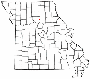
Forest Green is an unincorporated community in southeastern Chariton County, Missouri, United States. It is located approximately eight miles south of Salisbury on Route 5.
Prairie Hill is an unincorporated community in eastern Chariton County, Missouri, United States, located approximately eight miles northeast of Salisbury.
Cunningham is an unincorporated community in Chariton County, in the U.S. state of Missouri.
Triplett Township is a township in Chariton County, in the U.S. state of Missouri.
Guthridge is an unincorporated community in Chariton County, in the U.S. state of Missouri.
Hamden is an unincorporated community in Chariton County, in the U.S. state of Missouri.
Lagonda is an unincorporated community in Chariton County, in the U.S. state of Missouri.
Locust Creek is a stream in Wayne County, Iowa and Chariton, Linn, Livingston, Putnam and Sullivan counties in Missouri. It is a tributary of the Grand River.
Mike is an unincorporated community in Chariton County, in the U.S. state of Missouri.
Newcomer is an unincorporated community in Chariton County, in the U.S. state of Missouri.
Rockford is an unincorporated community in Chariton County, in the U.S. state of Missouri.
Shannondale is an unincorporated community in Chariton County, in the U.S. state of Missouri.
Westville is an unincorporated community in Chariton County, in the U.S. state of Missouri.
Wien is an unincorporated community in Chariton County, in the U.S. state of Missouri.
Brunswick Township is a township in Chariton County, in the U.S. state of Missouri.
Cunningham Township is a township in Chariton County, in the U.S. state of Missouri.
Mendon Township is a township in Chariton County, in the U.S. state of Missouri.
Salt Creek Township is a township in Chariton County, in the U.S. state of Missouri.
Palmer Creek is a stream in Chariton County in the U.S. state of Missouri. It is a tributary of the Missouri River.
References
- ↑ U.S. Geological Survey Geographic Names Information System: Indian Grove, Missouri
- ↑ Indian Grove, MO, 7.5 Minute Topographic Quadrangle, USGS, 1949 (1979 rev.)
- ↑ Missouri Atlas & Gazetteer, DeLorme, 1st ed., 1998, p. 29 ISBN 0899332242
- ↑ "Post Offices". Jim Forte Postal History. Retrieved 17 September 2016.
- ↑ "Chariton County Place Names, 1928–1945 (archived)". The State Historical Society of Missouri. Archived from the original on 24 June 2016. Retrieved 17 September 2016.CS1 maint: bot: original URL status unknown (link)
Municipalities and communities of Chariton County, Missouri, United States | ||
|---|---|---|
| Cities |  | |
| Villages | ||
| Townships | ||
| Unincorporated communities | ||
| Footnotes | ‡This populated place also has portions in an adjacent county or counties | |
Coordinates: 39°30′38″N93°02′06″W / 39.51056°N 93.03500°W
| | This Chariton County, Missouri state location article is a stub. You can help Wikipedia by expanding it. |