| IBRA regions and subregions: IBRA7 |
|---|
| IBRA region / subregion | IBRA code | Area | States | Location in Australia |
|---|
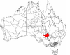
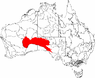
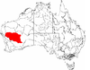
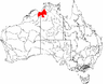
| Simpson Strzelecki Dunefields | SSD | 27,984,283 hectares (69,150,670 acres) | NSW, NT, Qld, SA |  |
| Andado | SSD01 | 1,355,195 hectares (3,348,760 acres) |
| Simpson Desert | SSD02 | 12,962,073 hectares (32,029,980 acres) |
| Dieri | SSD03 | 5,152,029 hectares (12,730,940 acres) |
| Warriner | SSD04 | 1,032,165 hectares (2,550,540 acres) |
| Strzelecki Desert | SSD05 | 7,482,821 hectares (18,490,450 acres) |
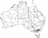
| South East Coastal Plain | SCP | 1,749,237 hectares (4,322,460 acres) | Vic |  |
| Gippsland Plain | SCP01 | 1,246,995 hectares (3,081,390 acres) |
| Otway Plain | SCP02 | 237,799 hectares (587,610 acres) |
| Warrnambool Plain | SCP03 | 264,443 hectares (653,450 acres) |
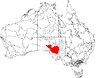
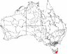
| South East Corner | SEC | 2,532,053 hectares (6,256,840 acres) | NSW / Vic |  |
| East Gippsland Lowlands | SEC01 | 623,515 hectares (1,540,740 acres) |
| South East Coastal Ranges | SEC02 | 1,734,517 hectares (4,286,080 acres) |
| Bateman | SEC03 | 174,020 hectares (430,000 acres) |
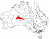
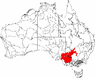
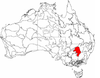
| South Eastern Highlands | SEH | 8,375,961 hectares (20,697,450 acres) | ACT, NSW, Vic |  |
| Highlands-Southern Fall | SEH01 | 1,196,334 hectares (2,956,210 acres) |
| Highlands-Northern Fall | SEH02 | 1,415,806 hectares (3,498,530 acres) |
| Otway Ranges | SEH03 | 149,857 hectares (370,300 acres) |
| Strzelecki Ranges | SEH04 | 342,045 hectares (845,210 acres) |
| Murrumbateman | SEH06 | 630,454 hectares (1,557,890 acres) |
| Bungonia | SEH07 | 431,185 hectares (1,065,480 acres) |
| Kanangra | SEH08 | 131,310 hectares (324,500 acres) |
| Crookwell | SEH09 | 466,523 hectares (1,152,800 acres) |
| Oberon | SEH10 | 293,164 hectares (724,420 acres) |
| Bathurst | SEH11 | 161,486 hectares (399,040 acres) |
| Orange | SEH12 | 284,172 hectares (702,200 acres) |
| Hill End | SEH13 | 504,377 hectares (1,246,340 acres) |
| Bondo | SEH14 | 541,990 hectares (1,339,300 acres) |
| Kybeyan-Gourock | SEH15 | 479,221 hectares (1,184,180 acres) |
| Monaro | SEH16 | 1,267,543 hectares (3,132,170 acres) |
| Capertee Uplands | SEH17 | 80,494 hectares (198,910 acres) |
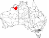
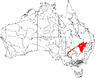
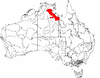
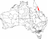
| South Eastern Queensland | SEQ | 7,804,921 hectares (19,286,380 acres) | NSW / Qld |  |
| Burnett-Curtis Hills and Ranges | SEQ01 | 962,583 hectares (2,378,590 acres) |
| Moreton Basin | SEQ02 | 784,969 hectares (1,939,700 acres) |
| Burringbar-Conondale Ranges | SEQ03 | 630,616 hectares (1,558,290 acres) |
| Sunshine Coast-Gold Coast Lowlands | SEQ04 | 351,123 hectares (867,640 acres) |
| Brisbane-Barambah Volcanics | SEQ05 | 806,778 hectares (1,993,590 acres) |
| South Burnett | SEQ06 | 563,866 hectares (1,393,340 acres) |
| Gympie Block | SEQ07 | 859,020 hectares (2,122,700 acres) |
| Burnett-Curtis Coastal Lowlands | SEQ08 | 700,181 hectares (1,730,180 acres) |
| Great Sandy | SEQ09 | 356,502 hectares (880,940 acres) |
| Scenic Rim | SEQ10 | 614,729 hectares (1,519,030 acres) |
| Woodenbong | SEQ11 | 325,603 hectares (804,580 acres) |
| Clarence Sandstones | SEQ12 | 327,829 hectares (810,080 acres) |
| Clarence Lowlands | SEQ13 | 520,901 hectares (1,287,170 acres) |
| Southern Volcanic Plain | SVP | 2,440,340 hectares (6,030,200 acres) | SA / Vic | |
| Victorian Volcanic Plain | SVP01 | 2,356,147 hectares (5,822,170 acres) |
| Mount Gambier | SVP02 | 84,194 hectares (208,050 acres) |
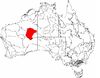
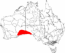
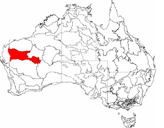
| Stony Plains | STP | 13,166,372 hectares (32,534,810 acres) | SA |  |
| Breakaways | STP01 | 2,444,385 hectares (6,040,210 acres) |
| Oodnadatta | STP02 | 2,593,717 hectares (6,409,210 acres) |
| Murnpeowie | STP03 | 2,910,385 hectares (7,191,720 acres) |
| Peake-Dennison Inlier | STP04 | 158,623 hectares (391,970 acres) |
| Macumba | STP05 | 693,282 hectares (1,713,140 acres) |
| Witjira | STP06 | 1,677,111 hectares (4,144,230 acres) |
| Baltana | STP07 | 2,688,870 hectares (6,644,300 acres) |
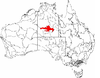
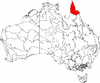
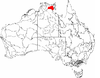
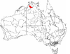
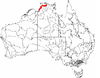
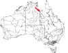
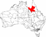
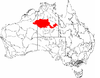
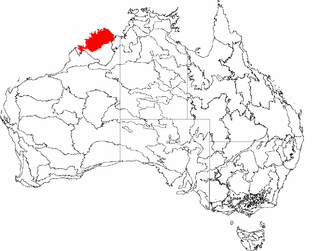
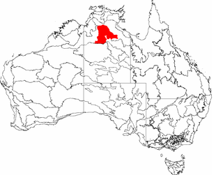
| Sturt Plateau | STU | 9,857,531 hectares (24,358,490 acres) | NT |  |
| Renehan | STU01 | 1,938,959 hectares (4,791,270 acres) |
| Newcastle | STU02 | 4,333,836 hectares (10,709,140 acres) |
| Birdum | STU03 | 3,584,736 hectares (8,858,080 acres) |
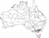
| Subantarctic Islands | SAI | 49,164 hectares (121,490 acres) | NSW / Vic | |
| Heard and McDonald Islands | SAI01 | 36,764 hectares (90,850 acres) |
| Macquarie Island | SAI02 | 12,400 hectares (31,000 acres) |
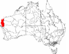
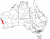
| Swan Coastal Plain | SWA | 1,525,798 hectares (3,770,330 acres) | WA |  |
| Dandarragan Plateau | SWA01 | 383,465 hectares (947,560 acres) |
| Perth | SWA02 | 1,142,334 hectares (2,822,770 acres) |
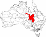
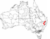
| Sydney Basin | SYB | 3,629,597 hectares (8,968,930 acres) | NSW |  |
| Kerrabee | SYB01 | 437,384 hectares (1,080,800 acres) |
| Hunter | SYB02 | 461,515 hectares (1,140,430 acres) |
| Wollemi | SYB04 | 687,622 hectares (1,699,150 acres) |
| Yengo | SYB05 | 461,327 hectares (1,139,960 acres) |
| Wyong | SYB06 | 211,494 hectares (522,610 acres) |
| Pittwater | SYB07 | 148,389 hectares (366,680 acres) |
| Cumberland | SYB08 | 275,693 hectares (681,250 acres) |
| Burragorang | SYB09 | 257,572 hectares (636,470 acres) |
| Sydney Cataract | SYB10 | 153,839 hectares (380,140 acres) |
| Moss Vale | SYB11 | 96,903 hectares (239,450 acres) |
| Illawarra | SYB12 | 122,752 hectares (303,330 acres) |
| Ettrema | SYB13 | 179,126 hectares (442,630 acres) |
| Jervis | SYB14 | 135,981 hectares (336,020 acres) |