Inwood, Indiana

Last updated

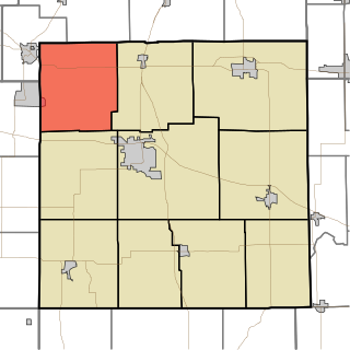
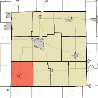
Inwood is an unincorporated community in Marshall County, Indiana, in the United States. [1]

Marshall County, Indiana County in the United States

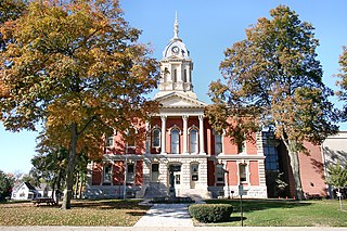
Marshall County is a county located in the U.S. state of Indiana. Census 2010 recorded the population at 47,051. The county seat is Plymouth.

United States Federal republic in North America

The United States of America (USA), commonly known as the United States or America, is a country composed of 50 states, a federal district, five major self-governing territories, and various possessions. At 3.8 million square miles, the United States is the world's third or fourth largest country by total area and is slightly smaller than the entire continent of Europe's 3.9 million square miles. With a population of over 327 million people, the U.S. is the third most populous country. The capital is Washington, D.C., and the largest city by population is New York City. Forty-eight states and the capital's federal district are contiguous in North America between Canada and Mexico. The State of Alaska is in the northwest corner of North America, bordered by Canada to the east and across the Bering Strait from Russia to the west. The State of Hawaii is an archipelago in the mid-Pacific Ocean. The U.S. territories are scattered about the Pacific Ocean and the Caribbean Sea, stretching across nine official time zones. The extremely diverse geography, climate, and wildlife of the United States make it one of the world's 17 megadiverse countries.

History

Inwood was originally called Pearsonville, and under the latter name was platted and laid out in 1854. When the railroad was built through the settlement two years later, it was given the shorter Inwood by the railroad company for its forested setting. [2]

Plat scale map showing the divisions of a piece of land

In the United States, a plat is a map, drawn to scale, showing the divisions of a piece of land. United States General Land Office surveyors drafted township plats of Public Lands Surveys to show the distance and bearing between section corners, sometimes including topographic or vegetation information. City, town or village plats show subdivisions into blocks with streets and alleys. Further refinement often splits blocks into individual lots, usually for the purpose of selling the described lots; this has become known as subdivision.

Related Research Articles

Burr Oak, Marshall County, Indiana Unincorporated community in Indiana, United States

Burr Oak is an unincorporated community in Union Township, Marshall County, Indiana.

Rutland, Indiana Unincorporated community in Indiana, United States

Rutland is an unincorporated community in Union Township, Marshall County, Indiana.

Hibbard, Indiana Unincorporated community in Indiana, United States

Hibbard is an unincorporated community in Union Township, Marshall County, Indiana.

Center Township, Marshall County, Indiana Township in Indiana, United States

Center Township is one of ten townships in Marshall County, Indiana, United States. As of the 2010 census, its population was 15,593 and it contained 6,491 housing units.

North Township, Marshall County, Indiana Township in Indiana, United States

North Township is one of ten townships in Marshall County, Indiana, United States. As of the 2010 census, its population was 4,321 and it contained 1,754 housing units.

Polk Township, Marshall County, Indiana Township in Indiana, United States

Polk Township is one of ten townships in Marshall County, Indiana, United States. As of the 2010 census, its population was 2,824 and it contained 1,183 housing units.

Tippecanoe Township, Marshall County, Indiana Township in Indiana, United States

Tippecanoe Township is one of ten townships in Marshall County, Indiana, United States. As of the 2010 census, its population was 1,313 and it contained 542 housing units.

Union Township, Marshall County, Indiana Township in Indiana, United States

Union Township is one of ten townships in Marshall County, Indiana, United States. As of the 2010 census, its population was 3,088 and it contained 1,938 housing units.

West Township, Marshall County, Indiana Township in Indiana, United States

West Township is one of ten townships in Marshall County, Indiana, United States. As of the 2010 census, its population was 4,008 and it contained 1,729 housing units.

Crumstown, Indiana Unincorporated community in Indiana, United States

Crumstown is an unincorporated community in LaPorte and St. Joseph counties, in the U.S. state of Indiana.

Donaldson, Indiana Unincorporated community in Indiana, United States

Donaldson is an unincorporated community in West Township, Marshall County, Indiana.

Harris, Indiana Unincorporated community in Indiana, United States

Harris is an unincorporated community in North Township, Marshall County, Indiana.

Maxinkuckee, Indiana Unincorporated community in Indiana, United States

Maxinkuckee is an unincorporated community in Union Township, Marshall County, Indiana.

Teegarden, Indiana Unincorporated community in Indiana, United States

Teegarden is an unincorporated community in Polk Township, Marshall County, Indiana.

Tyner, Indiana Unincorporated community in Indiana, United States

Tyner is an unincorporated community in Polk Township, Marshall County, Indiana. Originally named Tyner City, it is named after Thomas Tyner. He died in 1880, and is buried in the town's cemetery.

Walnut, Indiana Unincorporated community in Indiana, United States

Walnut is an unincorporated community in Walnut Township, Marshall County, Indiana.

Linkville is an unincorporated community in Marshall County, Indiana, in the United States.

La Paz Junction is an unincorporated community in Marshall County, Indiana, in the United States.

Ardmore, Indiana Unincorporated community in Indiana, United States

Ardmore is an unincorporated community in Portage Township, St. Joseph County, in the U.S. state of Indiana.

Nutwood, Indiana Unincorporated community in Indiana, United States

Nutwood is an unincorporated community in Centre Township, St. Joseph County, in the U.S. state of Indiana.

References

Coordinates: 41°19′03″N86°12′11″W / 41.31750°N 86.20306°W / 41.31750; -86.20306

Geographic coordinate system Coordinate system

A geographic coordinate system is a coordinate system that enables every location on Earth to be specified by a set of numbers, letters or symbols. The coordinates are often chosen such that one of the numbers represents a vertical position and two or three of the numbers represent a horizontal position; alternatively, a geographic position may be expressed in a combined three-dimensional Cartesian vector. A common choice of coordinates is latitude, longitude and elevation. To specify a location on a plane requires a map projection.