
Lantau Island is the largest island in Hong Kong,located west of Hong Kong Island and the Kowloon Peninsula,and is part of the New Territories. Administratively,most of Lantau Island is part of the Islands District of Hong Kong. A small northeastern portion of the island is located in the Tsuen Wan District.
Hong Kong has a long coastline that is full of twists and turns with many bays and beaches. Many of them are well sheltered by mountains nearby,as Hong Kong is a mountainous place. As a result,large waves seldom appear at the bays,making them suitable for human swimming.
Hong Kong counts approximately 600 temples,shrines and monasteries. While Buddhism and Christianity are the most widely practiced religions,most religions are represented in the Special Administrative Region.

Mui Wo is a rural town on the eastern coast of Lantau Island in Hong Kong. The 2011 Census recorded 5,485 people living in Mui Wo and its environs.

The kai-to,sometimes kaito or kaido is a type of small,motorised ferry that operates in Hong Kong. They are usually used to serve remote coastal settlements in the territory's outlying islands.
Telephone numbers in Hong Kong are mostly eight-digit. Fixed land line numbers start with 2 or 3,mobile (cellular) phone numbers with 5,6,7 or 9,pager numbers with 7 and forwarding service with 8. Since the end of 1989,there have been no area codes within Hong Kong.
A Site of Special Scientific Interest or SSSI is a special area to protect wildlife,habitats and geographic features based on scientific interest in Hong Kong. Scientific interests are special features relating to animal life,plant life,geology and/or geography. After being identified by the Agriculture,Fisheries and Conservation Department,these areas are documented by the Planning Department and added to maps. From 1975 to 2005,67 locations were designated SSSIs throughout Hong Kong.
The Outlying Islands are all the islands that make up the territory of Hong Kong,with the exception of Hong Kong Island and some smaller islands near its coast. There are 263 islands over 500 m2 in Hong Kong,the vast majority of which are located within the New Territories,with significant numbers located in Islands District in the south and southwest,Sai Kung District in the southeast,and Tai Po District and North District in the northeast. The term "outlying" is not strictly defined and in some cases islands very close to Hong Kong Island and mainland China are not included.
Articles related to Hong Kong include:

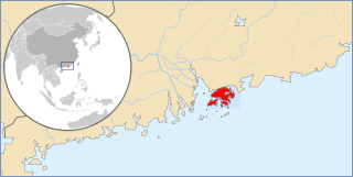
Tsing Chau Tsai Peninsula is the peninsula located at the northeast of Lantau Island,New Territories,Hong Kong,including Yam O,To Kau Wan,Tai Tsing Chau,Tsing Chau Tsai and Penny's Bay.

Outlying Islands Ferry Pier means the ferry piers which provide ferry service outside Victoria Harbour in Central,Hong Kong. It now refers to Central Piers No.2 to No.6,near International Finance Centre. The ferry routes travel between Central and Ma Wan,Lantau Island,Lamma Island,Cheung Chau and Peng Chau.

Silvermine Bay Ferry Pier or Mui Wo Ferry Pier is a ferry pier located on the waterfront of Silver Mine Bay in Mui Wo Ferry Pier Road,Mui Wo,New Territories,Hong Kong. There are two ferry routes provided in the pier. One is the service between Mui Wo and Central,operated by Sun Ferry. Another one is the "Inter-Island" service among Peng Chau,Lantau Island and Cheung Chau,also operated by the same operator.


