
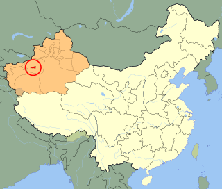
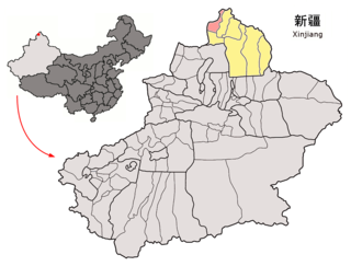
Altay is a county-level city in Altay Prefecture within Ili Kazakh Autonomous Prefecture, in far Northern Xinjiang, China. The city centre is located on the banks of Kelan River.
Aral is a sub-prefecture-level city surrounded by Aksu Prefecture in Xinjiang Uyghur Autonomous Region, China. Aral means "island" in Uyghur. The city's name is often written as Alar.

Wujiaqu is a county-level city in the northern part of Xinjiang Uyghur Autonomous Region, China, about 40 kilometres (25 mi) north of Ürümqi.

Alashankou is a border city in Bortala Mongol Autonomous Prefecture, Xinjiang Uyghur Autonomous Region, China. It is a port of entry by both railroad and highway from Kazakhstan as part of the Eurasian Land Bridge.

Burqin County is a county in Xinjiang, China and is under the administration of the Kazakh autonomous area of Altay Prefecture. It has an area of 10,362 km2 (4,001 sq mi) with a population of 70,000. The postcode is 836600.
Habahe County as the official romanized name, also transliterated from Uyghur as Kaba County, is a county situated in the far north of the Xinjiang Uyghur Autonomous Region and is under the administration of the Altay Prefecture. It has an area of 8,179 km2 (3,158 sq mi) with a population of 80,000. The Postcode is 836700.

Yumin County as the official romanized name, also transliterated from Mongolian as Qagantokay County, is a county situated in the Xinjiang Uyghur Autonomous Region and is under the administration of the Tacheng Prefecture, bordering Kazakhstan's regions of East Kazakhstan and Almaty. It has an area of 6,090 km2 (2,350 sq mi) with a population of 50,000. The Postcode is 834800.

Shawan, also transliterated from Chinese to Uyghur as Savan, is a county-level city situated in the north of the Xinjiang Uyghur Autonomous Region under the administration of the Tacheng Prefecture. It has an area of 12,468 km2 (4,814 sq mi) with a population of 200,000. The Postcode is 832100.

Hejing County is located in the central-southern part of the Tian Shan mountains of Xinjiang, in the north-west of Bayingolin Mongol Autonomous Prefecture. The northernmost county-level division of Bayingolin, it borders Ürümqi City to the north, from which it is 190 km (120 mi) as the crow flies, and Korla City to the south, which is 80 km (50 mi) away. It borders 15 cities and counties and is the most bordered county in the world.

Hoxud County is a county in the Xinjiang Uyghur Autonomous Region and is under the administration of the Bayin'gholin Mongol Autonomous Prefecture. It contains an area of 12,753 km2 (4,924 sq mi). According to the 2002 census, it has a population of 60,000.

Manas County is a county in the Xinjiang Uyghur Autonomous Region under the administration of the Changji Hui Autonomous Prefecture. It covers an area of 9,174 square kilometres (3,542 sq mi) and as of the 2002 census it had a population of 170,000.

Mori Kazakh Autonomous County is a county within the Xinjiang Uyghur Autonomous Region and is under the administration of the Changji Hui Autonomous Prefecture. It contains an area of 13,510 km2. According to the 2002 census, it has a population of 90,000.
Wenquan County as the official romanized name, also transliterated from Mongolian as Arixang County, is a county in the northwest of the Xinjiang Uyghur Autonomous Region and is under the administration of the Börtala Mongol Autonomous Prefecture, bordering Kazakhstan's Almaty Region to the north and west. It contains an area of 5,900 km2 (2,300 sq mi). According to the 2002 census, it has a population of 70,000.

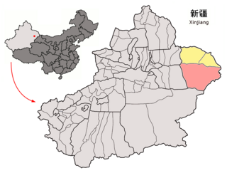
Yiwu County as the official romanized name, also transliterated from Uyghur as Aratürük County, is a county in the northeast of the Xinjiang Uyghur Autonomous Region and is under the administration of the Hami City. It contains an area of 19,511 km2 (7,533 sq mi). According to the 2002 census, it has a population of 20,000.

Koktokay county, also known as Fuyun County, is a county of Altay Prefecture, in the Xinjiang Uyghur Autonomous Region of China. It has an area of 32,237 km2 with a population of 80,000. The seat of Fuyun County is in Ku Ertix Town. The Koktokay National Geopark is in Koktokay Town. The postal code of Fuyun County is 836100. The county is served by Fuyun Keketuohai Airport.

Zhaosu County, also known as Mongolküre County, is a county in northwestern Xinjiang, China. It is under the administration of Ili Kazakh Autonomous Prefecture and shares a border with Kazakhstan's Almaty Region to the west. It covers an area of 10,455 km2 (4,037 sq mi). According to the 2012 census, it had a population of 189,102.

Xinyuan County as the official romanized name, also transliterated from Uyghur as Künas County, is a county in the Xinjiang Uyghur Autonomous Region and is under the administration of the Ili Kazakh Autonomous Prefecture. It contains an area of 7,581 km2. According to the 2002 census, it has a population of 290,000. The county is served by Xinyuan Nalati Airport.

Huocheng County, as the official romanized name, is also transliterated from Uyghur as Korgas County. It is situated within the Xinjiang Uyghur Autonomous Region and falls under the administration of the Ili Kazakh Autonomous Prefecture. The county is located between Yining and the border city of Khorgas, covering an area of 5,466 km2 (2,110 sq mi), with a population of 360,000. There are twenty-nine ethnic groups residing in the county, including the Han and Uyghur nationalities.

Tekes County is a county within the Xinjiang Uyghur Autonomous Region and is under the administration of the Ili Kazakh Autonomous Prefecture. It contains an area of 8,067 km2. According to the 2002 census, it has a population of 150,000.
Yizhou is the central district of the Hami prefecture-level city, in Xinjiang Uyghur Autonomous Region, China. Its population was 472,175 at the end of 2010. It was known as Hami county-level city until February 2016, when it was merged with the Hami Prefecture to form the Hami prefecture-level city and the county-level city was renamed Yizhou District. Xingxingxia (Singsingsia) town is located on the border with Gansu.


