Jessup, Pennsylvania

Last updated
Jessup, Pennsylvania
Jessup, pa.JPG
Church Street in Jessup
Etymology: Judge William Jessup
Lackawanna County Pennsylvania Incorporated and Unincorporated areas Jessup Highlighted.svg
Location of Jessup in Lackawanna County, Pennsylvania
USA Pennsylvania location map.svg
Red pog.svg
Jessup
Location in Pennsylvania
Usa edcp location map.svg
Red pog.svg
Jessup
Location in the United States
Coordinates: 41°28′16″N75°33′44″W / 41.47111°N 75.56222°W / 41.47111; -75.56222
CountryUnited States
StatePennsylvania
County Lackawanna
Settled1849
IncorporatedDecember 1876
Area
[1]
  Total6.79 sq mi (17.57 km2)
  Land6.74 sq mi (17.45 km2)
  Water0.05 sq mi (0.13 km2)
Elevation
853 ft (260 m)
Population
 (2020) [2]
  Total4,520
  Density670.92/sq mi (259.04/km2)
Time zone UTC-5 (EST)
  Summer (DST) UTC-4 (EDT)
Zip Code
18434
Area code 570
FIPS code 42-38160
Website www.jessupborough.com

Jessup is a borough in Lackawanna County, Pennsylvania, United States. The population was 4,532 at the 2020 census. [3]

Contents

Geography

Jessup is located at 41°28′16″N75°33′44″W / 41.47111°N 75.56222°W / 41.47111; -75.56222 (41.471131, -75.562171). [4]

According to the United States Census Bureau, the borough has a total area of 6.75 square miles (17.5 km2), of which 6.7 square miles (17 km2) is land and 0.05 square miles (0.13 km2) (0.74%) is water.

History

Settled in 1849, the town of Jessup was named after Judge William Jessup. It was presented to the Luzerne County Court for incorporation as the Borough of Winton in December 1876. Two years later, Lackawanna County was incorporated. The early 1890s were very significant for the little town, as numerous new mining operations were opened. Shortly after these were opened, immigrants from Europe were lured to the area by the work available in the booming anthracite coal fields.

Demographics

Historical population
CensusPop.Note
1880 905
1890 1,79798.6%
1900 3,42590.6%
1910 5,28054.2%
1920 7,58343.6%
1930 8,50812.2%
1940 7,989−6.1%
1950 6,280−21.4%
1960 5,456−13.1%
1970 4,948−9.3%
1980 4,9740.5%
1990 4,605−7.4%
2000 4,7182.5%
2010 4,676−0.9%
2020 4,532−3.1%
2021 (est.)4,517 [3] −0.3%
Sources: [5] [6] [7] [2]

At the 2010 census there were 4,676 people, 2,007 households, and 1,272 families residing in the borough. The population density was 697.9 inhabitants per square mile (269.5/km2). There were 2,134 housing units at an average density of 318.5 units per square mile (123.0 units/km2). The racial makeup of the borough was 96.9% White, 0.8% African American, 0.2% American Indian, 0.4% Asian, 0.05% Pacific Islander, 0.4% from other races, and 1.2% from two or more races. Hispanic or Latino of any race were 1.9%. [8]

There were 2,007 households, 24.7% had children under the age of 18 living with them, 45.9% were married couples living together, 12.7% had a female householder with no husband present, and 36.6% were non-families. 31.4% of households were made up of individuals, and 15.4% were one person aged 65 or older. The average household size was 2.33 and the average family size was 2.92.

In the borough the population was spread out, with 20.2% under the age of 18, 61.6% from 18 to 64, and 18.2% 65 or older. The median age was 42.5 years.

The median household income was $32,201 and the median family income was $43,013. Males had a median income of $36,339 versus $25,267 for females. The per capita income for the borough was $17,189. About 8.0% of families and 10.4% of the population were below the poverty line, including 11.3% of those under age 18 and 12.8% of those age 65 or over.

Notable people

Related Research Articles

<span class="mw-page-title-main">Ferndale, Pennsylvania</span> Borough in Pennsylvania, United States

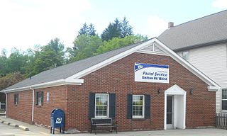
Ferndale is a borough in Cambria County, Pennsylvania, United States. It is part of the Johnstown, Pennsylvania Metropolitan Statistical Area. The population was 1,636 at the 2010 census, down from 1,834 at the 2000 census.

<span class="mw-page-title-main">Archbald, Pennsylvania</span> Borough in Pennsylvania, United States

Archbald is a borough in Lackawanna County, Pennsylvania, United States. It is part of Northeastern Pennsylvania and is named for James Archbald, the first mayor of Carbondale, Pennsylvania. Before being renamed in Archbald's honor, the name of the settlement was White Oak Run. Most of the original settlers were Irish Catholics, fleeing the Great Famine. The population was 7,348 at the 2021 census.

<span class="mw-page-title-main">Clarks Green, Pennsylvania</span> Borough in Pennsylvania, United States

Clarks Green is a borough in Lackawanna County, Pennsylvania, United States. It is part of Northeastern Pennsylvania. The population was 1,529 at the 2020 census.

<span class="mw-page-title-main">Clarks Summit, Pennsylvania</span> Borough in Pennsylvania, United States

Clarks Summit is a borough in Lackawanna County, northwest of Scranton in Northeastern Pennsylvania. The population was 5,108 at the 2020 census. It is also the northern control city of the Pennsylvania Turnpike Northeast Extension, I-476, though the official terminus is in adjacent South Abington Township.

<span class="mw-page-title-main">Dalton, Pennsylvania</span> Borough in Pennsylvania, United States

Dalton is a borough in Lackawanna County, Pennsylvania, United States. It is part of Northeastern Pennsylvania and is located approximately eight miles north of the city of Scranton in a suburban area known as "the Abingtons." Dalton is also approximately three miles north of Clarks Summit, the hub of the Abington community. The population was 1,283 at the 2020 census.

<span class="mw-page-title-main">Dickson City, Pennsylvania</span> Borough in Lackawanna County, Pennsylvania, United States

Dickson City is a borough in Lackawanna County, Pennsylvania, 4 miles (6 km) north of Scranton. Coal mining was an important industry in the past. The borough's population peaked at 12,395 in 1930 and was 6,051 at the 2020 census.

Glenburn is a census-designated place (CDP) in Glenburn Township, Lackawanna County, Pennsylvania, United States. The population was 953 at the 2010 census. It is approximately 10 miles (16 km) north of downtown Scranton, in the growing suburban area known as the "Abingtons". Glenburn is located north of Clarks Summit and south of Dalton.

<span class="mw-page-title-main">Jermyn, Pennsylvania</span> Borough in Pennsylvania, United States

Jermyn, known as "The Birthplace of First Aid in America", is a borough which is located in Lackawanna County, Pennsylvania, United States. Located on the Lackawanna River, it is 12 miles (19 km) northeast of Scranton.

<span class="mw-page-title-main">Mayfield, Pennsylvania</span> Borough in Pennsylvania, United States

Mayfield is a borough in Lackawanna County, Pennsylvania, United States, approximately 14 miles (23 km) northeast of Scranton. In the past, it contained a silk mill and a coal mining industry. The population was 1,763 at the 2020 census.

<span class="mw-page-title-main">Moscow, Pennsylvania</span> Borough in Pennsylvania, United States

Moscow is a borough in Lackawanna County, Pennsylvania, United States. The population was 2,039 at the 2020 census. It is located 11 miles (18 km) southeast of Scranton and 24 miles (39 km) southwest of Honesdale.

Mount Cobb is an unincorporated community and census-designated place (CDP) in Lackawanna County, Pennsylvania, United States. The population was 1,799 at the 2010 census.

<span class="mw-page-title-main">Olyphant, Pennsylvania</span> Borough in Pennsylvania, United States

Olyphant is a borough in Lackawanna County, Pennsylvania, United States. It is six miles (10 km) northeast of downtown Scranton, on the Lackawanna River in the heart of the anthracite region of the state. Its main source of employment was the mining and shipping of coal. It was the headquarters of the Lackawanna Coal Company. Other industries of the past were the manufacturing of blasting powder, iron and steel goods, cigars, and silks. Olyphant experienced a severe downturn in the 1950s. There was once a thriving garment industry with numerous dress factories in the downtown area. There was also a slaughterhouse. Until 2018, the biggest industry was Cinram the manufacture of compact discs (CD) and digital video discs (DVD). The population was 5,395 at the 2020 census.

<span class="mw-page-title-main">Taylor, Pennsylvania</span> Borough in Pennsylvania, United States

Taylor is a borough in Lackawanna County, Pennsylvania, United States, 3 miles (5 km) southwest of Scranton on the Lackawanna River. It was founded in 1790 by Cornelius Atherton. Silk manufacturing and coal mining were once practiced in the borough. Most of Taylor is built over abandoned mines. The Pennsylvania Turnpike Northeast Extension (I-476), accessible via the Keyser Avenue Interchange, passes through Taylor, going north to Clarks Summit and south to Philadelphia.

<span class="mw-page-title-main">Vandling, Pennsylvania</span> Borough in Pennsylvania, United States

Vandling is a borough in the northeastern corner of Lackawanna County, Pennsylvania, United States. The population was 730 at the 2020 census. It is located immediately south of Forest City, which is in Susquehanna County.

<span class="mw-page-title-main">East Berwick, Pennsylvania</span> Census-designated place in Pennsylvania, United States

East Berwick is a census-designated place (CDP) in Salem Township, Luzerne County, Pennsylvania, United States. The population was 2,007 at the 2010 census.

<span class="mw-page-title-main">Edwardsville, Pennsylvania</span> Borough in Pennsylvania, United States

Edwardsville is a borough in Luzerne County, Pennsylvania, United States. The population was 4,918 at the 2020 census.

<span class="mw-page-title-main">Lanesboro, Pennsylvania</span> Borough in Pennsylvania, United States

Lanesboro is a borough in Susquehanna County, Pennsylvania, United States. The population was 485 at the 2020 census.

<span class="mw-page-title-main">Factoryville, Pennsylvania</span> Borough in Pennsylvania, United States

Factoryville is a borough in Wyoming County, Pennsylvania, United States. The population was 1,146 at the 2020 census.

<span class="mw-page-title-main">Nicholson, Pennsylvania</span> Borough in Pennsylvania, United States

Nicholson is a borough in Wyoming County, Pennsylvania. The population was 698 at the 2020 census.

<span class="mw-page-title-main">Pine Grove, West Virginia</span> Town in West Virginia, United States

Pine Grove is a town in Wetzel County, West Virginia, United States. The population was 363 at the 2020 census. The community was named for a grove of pine trees near the original town site.

References

  1. "ArcGIS REST Services Directory". United States Census Bureau. Retrieved October 12, 2022.
  2. 1 2 "Census Population API". United States Census Bureau. Retrieved Oct 12, 2022.
  3. 1 2 Bureau, US Census. "City and Town Population Totals: 2020—2021". Census.gov. US Census Bureau. Retrieved August 5, 2022.
  4. "US Gazetteer files: 2010, 2000, and 1990". United States Census Bureau. 2011-02-12. Retrieved 2011-04-23.
  5. "Census of Population and Housing". U.S. Census Bureau. Retrieved 11 December 2013.
  6. "U.S. Census website". United States Census Bureau . Retrieved 2008-01-31.
  7. "Incorporated Places and Minor Civil Divisions Datasets: Subcounty Resident Population Estimates: April 1, 2010 to July 1, 2012". Population Estimates. U.S. Census Bureau. Archived from the original on 11 June 2013. Retrieved 11 December 2013.
  8. "U.S. Census website". United States Census Bureau . Retrieved 2011-05-14.