Vandling, Pennsylvania

Last updated
Vandling, Pennsylvania
Vandling PA Muni Complex.jpg
Vandling Municipal Complex
Lackawanna County Pennsylvania Incorporated and Unincorporated areas Vandling Highlighted.svg
Location in Lackawanna County, Pennsylvania
USA Pennsylvania location map.svg
Red pog.svg
Vandling
Location in Pennsylvania
Usa edcp location map.svg
Red pog.svg
Vandling
Location in the United States
Coordinates: 41°38′02″N75°28′10″W / 41.63389°N 75.46944°W / 41.63389; -75.46944 Coordinates: 41°38′02″N75°28′10″W / 41.63389°N 75.46944°W / 41.63389; -75.46944
CountryUnited States
StatePennsylvania
County Lackawanna
Area
[1]
  Total1.31 sq mi (3.40 km2)
  Land1.31 sq mi (3.40 km2)
  Water0.00 sq mi (0.00 km2)
Elevation
1,365 ft (416 m)
Population
 (2020) [2]
  Total730 Decrease2.svg
  Estimate 
(2021) [2]
728
  Density536.94/sq mi (207.34/km2)
Time zone UTC-5 (EST)
  Summer (DST) UTC-4 (EDT)
Zip Code
18421
Area code 570
FIPS code 42-79792
Website vandlingpa.us

Vandling is a borough in the northeastern corner of Lackawanna County, Pennsylvania, United States. The population was 730 at the 2020 census. [2] It is located immediately south of Forest City (population 1,911), which is in Susquehanna County.

Contents

Geography

Vandling is located at 41°38′2″N75°28′10″W / 41.63389°N 75.46944°W / 41.63389; -75.46944 (41.633771, -75.469578). [3]

According to the United States Census Bureau, the borough has a total area of 3.4 square kilometers (1.3 sq mi) , all land.

Demographics

Historical population
CensusPop.
1900 765
1910 98528.8%
1920 1,25827.7%
1930 1,169−7.1%
1940 970−17.0%
1950 722−25.6%
1960 578−19.9%
1970 6339.5%
1980 557−12.0%
1990 66018.5%
2000 73811.8%
2010 7511.8%
2020 730−2.8%
2021 (est.)728 [2] −0.3%
Sources: [4] [5] [6]

As of the 2010 Census, [7] there were 751 people, 309 households, and 203 families residing in the borough. The population density was 577.7 people per square mile (223.1/km2). There were 340 housing units at an average density of 102.1 per square kilometer; (261.5 per square mile;). The racial makeup of the borough was 96% White, 1.3% Black, 0.7% American Indian, 0.3% Asian, 0.5% from some other race, and 1.2% from two or more races. Hispanic or Latino of any race were 2.1% of the population.

444 Main Street 444 Main Vandling PA.jpg
444 Main Street

There were 309 households, out of which 27.5% had children under the age of 18 living with them, 51.8% were married couples living together, 10.7% had a female householder with no husband present, and 34.3% were non-families. 27.2% of all households were made up of individuals, and 13.6% had someone living alone who was 65 years of age or older. The average household size was 2.43 and the average family size was 2.95.

In the borough the population was spread out, with 22.2% under the age of 18, 60.4% from 18 to 64, and 17.4% who were 65 years of age or older. The median age was 42.5 years.

The median income for a household in the borough was $37,212, and the median income for a family was $46,250. Males had a median income of $32,250 versus $24,444 for females. The per capita income for the borough was $18,748. About 3.4% of families and 5.6% of the population were below the poverty line, including 6.3% of those under age 18 and 6.5% of those age 65 or over.

Education

Forest City Regional School District is a Preschool-12th grade public school district serving residents of Vanding Borough.

Related Research Articles

<span class="mw-page-title-main">Clarks Green, Pennsylvania</span> Borough in Pennsylvania, United States

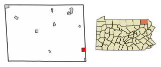
Clarks Green is a borough in Lackawanna County, Pennsylvania, United States. The population was 1,529 at the 2020 census.

<span class="mw-page-title-main">Dalton, Pennsylvania</span> Borough in Pennsylvania, United States

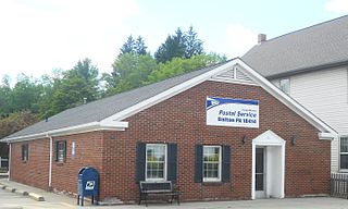
Dalton is a borough in Lackawanna County, Pennsylvania, United States. It is located approximately eight miles north of the city of Scranton in a suburban area known as “the Abingtons." Dalton is also approximately three miles north of Clarks Summit, the hub of the Abington community. The population was 1,283 at the 2020 census.

<span class="mw-page-title-main">Jessup, Pennsylvania</span> Borough in Pennsylvania, United States

Jessup is a borough in Lackawanna County, Pennsylvania. The population was 4,532 at the 2020 census.

<span class="mw-page-title-main">Mayfield, Pennsylvania</span> Borough in Pennsylvania, United States

Mayfield is a borough in Lackawanna County, Pennsylvania, United States, approximately 14 miles (23 km) northeast of Scranton. In the past, it contained a silk mill and a coal mining industry. The population was 1,763 at the 2020 census.

<span class="mw-page-title-main">Taylor, Pennsylvania</span> Borough in Pennsylvania, United States

Taylor is a borough in Lackawanna County, Pennsylvania, United States, 3 miles (5 km) southwest of Scranton on the Lackawanna River. It was founded in 1790 by Cornelius Atherton. Silk manufacturing and coal mining were once practiced in the borough. Most of Taylor is built over abandoned mines. The Pennsylvania Turnpike Northeast Extension (I-476), available via the Keyser Avenue Interchange, passes through Taylor, going north to Clarks Summit and south to Philadelphia.

<span class="mw-page-title-main">South New Castle, Pennsylvania</span> Borough in Pennsylvania, United States

South New Castle is a borough in Lawrence County, Pennsylvania, United States. The population was 649 at the 2020 census. South New Castle is primarily a residential neighborhood which lies south of the city of New Castle, and is part of the New Castle micropolitan area.

<span class="mw-page-title-main">Ashley, Pennsylvania</span> Borough in Pennsylvania, United States

Ashley is a borough in Luzerne County, Pennsylvania, one mile (2 km) from Wilkes Barre. The population was 2,588 at the 2020 census.

<span class="mw-page-title-main">Dallas, Pennsylvania</span> Borough in Pennsylvania, United States

Dallas is a borough in Luzerne County, Pennsylvania, United States. The population was 2,692 at the 2020 census. The local government describes the borough as the "Pride" of the Back Mountain. The area includes the townships of Dallas, Franklin, Jackson, Kingston, Lake, and Lehman. The region also includes the boroughs of Dallas and Harveys Lake. Dallas is in the vicinity of Misericordia University and Dallas State Correctional Institution.

<span class="mw-page-title-main">Dupont, Pennsylvania</span> Borough in Pennsylvania, United States

Dupont is a borough in the Greater Pittston area of Luzerne County, Pennsylvania, United States. The population was 2,536 as of the 2020 census.

<span class="mw-page-title-main">Edwardsville, Pennsylvania</span> Borough in Pennsylvania, United States

Edwardsville is a borough in Luzerne County, Pennsylvania, United States. The population was 4,918 at the 2020 census.

<span class="mw-page-title-main">Luzerne, Pennsylvania</span> Borough in Pennsylvania, United States

Luzerne is a borough located 5 miles (8 km) north of Wilkes Barre in Luzerne County, Pennsylvania, United States. The population was 2,703 at the 2020 census.

<span class="mw-page-title-main">Pringle, Pennsylvania</span> Borough in Pennsylvania, United States

Pringle is a borough in Luzerne County, Pennsylvania, United States. As of the 2020 census, the borough population was 891.

<span class="mw-page-title-main">Yatesville, Pennsylvania</span> Borough in Pennsylvania, United States

Yatesville is a borough in the Greater Pittston area of Luzerne County, Pennsylvania. The population was 638 as of the 2020 census.

<span class="mw-page-title-main">Lanesboro, Pennsylvania</span> Borough in Pennsylvania, United States

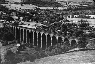
Lanesboro is a borough in Susquehanna County, Pennsylvania, United States. The population was 485 at the 2020 census.

<span class="mw-page-title-main">New Milford, Pennsylvania</span> Borough in Pennsylvania, United States

New Milford is a borough in Susquehanna County, Pennsylvania, United States. The population was 817 at the 2020 census. Children living in New Milford are served by the schools in the Blue Ridge School District, including Blue Ridge High School.

<span class="mw-page-title-main">Thompson, Pennsylvania</span> Borough in Pennsylvania, United States

Thompson is a borough in Susquehanna County, Pennsylvania, United States. The population was 255 at the 2020 census.

<span class="mw-page-title-main">Union Dale, Pennsylvania</span> Borough in Pennsylvania, United States

Union Dale is a borough in Susquehanna County, Pennsylvania, United States. The borough was incorporated in 1885. Union Dale's population was 267 at the 2010 census.

<span class="mw-page-title-main">Prompton, Pennsylvania</span> Borough in Pennsylvania, United States

Prompton is a borough in Wayne County, Pennsylvania, United States. The population was 250 at the 2010 census.

<span class="mw-page-title-main">Waymart, Pennsylvania</span> Borough in Pennsylvania, United States

Waymart is a borough in Wayne County, Pennsylvania, United States. The borough's population was 1,341 at the time of the 2010 United States Census.

<span class="mw-page-title-main">Factoryville, Pennsylvania</span> Borough in Pennsylvania, United States

Factoryville is a borough in Wyoming County, Pennsylvania, United States. The population was 1,146 at the 2020 census.

References

  1. "2019 U.S. Gazetteer Files". United States Census Bureau. Retrieved July 28, 2020.
  2. 1 2 3 4 Bureau, US Census. "City and Town Population Totals: 2020—2021". Census.gov. US Census Bureau. Retrieved August 5, 2022.
  3. "US Gazetteer files: 2010, 2000, and 1990". United States Census Bureau. 2011-02-12. Retrieved 2011-04-23.
  4. "Census of Population and Housing". U.S. Census Bureau. Retrieved 11 December 2013.
  5. "U.S. Census website". United States Census Bureau . Retrieved 2008-01-31.
  6. "Incorporated Places and Minor Civil Divisions Datasets: Subcounty Resident Population Estimates: April 1, 2010 to July 1, 2012". Population Estimates. U.S. Census Bureau. Archived from the original on 11 June 2013. Retrieved 11 December 2013.
  7. "U.S. Census website". United States Census Bureau . Retrieved 2011-05-14.