
Luzerne County is a county in the Commonwealth of Pennsylvania. According to the United States Census Bureau, the county has a total area of 906 square miles (2,350 km2), of which 890 square miles (2,300 km2) is land and 16 square miles (41 km2) is water. It is Northeastern Pennsylvania's second-largest county by total area. As of the 2020 census, the population was 325,594, making it the most populous county in the northeastern part of the state. The county seat and largest city is Wilkes-Barre. Other populous communities include Hazleton, Kingston, Nanticoke, and Pittston. Luzerne County is included in the Scranton–Wilkes-Barre–Hazleton Metropolitan Statistical Area, which has a total population of 555,426 as of 2017.

Lackawanna County is a county in the Commonwealth of Pennsylvania. It is located in Northeastern Pennsylvania and had a population of 215,896 as of the 2020 census. Its county seat and largest city is Scranton.
Dickson City is a borough in Lackawanna County, Pennsylvania, 4 miles (6 km) north of Scranton. Coal mining was an important industry in the past. The borough's population peaked at 12,395 in 1930 and was 6,051 at the 2020 census.

Olyphant is a borough in Lackawanna County, Pennsylvania, United States. It is six miles (10 km) northeast of downtown Scranton, on the Lackawanna River in the heart of the anthracite region of the state. Its main source of employment was the mining and shipping of coal. It was the headquarters of the Lackawanna Coal Company. Other industries of the past were the manufacturing of blasting powder, iron and steel goods, cigars, and silks. Olyphant experienced a severe downturn in the 1950s. There was once a thriving garment industry with numerous dress factories in the downtown area. There was also a slaughterhouse. Until 2018, the biggest industry was Cinram the manufacture of compact discs (CD) and digital video discs (DVD). The population was 5,395 at the 2020 census.

Scranton is a city in and the county seat of Lackawanna County, Pennsylvania, United States. With a population of 76,328 as of the 2020 U.S. census, Scranton is the largest city in Northeastern Pennsylvania and the Wyoming Valley metropolitan area, which has a population of 562,037 as of 2020. It is the sixth-largest city in Pennsylvania.

Duryea is a borough in the Greater Pittston area of Luzerne County, Pennsylvania, United States, 9 miles (14 km) south of Scranton. The Susquehanna River marks Duryea's western boundary and the Lackawanna River flows through Duryea. It was incorporated as a borough in 1901, and had a notable switching rail yard, the Duryea yard, connecting the central Wyoming Valley to destinations in lower New York and down-state Pennsylvania. Coal mining and silk manufacturing were the chief industries in Duryea's early years. The population was 5,032 at the 2020 census.

Pittston is a city in Luzerne County, Pennsylvania, United States. The city lies in the Wyoming Valley on the east side of the Susquehanna River and on the south side of the Lackawanna River. It is approximately midway between Wilkes-Barre and Scranton. Named after the British statesman William Pitt the Elder, the city was settled around 1770 by the Susquehanna Company of Connecticut. It was originally called "Pittstown." The city gained prominence in the late 19th and early 20th centuries as an active anthracite coal mining city, drawing a large portion of its labor force from European immigrants. The population was 7,591 as of the 2020 census, making it Luzerne County's fourth-largest city.

The Lackawanna River is a 42-mile-long (68 km) tributary of the Susquehanna River in Northeastern Pennsylvania. It flows through a region of the northern Pocono Mountains that was once a center of anthracite coal mining in the United States. It starts in north Wayne County, Pennsylvania and ends in east Luzerne County, Pennsylvania in Duryea, Pennsylvania. The lower reaches of the river flow through the urban areas of Scranton, which grew around its banks in the 19th century as an industrial center. Its name comes from a Lenape word meaning "stream that forks".

The Delaware, Lackawanna and Western Railroad, also known as the DL&W or Lackawanna Railroad, was a U.S. Class 1 railroad that connected Buffalo, New York, and Hoboken, New Jersey, and by ferry with New York City, a distance of 395 miles (636 km). The railroad was incorporated in Pennsylvania in 1853, and created primarily to provide a means of transport of anthracite coal from the Coal Region in Northeast Pennsylvania to large coal markets in New York City. The railroad gradually expanded both east and west, and eventually linked Buffalo with New York City.

The Coal Region is a region of Northeastern Pennsylvania. It is known for being home to the largest known deposits of anthracite coal in the world with an estimated reserve of seven billion short tons.

The Delaware and Hudson Railway (D&H) is a railroad that operates in the Northeastern United States. In 1991, after more than 150 years as an independent railroad, the D&H was purchased by the Canadian Pacific Railway (CP). CP operated D&H under its subsidiary Soo Line Corporation which also operates Soo Line Railroad.

The Wyoming Valley is a historic industrialized region of Northeastern Pennsylvania. The region is historically notable for its influence in helping fuel the American Industrial Revolution with its many anthracite coal-mines. As a metropolitan area, it is known as the Scranton/Wilkes-Barre metropolitan area, after its principal cities, Scranton and Wilkes-Barre. With a population of 567,559 as of the 2020 United States census, it is the fifth-largest metropolitan area in Pennsylvania, after the Delaware Valley, Greater Pittsburgh, the Lehigh Valley, and the Harrisburg–Carlisle metropolitan statistical areas.

The Delaware-Lackawanna Railroad is a shortline railroad operating in Northeastern Pennsylvania, especially the Scranton area.
The Stourbridge Line is a shortline railroad that operates 25 miles (40 km) of former Erie Lackawanna Railroad trackage between Honesdale and Lackawaxen, Pennsylvania, where it connects with Norfolk Southern Railway. The line was previously owned by the Lackawaxen-Honesdale Shippers Association and operated under contract by Robey Railroads. The operation was contracted to the Morristown & Erie Railway in January, 2009; service ended in 2011. Service was resumed by the Delaware, Lackawaxen & Stourbridge Railroad (DL&S) on May 9, 2015.
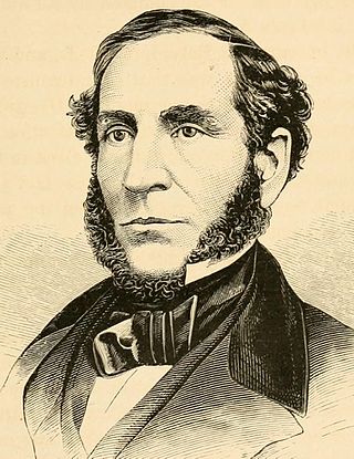
George Whitfield Scranton was an American industrialist and politician, a Republican member of the U.S. House of Representatives from Pennsylvania from March 4, 1859, until his death in 1861. Moving to Pennsylvania in the late 1830s to establish an iron furnace, he and his brother Selden T. Scranton are considered the founders of the city of Scranton, Pennsylvania, named for their family. They and two partners established what became known as the Iron & Coal Company. They developed a method of producing T-rails for constructing railroad track, which previously had been imported from England. The innovation led to a boom in production of track and construction of railroads.
The Lackawanna Steel Company was an American steel manufacturing company that existed as an independent company from 1840 to 1922, and as a subsidiary of the Bethlehem Steel company from 1922 to 1983. Founded by the Scranton family, it was once the second-largest steel company in the world. Scranton, Pennsylvania, developed around the company's original location. When the company moved to a suburb of Buffalo, New York, in 1902, it stimulated the founding of the city of Lackawanna.

Old Forge is a borough in Lackawanna County, Pennsylvania, United States. The population was 8,524 at the 2020 census. It is located 5 miles (8 km) southwest of downtown Scranton and 12 miles (19 km) northeast of Wilkes-Barre.
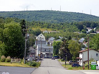
Simpson is an unincorporated community and census-designated place in Fell Township, Lackawanna County, Pennsylvania, United States. It is directly north of the city of Carbondale on Pennsylvania Route 171. As of the 2010 census the population of Simpson was 1,275.

William Henry Richmond (1821-1922) was an American coal mine operator. He is reckoned as one of the key actors in the expansion of the Lackawanna Coal Mine district of Scranton, Pennsylvania, during the second half of the 19th Century. Richmond is best remembered today as the namesake of Richmond Memorial Library in Marlborough, Connecticut.
Racket Brook is a tributary of the Lackawanna River in Wayne County and Lackawanna County, in Pennsylvania, in the United States. It is approximately 3.6 miles (5.8 km) long and flows through Canaan Township in Wayne County and Carbondale Township and Carbondale in Lackawanna County. The watershed of the stream has an area of 5.29 square miles (13.7 km2). The stream has no named tributaries, but has two unnamed tributaries. It is not designated as impaired, but it does experience minor flow loss. It drains part of the Moosic Mountains and also flows through a ravine known as the Brownell Ravine.


