
Ray is an unincorporated community in southeastern Harrison Township, Vinton County, Ohio, United States. Although it is unincorporated, it has a post office, with the ZIP code of 45672. It is located along State Route 327 in western Vinton County.
Zaleski State Forest is the second-largest state forest in the U.S. state of Ohio, located primarily in Vinton County, with areas in Athens County as well. The 28,000 acre (110 km²) forest surrounds Lake Hope State Park in Vinton County, and extensively borders the Waterloo Wildlife Research Station in Athens County. It is also located close to the Wayne National Forest. In addition, the older and much smaller Waterloo State Forest in Athens County is administered as part of the Zaleski. The forest is named after the Vinton County village of Zaleski, where the forest headquarters are located, and is centered on State Route 278.
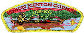
The Simon Kenton Council (#441) is a Boy Scouts of America council created in 1994 that serves members of the Cub Scouts, Scouts BSA, Venturing, Exploring and in-school programs in central and southern Ohio, and northern Kentucky. The council is divided into ten districts with headquarters in Columbus, Ohio and additional service centers located in Chillicothe and Portsmouth, Ohio. Simon Kenton Council is part of Area 4 of the Central Region, and is named in honor of frontiersman Simon Kenton.

Rupert is an unincorporated community in Union Township, Madison County, Ohio, United States. It is located at 39°52′57″N83°21′12″W, at the intersection of Ohio State Route 665 and Glade Run Road, approximately four miles east of London.
Raccoon Creek is a 114-mile-long (183 km) stream that drains parts of five Ohio counties. It originates in Hocking County, Ohio. It flows through Vinton County and Gallia County and a corner of Meigs County. Its largest tributary, Little Raccoon Creek, arises in Jackson County. The watershed also includes part of Athens County, drained by another tributary, Hewett Fork. The other major tributaries are Elk Fork, located entirely in Vinton County, and Brushy Fork, which is mostly in Vinton County with a small area in Hocking County.
Hue is an unincorporated community in Swan Township, Vinton County, Ohio, in the United States.
Orland is an unincorporated community in Swan Township, Vinton County, Ohio, in the United States.
Siverly is an unincorporated community in Swan Township, Vinton County, Ohio, in the United States.
Stella is an unincorporated community in Jackson Township, Vinton County, Ohio, in the United States.
Hope is an unincorporated community in Vinton County, in the U.S. state of Ohio.
Dundas is an unincorporated community in Vinton County, in the U.S. state of Ohio.
Eagle Mills is an unincorporated community in Vinton County, in the U.S. state of Ohio.
Knox is a former town in Vinton County, in the U.S. state of Ohio. The GNIS classifies it as a populated place.
Minerton is a former town in Vinton County, in the U.S. state of Ohio. The GNIS classifies it as a populated place.
Puritan is an unincorporated community in Vinton County, in the U.S. state of Ohio.
Radcliff is an unincorporated community in Vinton County, in the U.S. state of Ohio.
Ratcliffburg is an unincorporated community in Vinton County, in the U.S. state of Ohio.
Richland is a former town in Vinton County, in the U.S. state of Ohio. The GNIS classifies it as a populated place.
Vales Mills is an unincorporated community in Vinton County, in the U.S. state of Ohio.
Little Chicago is an unincorporated community in Pickaway County, in the U.S. state of Ohio. The community has been incorporated into the Village of Ashville, Ohio.


