Related Research Articles

Vinton County is a county located in the U.S. state of Ohio. As of the 2020 census, the population was 12,800, making it the least populous county in the state. Its county seat is McArthur. The county is named for Samuel Finley Vinton, US Representative from Ohio.

McArthur is a village in and the county seat of Vinton County, Ohio, United States. It is located 27 miles (43 km) southeast of Chillicothe. The population was 1,783 at the 2020 census.

Ray is an unincorporated community in southeastern Harrison Township, Vinton County, Ohio, United States. It has a post office with the ZIP code 45672. It is located along State Route 327 in western Vinton County.
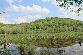
Zaleski State Forest is a state forest in the U.S. state of Ohio, located primarily in Vinton County, with areas in Athens County as well. The 28,000 acre (110 km²) forest surrounds Lake Hope State Park in Vinton County, and borders the Waterloo Wildlife Research Station in Athens County.

Oreton is a ghost town in eastern Vinton Township, Vinton County, Ohio, United States, located along State Route 160. Oreton was a small mining community. Today, all that remains are the crumbled ruins of the iron furnace, a few concrete foundations, and the brick safe of Dave Ebert's company store.

The Vinton Furnace State Experimental Forest and Raccoon Ecological Management Area (REMA) is a state forest in Vinton County, Ohio, United States. It comprises 15,849 acres, the largest remaining intact block of forest in Ohio still available for permanent protection. Since 2000, data collected at the forest has been cited in nearly 200 academic articles.
Hue is an unincorporated community in Swan Township, Vinton County, Ohio, in the United States.
Orland is an unincorporated community in Swan Township, Vinton County, Ohio, in the United States.
Siverly is an unincorporated community in Swan Township, Vinton County, Ohio, in the United States.
Stella is an unincorporated community in Jackson Township, Vinton County, Ohio, in the United States.
Hope is an unincorporated community in Brown Township, Vinton County, Ohio.
Dundas is an unincorporated community in Vinton County, in the U.S. state of Ohio. It is located near the junction of State Route 324 and State Route 93.
Eagle Mills is an unincorporated community in Vinton County, in the U.S. state of Ohio.
Jimtown is an unincorporated community in Vinton County, in the U.S. state of Ohio.
Knox is a former town in Vinton County, in the U.S. State of Ohio. The GNIS classifies it as a populated place.
Minerton is a former town in Vinton County, in the U.S. state of Ohio. The GNIS classifies it as a populated place.
Radcliff is an unincorporated community in Vinton County, in the U.S. state of Ohio.
Ratcliffburg is an unincorporated community in Vinton County, in the U.S. state of Ohio.
Richland is a ghost town in Vinton County, in the U.S. state of Ohio. The GNIS classifies it as a populated place.
Vales Mills is an unincorporated community in Vinton County, in the U.S. state of Ohio.
References
- ↑ U.S. Geological Survey Geographic Names Information System: Puritan, Ohio
- ↑ Tribe, Deanna L. (May 4, 2015). Vinton County. Arcadia Publishing. p. 37. ISBN 978-1-4671-1381-6.
Municipalities and communities of Vinton County, Ohio, United States | ||
|---|---|---|
| Villages |  | |
| Townships | ||
| Unincorporated communities | ||
| Ghost towns | ||
39°09′31″N82°29′21″W / 39.15861°N 82.48917°W
| | This Vinton County, Ohio state location article is a stub. You can help Wikipedia by expanding it. |