
The Jhelum River is a river in the northern Indian subcontinent. It originates at Verinag and flows through the Indian-administered territory of Jammu and Kashmir, into Pakistani-administered Azad Kashmir, then the Pakistani province of Punjab. It is the westernmost of the five rivers of the Punjab region, and flows through the Kashmir Valley. It is a tributary of the Chenab River and has a total length of about 725 kilometres (450 mi).

Baramulla district or Varmul is one of the 20 districts in the Indian-administered union territory of Jammu and Kashmir in the disputed Kashmir region. Baramulla town is the administrative headquarters of this district. The district covered an area of 4,588 km2 (1,771 sq mi) in 2001, but it was reduced to 4,243 km2 (1,638 sq mi) at the time of 2011 census. In 2016, the district administration said that the area was 4,190 km2 (1,620 sq mi). Muslims constitute about 98% of the population.

The Pulwama district is an administrative district of Indian-administered Jammu and Kashmir in the disputed Kashmir region. It is located to the south of Srinagar. Its district headquarters are situated in the city of Pulwama. It is located in the central part of the Kashmir Valley.

Baramulla, also known as Varmul in Kashmiri, is a city and municipality of the Baramulla district of the Indian-administered Jammu and Kashmir in the disputed Kashmir region. It is also the administrative headquarters of the Baramulla district, located on the banks of the River Jhelum downstream from Srinagar, the summer capital of Jammu and Kashmir. The town is known as gateway of Kashmir, serving as the major distribution centre for goods arriving in Kashmir valley through the Jhelum valley cart road.

The Neelum River, or Kishanganga River, is a river in the Kashmir region of Pakistan and India. It originates in Ganderbal district of Jammu and Kashmir in India, flows through the Neelam Valley in Pakistan's Azad Kashmir, where parts of its course fall along the Line of Control, before merging with the Jhelum River near the city of Muzaffarabad.

Poonch or Punch is a district of the Jammu division of Indian-administered Jammu and Kashmir in the disputed Kashmir region. With headquarters in the town of Poonch, it is bounded by the Line of Control on three sides. The 1947-48 war between India and Pakistan divided the earlier district into two parts. One went to Pakistan and the other became part of the then-Indian state of Jammu and Kashmir.

Rajouri is a district in the Jammu division of Indian-administered Jammu and Kashmir in the disputed Kashmir region. The Line of Control, between the Indian- and Pakistani-administered Jammu and Kashmir, lies to its west, Poonch to its north, the Reasi district to the east and the Jammu district to its south. Rajouri is famous for its "Kalari". Representing an ancient principality, Rajouri was a joint district, along with Reasi, at the time of princely state's accession to India in 1947. The two tehsils were separated and Rajouri was merged with the Poonch district. Rajouri again became a separate district along with Reasi in 1968 till 2006 when both were separated again. The Rajouri district comprises 13 tehsils (boroughs). The land is mostly fertile and mountainous. Maize, wheat and rice are the main crops of the area and the main source of the irrigation is the river Tawi that originates from the mountains of Pir Panjal.

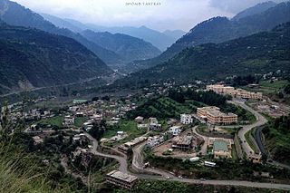
Kupwara district is an administrative district of Indian-administered Jammu and Kashmir in the disputed Kashmir region. It is one of the 10 districts located in the Kashmir Valley Division of Indian administered Kashmir. The Pohru River and Mawar river are two main rivers in the district. Both of them meet Jhelum river in Baramulla district.

Jammu and Kashmir is home to several valleys such as the Kashmir Valley, Chenab Valley, Sindh Valley and Lidder Valley. Some major tourist attractions in Jammu and Kashmir are Srinagar, with its renowned Dal Lake and Mughal Gardens, Gulmarg, Pahalgam, Bhaderwah, Patnitop and Jammu. Every year, thousands of Hindu pilgrims visit holy shrines of Vaishno Devi and Amarnath which has had a significant impact on the state's economy.
Ramban district is an administrative district in the Jammu division of Indian-administered Jammu and Kashmir in the disputed Kashmir region. It is located in a valley surrounded the Pir Panjal range. It was carved out as a separate district from erstwhile Doda district in 2007. It is located in the Jammu division. The district headquarters are at Ramban town, which is located midway between Jammu and Srinagar along the Chenab river in the Chenab valley on National Highway-44, approximately 151 km from Jammu and Srinagar.

Neelum is a district of Pakistan-administered Azad Kashmir in the disputed Kashmir region. It is the northernmost of 10 districts located within the Pakistani-administered territory of Azad Kashmir. Taking up the larger part of the Neelum Valley, the district had a population of around 191,000 people. It was among the worst-hit areas of Pakistan during the 2005 Kashmir earthquake.

Bandipore district is an administrative district of Indian-administered Jammu and Kashmir in the disputed Kashmir region. It is one of the 20 districts in the Jammu and Kashmir. Bandipore town is the administrative headquarters of the district. Bandipore is located in the foothills of the snow-clad peaks of Harmukh overlooking the shores of Wular Lake and has produced hundreds of scholars and intellectuals. The district is known for its tourist places such as Wular Vintage Park, Athwatoo and Gurez valley. Before 1947, this town was a big trade and literary centre of Kashmir. This district was carved out from the erstwhile Baramulla district in 2007. The district is bounded by Kupwara district from the north, Baramulla district from west and Kargil district in Ladakh and Ganderbal district from the east. This district occupies an area of 398 km2. The district has a population of 392,232 as per 2011 census.

The Ganderbal district, or more formally District Ganderbal, is an administrative district of Indian-administered Jammu and Kashmir in the disputed Kashmir region. Ganderbal town is the administrative headquarters of the district. It was formed in 2007 and has 6 subdistricts (tehsils): Kangan, Ganderbal, Tullamulla, Wakura, Lar, and Gund.

Kishtwar district is an administrative district of the Jammu division of Indian-administered Jammu and Kashmir in the Jammu Division. As of 2011, it is the largest and the least populous district of Jammu and Kashmir.

The Haveli District is a district of Pakistan-administered Azad Kashmir in the disputed Kashmir region. It is one of the 10 districts of the Pakistan-administered territory of Azad Kashmir. It was previously a tehsil of the Bagh District but was promoted to the district status on 1 July 2009.

Indian Army operations in Jammu and Kashmir include security operations such as Operation Rakshak, which began in 1990, Operation Sarp Vinash in 2003 and Operation Randori Behak in 2020. Other operations include humanitarian missions such as Operation Megh Rahat and operations with a social aim such as Operation Goodwill and Operation Calm Down. The Indian Army works in tandem with the other arms of the Indian Armed Forces and security forces in Jammu and Kashmir such as during Mission Sahayata or joint operations.

Jammu and Kashmir is a region administered by India as a union territory and consists of the southern portion of the larger Kashmir region, which has been the subject of a dispute between India and Pakistan since 1947 and between India and China since 1959. The Line of Control separates Jammu and Kashmir from the Pakistani-administered territories of Azad Kashmir and Gilgit-Baltistan in the west and north. It lies to the north of the Indian states of Himachal Pradesh and Punjab and to the west of Ladakh which is administered by India as a union territory.
Tangdhar is a village located in Kupwara district of the Indian union territory of Jammu and Kashmir. The village is located at a distance of 67 kilometres (42 mi) from the district headquarters Kupwara. It is a forward village along the Line of Control (LoC). With Neelum valley to its north and Leepa to the south, Tangdhar is surrounded by Pakistan administered Kashmir from three sides. Tangdhar sector is popular for infiltrations and ceasefire violations from Pakistan.
Teetwal is a small border-village in Jammu and Kashmir, India. It is situated on the banks of the Kishanganga River in Kupwara district, 82 km (51 mi) from the district headquarters of Kupwara and close to the Line of Control with Pakistani-administered Kashmir. Teetwal is connected to the rest of India via Tangdhar.
Kralpora is a Tehsil and a village in Kupwara district of the Indian administered union territory of Jammu and Kashmir. The village is located just 15 kilometres from district headquarters Kupwara town.


