
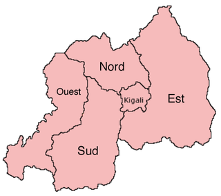
Kigali is the capital and largest city of Rwanda. It is near the nation's geographic centre in a region of rolling hills, with a series of valleys and ridges joined by steep slopes. As a primate city, Kigali is a relatively new city. It has been Rwanda's economic, cultural, and transport hub since it was founded as an administrative outpost in 1907, and became the capital of the country at independence in 1962, shifting focus away from Huye.
The provinces of Rwanda are divided into districts (akarere) and municipalities (umujyi). Prior to January 1, 2006, Rwanda was composed of 12 provinces. The Rwandan government decided to establish new provinces in an attempt to address issues that arose from the Rwandan genocide. The new provinces were to be "ethnically-diverse administrative areas".

Gasabo is a district (akarere) in Kigali city, the capital of Rwanda. The headquarter of Gasabo is located in Remera Sector. The district also includes large areas of the city itself, including Kacyiru, Kimironko, Remera, Nyarutarama and Kimihurura.

Kicukiro District is one of the three Districts which constitute the City of Kigali and is situated in the South-East of the City of Kigali. Is a district (akarere) located in Kigali Province, Rwanda. Kicukiro is home to a thriving market, a number of NGOs(Non-Government Organizations) and the Bralirwa Brewery. In addition, it is the headquarters for the Friends Church in Rwanda. Kicukiro District is also home to two major memorial sites associated with the Rwandan genocide. These are the Rebero Genocide Memorial Site where 14,400 victims are buried, and the Nyanza Genocide Memorial Site where 5,000 victims were killed after Belgian soldiers who were serving in the United Nations peacekeeping forces abandoned them.

Nyarugenge is a district (akarere) in Kigali Province, Rwanda. Its heart is the city centre of Kigali, and contains most of the city's businesses.
The Kandt House Museum, formerly known as the Natural History Museum, is located in what is now the city of Kigali, Nyarugenge District, westbound. This location was chosen as the colonial capital in Rwanda of Germany in 1907 by a German resident (Administrator) Richard Kandt under the name of Nyarugenge.The name was changed to Kigali in 1908 because it was too difficult for the colonialists to pronounce. But the name Kigali was named by King Cyirima I Rugwe in the 14th century by naming now known as Mount Kigali.
Nyarugenge is a sector (umurenge) located in Nyarugenge District, Kigali Province, Rwanda.
Bank of Kigali (BK) is a commercial bank in Rwanda. It is licensed by the National Bank of Rwanda.

I&M Bank Rwanda Plc., is a commercial bank in Rwanda that is licensed by the National Bank of Rwanda. It is the second largest bank in Rwanda.
Lycée de Kigali (LDK) is a secondary school in Kiyovu Cell, Nyarugenge Sector, Nyarugenge District, Kigali, Rwanda. It has A Level and O Level tracks. In 1974 the French government established the school, and it opened officially in 1975 and the Rwandan government took charge of the school in 1982. Lycée de Kigali celebrated 40 years of its existence on Friday July 31, 2015.

Ndera is one of the 15 sectors that make up the district of Gasabo found in kigali city. It is about 15 kilometres (9.3 mi) from the capital.
Kabarondo is a sector and town in the Republic of Rwanda.
The following is a timeline of the history of the city of Kigali, Rwanda.
Cimerwa Cement Limited (CCL) is a manufacturer of cement in Rwanda with capacity of approximately 600,000 tones per year.
Rwezamenyo is a sector (umurenge) in the Kigali Province, Nyarugenge district, Rwanda. It is located in the southwest part of the city of Kigali.
Mageragere is a sector (umurenge) in the Nyarugenge District of Kigali Province, Rwanda It is located in the west part of the city of Kigali.
Nyakabanda is a sector in the Nyarugenge District of Kigali Province, Rwanda. It is located in the south west part of the city of Kigali.
Muhima is a sector (umurenge) in the Kigali Province, Nyarugenge district, Rwanda. It is located in the west part of the city of Kigali.
Kagarama is a sector (umurenge) in the Kigali Province, Kicukiro District, Rwanda. It is located in the south part of the city of Kigali.
Kigali is a sector (umurenge) in the Kigali Province, Nyarugenge district, Rwanda. It is located in the west part of the city of Kigali.

