
Winchester is a cathedral city in Hampshire, England. The city lies at the heart of the wider City of Winchester, a local government district, at the western end of the South Downs National Park, on the River Itchen. It is 60 miles (97 km) south-west of London and 14 miles (23 km) from Southampton, its nearest city. At the 2011 census, Winchester had a population of 45,184. The wider City of Winchester district, which includes towns such as Alresford and Bishop's Waltham, has a population of 116,595. Winchester is the county town of Hampshire and contains the head offices of Hampshire County Council.

Stoke Mandeville is a village and civil parish in the Vale of Aylesbury in Buckinghamshire, England. It is located three miles (4.9 km) from Aylesbury and 3.4 miles (5.5 km) from the market town of Wendover. Although a separate civil parish, the village falls within the Aylesbury Urban Area. According to the Census Report the area of this parish is 1,460 acres (5.9 km2).

Totton and Eling is a civil parish in Hampshire, England, with a population of about 28,100 people. It contains the town of Totton and is situated between the eastern edge of the New Forest and the River Test, close to the city of Southampton but outside the city boundary; the town is within the New Forest non-metropolitan district. Surrounding towns and villages include Ashurst, Marchwood, Cadnam and Ower.

Old Basing is a village in Hampshire, England, just east of Basingstoke. It was called Basengum in the Anglo-Saxon Chronicle and Basinges in the Domesday Book.
Bloxham is a village and civil parish in northern Oxfordshire several miles from the Cotswolds, about 3 miles (5 km) southwest of Banbury. It is on the edge of a valley and overlooked by Hobb Hill. The village is on the A361 road. The 2011 Census recorded the parish's population as 3,374.

King's Sutton is a village and civil parish in West Northamptonshire, Northamptonshire, England in the valley of the River Cherwell. The village is about 4.1 miles (6.6 km) south-east of Banbury, Oxfordshire.
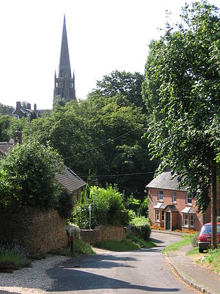
Liss is a village and civil parish in the East Hampshire district of Hampshire, 3.3 miles (5.3 km) north-east of Petersfield, on the A3 road, on the West Sussex border. It covers 3,567 acres (14 km2) of semi-rural countryside in the South Downs National Park. Liss railway station is on the Portsmouth Direct Line. The village comprises an old village at West Liss and a modern village round the 19th-century station. They are divided by the River Rother. Suburbs later spread towards Liss Forest.
Impington is a settlement and civil parish about 3 miles north of Cambridge city centre, in the South Cambridgeshire district, in the county of Cambridgeshire, England. It forms part of the Cambridge built-up area. In 2011 the parish had a population of 4,060. The parish borders Girton, Histon, Landbeach, Milton and Orchard Park. Impington shares a parish council with Histon called "Histon & Impington Parish Council".
Twyford is a village and civil parish in Hampshire, England, approximately three miles south of Winchester and near the M3 motorway and Twyford Down. In 2001, the population of the parish was 1,456. The village and parish are on the left bank of the Itchen, which passes through nearby watermeadows, and has been important economically for its residents.

Colden Common is a civil parish in the Winchester District of Hampshire, England, approximately 5 miles south of the city of Winchester, covering an area of 690.74 hectares (2.6670 sq mi) with a resident population of approximately 4,000 people. It includes the village of Colden Common and the hamlets of Hensting, Fisher's Pond, Nob's Crook, Highbridge and Brambridge. Part of the parish lies within the South Downs National Park.

Barton Stacey is a village and undulating civil parish, which includes the hamlets of Bransbury, Newton Stacey, Drayton and Cocum, in the Test Valley district of Hampshire, England, centred about 7 miles (11 km) south-east of Andover. It is bounded to the north by the estate of Drayton Lodge, and, to the south, by the minor A30 road; both being east–west routes, and connected by The Street/Cocum Road, the main road that bisects the village. The distance between the A303 and A30 at this point is 2 miles (3.2 km), which is twice the width of the parish.

Bentworth is a village and civil parish in the East Hampshire district of Hampshire, England. The nearest town is Alton, which lies about 3 miles (5 km) east of the village. The parish covers an area of 3,763 acres (15.23 km2) and at its highest point is King's Hill, 716 feet (218 m) above sea level. According to the 2011 census, Bentworth had a population of 553. It lies on the edge of the East Hampshire Hangers.

Micheldever is a village and civil parish in Hampshire, England, situated 6 miles (10 km) north of Winchester. It lies upon the River Dever.

Breamore is a village and civil parish near Fordingbridge in Hampshire, England. The parish includes a notable Elizabethan country house, Breamore House, built with an E-shaped ground plan. The Church of England parish church of Saint Mary has an Anglo-Saxon rood.

Damerham is a rural village and civil parish in the New Forest district of Hampshire, England, near Fordingbridge. The area has notable Neolithic and Bronze Age barrows. It was the site of an Anglo-Saxon religious community, mentioned in the will of Alfred the Great. By the time of Domesday Book (1086), Damerham was a major settlement in the possession of Glastonbury Abbey. The village has a riverside mill and a Norman church.

Oliver's Battery is a civil parish in Hampshire, England, of some 700 households located just to the south of the City of Winchester. The parish was formed in 1956 from part of Compton parish. The parish does not include the whole of the settlement known informally as Oliver's Battery, with the northern boundary following the A3090 and therefore excluding Oliver's Battery Road North.

Grateley is a village and civil parish in the north west of Hampshire, England.

East Tisted is a village and civil parish in the East Hampshire district of Hampshire, England. It is 4.8 miles (7.7 km) south of Alton on the A32 road.
Headbourne Worthy is a village and former manor within the City of Winchester district of Hampshire, England. The parish also includes the former manor of Worthy Pauncefoot.

Netley Marsh is a village and civil parish in Hampshire, close to the town of Totton. It lies within the New Forest District, and the New Forest National Park. It is the alleged site of the battle between an invading Anglo Saxon army, under Cerdic and a British army under Natanleod in the year 508.


