Koriya district

Last updated
Koriya district
Koriya in Chhattisgarh (India).svg
Location in Chhattisgarh
Koriya district
Koriya district
Country India
State Chhattisgarh
DivisionSurguja
Headquarters Baikunthpur
Tehsils 3
Government
   Vidhan Sabha constituencies 1
Area
  Total6,604 km2 (2,550 sq mi)
Population
 (2011)
  Total247,427
  Density37/km2 (97/sq mi)
Demographics
   Literacy 71.41
  Sex ratio971
Time zone UTC+05:30 (IST)
PIN
497xxx (Koriya) [1]
Major highways 1
Website korea.gov.in

Koriya district, officially known as Korea district, is a district in the north-western part of the Chhattisgarh state in Central India. The administrative headquarters of the district is Baikunthpur.

Contents

History

Little is known of the area before the 16th century. Koriya was a princely state of British Empire in India; the other princely state that lay within the Koriya district was Chang Bhakar. After Indian Independence in 1947, the rulers of Koriya and Chang Bhakar acceded to the Union of India on 1 January 1948 and both were made part of Surguja District of Madhya Pradesh state.

The district of Koriya came into existence on May 25, 1998, when it was carved out of Surguja district. After the formation of the new state of Chhattisgarh on November 1, 2000, Koriya District became part of the new state. It is currently a part of the Red Corridor. [2]

Geography

Koriya District lies between 22°56′ and 23°48′ North and 81°56′ and 82°47′ East. It is bounded on the north-west by Manendragarh-Chirmiri-Bharatpur district, on the south by Korba District, on the east by Surajpur District. The area of the district is 5977 km2, of which 59.9% is forest area. The district is a vast mass of hill ranges. The general height of the lower tableland is 550 m (1800 feet) above sea level. The Sonhat Plateau has a maximum elevation of 755 m (2477 feet). The highest peak in the district is Deogarh, which is 1027 m (3370 feet) high.

The climate is mild with a monsoon, a mild summer and a bearable[ citation needed ] winter.

Divisions

Koriya District consists of two subdivisions: Baikunthpur and Sonhat. The district encompasses 653 villages, 3 Janpad Panchayats, 236 garam Panchayats, 2 Nagar Panchayats and 1 municipality. [3]

Demographics

Religions in Koriya district (2011) [4]
ReligionPercent
Hinduism
92.31%
Islam
3.95%
Other (Tribal religion)
1.92%
Christianity
1.61%
Other or not stated
0.21%
Distribution of religions

According to the 2011 census Koriya district has a population of 658,917, [5] roughly equal to the nation of Montenegro [6] or the US state of Vermont. [7] This gives it a ranking of 510th in India (out of a total of 640). [5] The district has a population density of 100 inhabitants per square kilometre (260/sq mi). [5] Its population growth rate over the decade 2001-2011 was 12.4%. [5] Koriya has a sex ratio of 968 females for every 1000 males, [5] and a literacy rate of 71.41%. [5]

After bifurcation, the district had a population of 247,427. 29.30% of the population lived in urban areas. Koriya has a sex ratio of 964 females per 1000 males. Scheduled Castes and Scheduled Tribes made up 20,437 (8.30%) and 97,124 (39.25%) of the population respectively. [5]

According to the 2001 census, the total population of the district was 586,327 out of which 51.38% were male and 48.62% were female, 70.2% of this population was rural and 29.8% were urban, 8.2% belonged to the scheduled castes and 44.4% belonged to the scheduled tribes. Literacy rate was 63.1%, the male literacy rate being 75.7% and female literacy being 49.7%.

The original inhabitants of Korea district were the Kols, Gonds and Bhuinhars (Pando). All other communities in the district claim to have come from outside the district. Migration into Korea District was a continuous process. These migrants include the Cherva, Rajwars, Sahu, Ahir, Gwalas, Oraon, Gadaria (Gaderi), Koir, Bargah, Basods, Muslims, Kahars, Kunbi, Kewats, Guptas, Jaiswal, Schedule Caste, Agrawals, and Jains, and panika.

Languages

Languages in Koriya district (2011) [8]

   Surgujia (68.07%)
   Hindi (20.62%)
   Kurukh (3.14%)
   Chhattisgarhi (1.74%)
   Bhojpuri (1.12%)
  Others (5.31%)

At the time of the 2011 Census of India, 68.07% of the population in the district spoke Surgujia, 20.62% Hindi, 3.14% Kurukh, 1.74% Chhattisgarhi and 1.12% Bhojpuri as their first language. [8]

Culture

Three community dances, the Karma, Saila and Suva Dance are celebrated mainly in the district during different festivals. The main festivals of India such as Diwali, Dashehra and Holi are also celebrated in Korea District. Some other festivals are also special among the Koriyan communities, such as Ganga Dashera, Charta, Nuakhai and Surhul. [9]

Tourist places

Main tourist places in the district are as follows:

See also

Related Research Articles

<span class="mw-page-title-main">Bastar district</span> District of Chhattisgarh in India

Bastar is a district in the state of Chhattisgarh in Central India. Jagdalpur is the district headquarters. Bastar is bounded on the northwest by Narayanpur District, on the north by Kondagaon district, on the east by Nabarangpur and Koraput Districts of Odisha State, on the south and southwest by Dantewada and Sukma. The district possesses a unique blend of tribal and Odia culture.

<span class="mw-page-title-main">Sakti, Chhattisgarh</span> City in Chhattisgarh, India

Sakti is a city and a district in the state of Chhattisgarh. The assembly constituency number of District Sakti is 33, Earlier it was the only Education District of Chhattisgarh. There are 245 panchayats and 458 villages under Sakti district. Sakti district was formed on 15 August 2021 And came into complete district existence on 9 September 2022 by Chief Minister Bhupesh Baghel. The current 2018 - 2023 MLA here is Shri Charan Das Mahant, who is the Speaker of the Chhattisgarh Legislative assembly. The First Collector and District Magistrate of Sakti is Nupur Rashi Panna I.A.S, First Superintendent of Police is M.R. Ahire I.P.S and First District Education Officer is B.L. Khare, who was also the last District Education Officer of Education District Sakti.

<span class="mw-page-title-main">Dantewada district</span> District of Chhattisgarh in India

Dantewada District, also known as Dantewara District or Dakshin Bastar District, is a district in the Indian state of Chhattisgarh. Dantewada is the district headquarters. The district is part of Bastar Division. Until 1998, Dantewada District was a tehsil of the larger Bastar District.

<span class="mw-page-title-main">Jashpur district</span> District in the state of Chhattisgarh, India

Jashpur District is a district of the central Indian state of Chhattisgarh bordering Jharkhand and Odisha. Jashpur Nagar is the administrative headquarters of the district. The district was formerly a princely state before Independence. Highly mountainous and forested, Jashpur is known for its natural environment.

<span class="mw-page-title-main">Korea State</span>

Korea State, currently spelt as Koriya, was a princely state of the British Empire of India. After Indian independence in 1947, the ruler of Korea acceded to the Union of India on 1 January 1948, and Koriya was made part of Surguja District of Central Provinces and Berar province. In January 1950, "Central Provinces and Berar" province was renamed Madhya Pradesh state. After November 2000, Korea and the former princely state of Changbhakar became Koriya district of Chhattisgarh state.

<span class="mw-page-title-main">Korba district</span> District of Chhattisgarh in India

Korba District is an administrative district of Chhattisgarh state in central India. The headquarter of this district is Korba.

<span class="mw-page-title-main">Surguja district</span> District of Chhattisgarh in India

Surguja district is a district of the Indian state of Chhattisgarh. The district is one of the oldest districts of Chhattisgarh. The headquarters of the district is Ambikapur.

Sanjay National Park is a national park in Manendragarh-Chirmiri-Bharatpur district of Chhattisgarh and Singrauli district of Madhya Pradesh, India. It covers an area of 2,300 km2 (890 sq mi) and is a part of the Sanjay-Dubri Tiger Reserve. It is located in the Narmada Valley dry deciduous forests ecoregion.

<span class="mw-page-title-main">Manendragarh</span> City in Chhattisgarh in India

Manendragarh, is a city and administrative district headquarters of Manendragarh-Chirmiri-Bharatpur district in the state of Chhattisgarh, India. Formerly, it was the part of Koriya district. It is situated near the Chhattisgarh-Madhya Pradesh state border. The Chief Minister of Chhattisgarh state, Shri Bhupesh Baghel, inaugurated Manendragarh District on 9 September 2022 by separating it from korea district.

Baikunthpur is a town, a Nagar Palika and a notified area committee in Koriya District in the state of Chhattisgarh, India. It is the administrative headquarters of Koriya district.

Chhuikhadan is a City municipality and district in Khairagarh-Chhuikhadan-Gandai district in the Indian state of Chhattisgarh, India. Chhuikhadan is also known as "city of martyr".

Bishrampur is a census town in Surajpur district in the Indian state of Chhattisgarh.

<span class="mw-page-title-main">Surajpur district</span> District In Chhattisgarh, India

Surajpur district is a district in the state of Chhattisgarh in central India, with its administrative headquarters at Surajpur. National Highway 43 passes through Surajpur district. Surajpur was declared a district on 15 August 2011 along with eight other new districts. Surajpur is the first district to receive National Satyan Maitra Literacy Award. The district is known for its market and other major tourist places of Chhattisgarh with Tamor Pingla Wildlife Sanctuary.

<span class="mw-page-title-main">Kondagaon district</span> District of Chhattisgarh in India

Kondagaon district is a district of Chhattisgarh, India, and separated from Bastar district on 24 January 2012. with headquarters in Kondagaon. It is mostly renowned for its bell metal craft and other art forms native to the tribal of Bastar. It is also known as the Shilp sheher of Chhattisgarh owing to the variety of indigenous crafts produced in the area.

<span class="mw-page-title-main">Balrampur district, Chhattisgarh</span> District of Chhattisgarh in India

Balrampur-Ramanujganj district is a district in the Indian state of Chhattisgarh. It came into existence on 17 January 2012 and was formerly part of Surguja district. Balrampur-Ramanujganj district is the northernmost district of Chhattisgarh. Its seat is Balrampur.

<span class="mw-page-title-main">Tourism in Chhattisgarh</span>

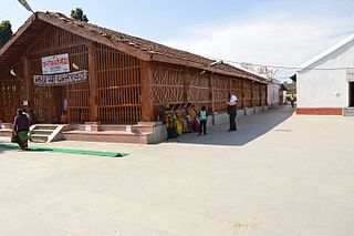
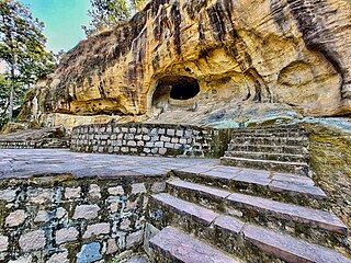
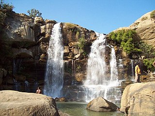
Tourism is an important part of the economy of the Indian state of Chhattisgarh, India's tenth largest state. The state has many ancient monuments, rare wildlife, carved temples, Buddhist sites, palaces, water falls, caves, rock paintings and hill plateaus.

<span class="mw-page-title-main">Gaurela-Pendra-Marwahi district</span> District of Chhattisgarh in India

Gaurela-Pendra-Marwahi district is a district in the Indian state of Chhattisgarh. Gaurella is the headquarters of the district. It was carved out of Bilaspur district and inaugurated in February 2020.

<span class="mw-page-title-main">Manendragarh-Chirmiri-Bharatpur district</span> District of Chhattisgarh in India

Manendragarh-Chirmiri-Bharatpur district is a district of Chhattisgarh state in India. Earlier it was in Korea district. Manendragarh has been inaugurated as a separate District on September 9, 2022 by the Chief Minister of Chhattisgarh State Shri Bhupesh Baghel. administrative headquarters of the district is Manendragarh.

<span class="mw-page-title-main">Khairagarh-Chhuikhadan-Gandai district</span> District of Chhattisgarh in India

Khairagarh-Chhuikhadan-GandaiKCG is a district in the central Indian state of Chhattisgarh which consists of three cities, Khairagarh, Chhuikhadan and Gandai. It was carved out of Rajnandgaon in 2022. It is the 31st district of the state inaugurated by chief minister Bhupesh Baghel.

References

  1. "Pin Codes of Korea, Chhattisgarh, India, Korea Pincode Search". indiapincodes.net.
  2. "83 districts under the Security Related Expenditure Scheme". IntelliBriefs. 2009-12-11. Archived from the original on 2011-10-27. Retrieved 2011-09-17.
  3. "Home". korea.gov.in.
  4. "Table C-01 Population by Religion: Chhattisgarh". censusindia.gov.in. Registrar General and Census Commissioner of India. 2011.
  5. 1 2 3 4 5 6 7 "District Census Handbook: Koriya" (PDF). censusindia.gov.in. Registrar General and Census Commissioner of India. 2011.
  6. US Directorate of Intelligence. "Country Comparison:Population". Archived from the original on June 13, 2007. Retrieved 2011-10-01. Montenegro 661,807 July 2011 est.
  7. "2010 Resident Population Data". U. S. Census Bureau. Archived from the original on 2013-10-19. Retrieved 2011-09-30. Vermont 625,741
  8. 1 2 "Table C-16 Population by Mother Tongue: Chhattisgarh". www.censusindia.gov.in. Registrar General and Census Commissioner of India.
  9. Culture korea.gov.in [ dead link ]
  10. "No-tiger-in-Sanjay-Tiger-Reserve-also-says-official", The Times of India , archived from the original on 2012-10-24, retrieved 2011-01-19
  11. "Chhattisgarh asked to propose tiger reserve status for Guru Ghasidas park". The Hindu. 30 June 2011. Retrieved 4 June 2016.
  12. Divyabhanusinh (1999). The End of a Trail: the Cheetah in India. Banyan Books, New Delhi.

23°15′N82°33′E / 23.250°N 82.550°E / 23.250; 82.550