
Mpumalanga is a province of South Africa. The name means "East", or literally "The Place Where the Sun Rises" in the Nguni languages. Mpumalanga lies in eastern South Africa, bordering Eswatini and Mozambique. It shares borders with the South African provinces of Limpopo to the north, Gauteng to the west, the Free State to the southwest, and KwaZulu-Natal to the south. The capital is Mbombela.
Nansindlela School is a public school in the Boekenhouthoek area, near the town of Kwaggafontein, Mpumalanga Province, South Africa.

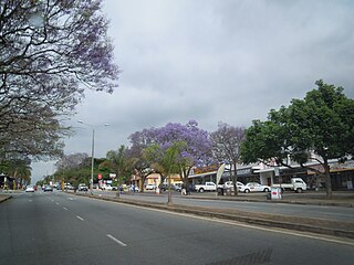
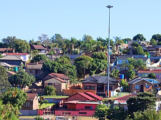
Mbombela, formerly Nelspruit, is a city in northeastern South Africa. It is the capital of the Mpumalanga province. Located on the Crocodile River, The city lies about 110 km (68 mi) by road west of the Mozambique border, 330 km (210 mi) east of Johannesburg and 82 km (51 mi) north of the Eswatini border. The city was one of the host cities of the 2010 FIFA World Cup.

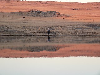
Lydenburg, also known as Mashishing, is a town in Thaba Chweu Local Municipality, on the Mpumalanga highveld, South Africa. It is situated on the Sterkspruit/Dorps River tributary of the Lepelle River at the summit of the Long Tom Pass. It has a long, rich history, ranging from AD 500 to the present. The name is derived from the Dutch Lijdenburg, or "Town of Suffering", and is named for the experiences of the white settlers. In Northern Sotho, Mashishing means "long green grass." Lydenburg has become the centre of the South African fly-fishing industry and is an agricultural, tourism and mining hub.

Witbank, officially eMalahleni, is a city situated on the Highveld of Mpumalanga, South Africa, within the Emalahleni Local Municipality. The name Witbank is Afrikaans for "white ridge", and is named after a white sandstone outcrop where wagon transport drivers rested. The city is known for its coal-mining in the surrounding region.
Dullstroom, also known as Emnothweni, is a small town in Mpumalanga province, South Africa. The town lies 35 kilometres north of Belfast and some 53 kilometres south-west of Lydenburg on the R540 road.

Carolina is an urban-rural area situated at the intersection of the R33, R36 and R38 routes in the Mpumalanga province of South Africa. The town lies in the grass and wetlands region of Mpumalanga at 1700 meters above sea level. It is a mixed farming and small-scale coal- and precious-stone-mining community.

Ermelo is the educational, industrial and commercial town of the 7,750 km2 Gert Sibande District Municipality in Mpumalanga province, Republic of South Africa. It is both a mixed agriculture and mining region. It is located 210 km east of Johannesburg.

KwaMhlanga is a town in the Nkangala district municipality of the Mpumalanga province in South Africa. It is the spiritual home of the Ndebele tribe that settled here in the early 18th century. Kwamhlanga now consists of Kwamhlanga, Mandela, Phola, Sun City, Lithuli, Jordan, Mountain View, eMpumelelweni Village, Kingspark Village, and Tweefontein.

Middelburg is a large farming and industrial town in the South African province of Mpumalanga.
White River is a small holiday and farming town situated just north of Mbombela in Mpumalanga, South Africa. The farms in the region produce tropical fruits, macadamia nuts, vegetables, flowers and timber. As of 2011, White River had a population of 16,639.

Mokopane, formerly known as Potgietersrus, is a town in the Limpopo province of South Africa.
The Northern Ndebele people are a Nguni ethnic group native to Southern Africa. Significant populations of native speakers of the Northern Ndebele language (siNdebele) are found in Zimbabwe and in South Africa.
Nkangala is one of the 3 districts of Mpumalanga province of South Africa. The seat of Nkangala is Middelburg. The Nkangala District Municipality consists of 160 towns and villages. The most spoken language of its 1,308,129 people is IsiNdebele with 28.4%, closely followed by Zulu speakers. The district code is DC31.
Ga-Rankuwa is a large settlement located about 37 km north-west of Pretoria. Provincially it is in Gauteng province, but it used to fall in Bophuthatswana during the apartheid years, and under the North West province until the early 2000s.
Bushbuckridge Municipality is a local municipality within the Ehlanzeni District Municipality, in the Mpumalanga province of South Africa. Commercial farming, which consists of pine and bluegum plantations, tobacco, cotton, sub-tropical fruits and vegetables is practised in the municipality's countryside. The municipality includes the southern part of the Kruger National Park. Bushbuckridge is the largest local municipality in Mpumalanga in terms of land size.
Kameel-rivier B or Kameelrivier is a village in the low-veld region of KwaNdebele, in the Nkangala District Municipality of the Mpumalanga province of South Africa. The majority of the residents are from the Ndebele people and Sepedi-speaking people. Siyabuswa is its main town. Main family clans include Napo, Masilela, Ramushu, Mahlangu and Skhosana clans.
Matsulu is a township in the Mbombela Local Municipality under the Ehlanzeni District Municipality in the Mpumalanga province of South Africa. It lies between Kruger National Park and the N4 national road 41 km east of Nelspruit (Mbombela) CBD, 3 km before the Kaapmuiden train station. It is also surrounded by the Nsikazi River & Crocodile River.
Gijimani Jim Skosana is a South African politician from Mpumalanga and a current Member of the National Assembly of South Africa for the African National Congress (ANC). He previously served as the mayor of the Dr JS Moroka Local Municipality from 2016 to 2017.


