
Southern Ndebele, also known as Transvaal Ndebele or South Ndebele, is an African language belonging to the Nguni group of Bantu languages, spoken by the Ndebele people of South Africa.

KwaZulu-Natal is a province of South Africa that was created in 1994 when the Zulu bantustan of KwaZulu and Natal Province were merged. It is located in the southeast of the country, with a long shoreline on the Indian Ocean and sharing borders with three other provinces and the countries of Mozambique, Eswatini and Lesotho. Its capital is Pietermaritzburg, and its largest city is Durban. It is the second-most populous province in South Africa, with slightly fewer residents than Gauteng.

A Bantustan was a territory that the National Party administration of South Africa set aside for black inhabitants of South Africa and South West Africa, as part of its policy of apartheid. By extension, outside South Africa the term refers to regions that lack any real legitimacy, consisting often of several unconnected enclaves, or which have emerged from national or international gerrymandering.

Mpumalanga is a province of South Africa. The name means "East", or literally "The Place Where the Sun Rises" in the Swazi, Xhosa, Ndebele and Zulu languages. Mpumalanga lies in eastern South Africa, bordering Eswatini and Mozambique. It constitutes 6.5% of South Africa's land area. It shares borders with the South African provinces of Limpopo to the north, Gauteng to the west, the Free State to the southwest, and KwaZulu-Natal to the south. The capital is Mbombela. Mpumalanga was formed in 1994, when the area that was the Eastern Transvaal was merged with the former bantustans KaNgwane, KwaNdebele and parts of Lebowa and Gazankulu. Although the contemporary borders of the province were only formed at the end of apartheid, the region and its surroundings has a history that extends back thousands of years. Much of its history, and current significance is as a region of trade.

Bulawayo is the second largest city in Zimbabwe, and the largest city in the country's Matabeleland region. The city's population is disputed; the 2022 census listed it at 665,940, while the Bulawayo City Council claimed it to be about 1.2 million. Bulawayo covers an area of about 546 square kilometres in the western part of the country, along the Matsheumhlope River. Along with the capital Harare, Bulawayo is one of two cities in Zimbabwe that is also a province.
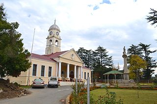
Kokstad is a town in the Harry Gwala District Municipality of KwaZulu-Natal Province, South Africa. Kokstad is named after the Griqua chief Adam Kok III who settled here in 1863. Kokstad is the capital town of the East Griqualand region, as it is also the biggest town in this region. It was built around Mount Currie, a local mountain range, by the city's founder Adam Kok III, for whom the town is named. Stad is the Dutch and Afrikaans word for "city".

Witbank, officially Emalahleni, is a city situated on the Highveld of Mpumalanga, South Africa, within the Emalahleni Local Municipality. The name Witbank is Afrikaans for "white ridge", and is named after a white sandstone outcrop where wagon transport drivers rested. The city is known for its coal-mining in the surrounding region.
Weenen is the second oldest European settlement in KwaZulu-Natal, South Africa. It is situated on the banks of the Bushman River. The farms around the town grow vegetables, lucerne, groundnuts, and citrus fruit.

KwaMhlanga is a fast growing town in the North Western corner of Mpumalanga province in South Africa. It is the spiritual home of the Ndebele tribe that settled here in the early 18th century. Kwamhlanga now consists of Kwamhlanga, Mandela, Phola, Sun City, Lithuli, Jordan, Mountain View, eMpumelelweni Village, Kingspark Village and Tweefontein.

The Northern Ndebele are an offshoot of the Southern Ndebele and they are found in Limpopo and Northwest provinces of the Republic of South Africa. Within the borders of the Republic of South Africa, there are two ethnolinguistic groups called Northern Ndebele and Southern Ndebele who speak different but related Ndebele languages, namely isiNdebele and isiNdebele.
South African Bantu-speaking peoples are the majority of black South Africans. Occasionally grouped as Bantu, the term itself is derived from the word for "people" common to many of the Bantu languages. The Oxford Dictionary of South African English describes its contemporary usage in a racial context as "obsolescent and offensive" because of its strong association with white minority rule with their apartheid system. However, Bantu is used without pejorative connotations in other parts of Africa and is still used in South Africa as the group term for the language family.

Lupane ( luːpɑːnɛ) District is located in the Matabeleland North Province of Zimbabwe, and it is also the Provincial Capital. The District is situated at an elevation of 976 m with a population of 198,600 inhabitants by 2019. Lupane Town is the main center of the district located 172 km from Bulawayo along the A8 Victoria Falls Road. The Government Provincial Administrative offices are located at the Town Centre. A new university near the Town has been established under the name Lupane State University, which caters for the region and beyond. The word Lupane is thought to be a Kalanga or Lozwi word.
Siyabuswa is a town in the countryside of the South African province of Mpumalanga. During the apartheid era, Siyabuswa was the capital of the KwaNdebele Bantustan. It served as a capital from 1981 to 1986 when KwaMhlanga replaced it. Most of its inhabitants are members of the Ndebele ethnic group. Currently Siyabuswa is home to several ethnic groups, namely the Ndebele, Pedi and Sotho people.
The Tonga people of Zambia and Zimbabwe are a Bantu ethnic group of southern Zambia and neighbouring northern Zimbabwe, and to a lesser extent, in Mozambique. They are related to the Batoka who are part of the Tokaleya people in the same area, but not to the Tonga people of Malawi. In southern Zambia they are patrons of the Kafue Twa. They differ culturally and linguistically from the Tsonga people of South Africa and southern Mozambique.
The Nguni people are a Bantu ethnic group from South Africa, with off-shoots in neighbouring countries in Southern Africa. Swazi people live in both South Africa and Eswatini, while Northern Ndebele people live in both South Africa and Zimbabwe.

Shurugwi District is located in Midlands Province, southern Zimbabwe.

AmaNdebele are an Mbo ethnic group native to South Africa who speak isiNdebele language. AmaNdebele mainly inhabit the provinces of Mpumalanga, Gauteng and Limpopo, all of which are in the northeast of the country.
Totororo Secondary School is a school in Empress Mine Ward of Kwekwe District in the Midlands Province of Zimbabwe.

115 South African Infantry Battalion was a motorised infantry unit of the South African Army.


